Sidi Bel Abbès
| Sidi Bel Abbès سيدي بلعباس | ||
|---|---|---|
| City | ||
|
A Street in Sidi Bel Abbès | ||
| ||
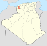
 Location of Sidi Bel Abbès in the Sidi Bel Abbès Province | ||
 Sidi Bel Abbès Location of Taher in the Algeria | ||
| Coordinates: 35°11′38″N 0°38′29″W / 35.19389°N 0.64139°WCoordinates: 35°11′38″N 0°38′29″W / 35.19389°N 0.64139°W | ||
| Country |
| |
| Province | Sidi Bel Abbès Province | |
| District | Sidi Bel Abbès District | |
| APC | 2012-2017 | |
| Government | ||
| • Type | Municipality | |
| Area | ||
| • Total | 3,533.08 sq mi (9,150.63 km2) | |
| Population (2008) | ||
| • Total | 212,935 | |
| Time zone | CET (UTC+1) | |
| Postal code | 22000 | |
| ISO 3166 code | CP | |

.svg.png)

Sidi Bel Abbès (Arabic: سيدي بلعباس) is capital (2005 pop. 200,000)[1] of the Sidi Bel Abbès wilaya (2005 pop. 590,000), Algeria. It is named after Sidi bel Abbass, a Muslim marabout or noble man who is buried there.[1] The city is the commercial center of an important area of vineyards, market gardens, orchards, and grain fields. It was formerly surrounded by a wall with four gates and there is a university there. Sidi Bel Abbès is 75 kilometers from the Mediterranean Sea.
History
The present city, on the Wadi Mékerra River, developed around a French camp built in 1843.[1] In 1849 a planned agricultural town was established around the existing military post. From the 1830s until 1962, the city was closely associated with the French Foreign Legion, the location of its basic training camp, and the headquarters of its 1st Foreign Regiment. In the late 1890s the town, described as being of Spanish appearance, had a civilian population of about 30,000.[2] The main buildings were in the French military district of the Quartier Vienot. The training centre of the modern Algerian National Gendarmerie is located in Sidi Bel Abbès.
In the 1930s much of the old city walls were demolished. Wide boulevards and squares replaced the traditional quarters, causing the town to lose much of its former character.
Geography
The city sits astride both sides of the Mekerra River.
Climate
| Climate data for Sidi-bel-abbes | |||||||||||||
|---|---|---|---|---|---|---|---|---|---|---|---|---|---|
| Month | Jan | Feb | Mar | Apr | May | Jun | Jul | Aug | Sep | Oct | Nov | Dec | Year |
| Average high °C (°F) | 14 (57) |
15 (59) |
18 (64) |
20 (68) |
24 (75) |
29 (84) |
34 (93) |
35 (95) |
30 (86) |
24 (75) |
18 (64) |
14 (57) |
22 (71) |
| Average low °C (°F) | 1 (33) |
2 (35) |
4 (39) |
6 (42) |
8 (46) |
12 (53) |
15 (59) |
15 (59) |
13 (55) |
9 (48) |
6 (42) |
2 (35) |
7 (44) |
| Average precipitation mm (inches) | 61 (2.4) |
48 (1.9) |
46 (1.8) |
41 (1.6) |
38 (1.5) |
10 (0.4) |
3 (0.1) |
5 (0.2) |
15 (0.6) |
38 (1.5) |
43 (1.7) |
64 (2.5) |
409 (16.1) |
| Source: Weatherbase [3] | |||||||||||||
Economy
The economy centers on agriculture, particularly the production of cereals such as wheat and barley and the grape industry. A farm machine manufacturing complex is located there.[1]
Transports
Sidi Bel Abbès is well connected to other Algerian cities by roads and railroads. Oran is 70 kilometers north and Tlemcen is 90 kilometers west of. The closest international airport is Oran Es Sénia,[1] but the city is served by a domestic one: Sidi Bel Abbès Airport (IATA: BFW, ICAO: DAOS).
Famous natives of Sidi Bel Abbès
- René Raphaël Viviani (November 8, 1863 – September 7, 1925) was a French politician of the Third Republic, who served as Prime Minister for the first year of World War I.
- Gaston Maurice Julia (February 3, 1893 – March 19, 1978) Mathematician famous for "Julia Set" in Chaos Theory.
- Marcel Cerdan (1916–49): French boxer; known as Le Bombardier Marocain (The Moroccan Bomber).
- Djillali Liabes (1948–93): Famous Algerian Sociologist, philosopher, Dr. status in literature and humanities.
- Mohammed Bedjaoui: (21 September 1929) Foreign minister. Ex Minister of Justice (1964–70), Ambassador to France (1970–79) and Algerian permanent representative to the UN (1979–82). He was a judge on the International Court of Justice at The Hague (1982–2001).
- Brigitte Giraud (born 1960), French writer
- Kad Merad (1964): actor in Bienvenue chez les Ch'tis
References
- 1 2 3 4 5 Sidi Bel Abbes, lexicorient.com (Encyclopaedia of the Orient), internet article.
- ↑ Martin Windrow, page 138 Our Friends Beneath the Sands - The Foreign Legion in France's Colonial Conquests 1870-1935, ISBN 978-0-297-85213-1
- ↑ "Weatherbase: Historical Weather for Sidi-bel-abbes, Algeria". Weatherbase. 2011. Retrieved on November 24, 2011.
External links
![]() Media related to Sidi Bel Abbès at Wikimedia Commons
Media related to Sidi Bel Abbès at Wikimedia Commons
| Wikivoyage has a travel guide for Sidi Bel Abbes. |
| Wikimedia Commons has media related to Sidi Bel Abbès. |