Sibut
| Sibut | |
|---|---|
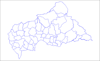
 Sibut Location in Central African Republic | |
| Coordinates: 5°44′16″N 19°05′12″E / 5.73778°N 19.08667°E | |
| Country | Central African Republic |
| Prefecture | Kémo |
| Elevation | 400 m (1,300 ft) |
| Population (2012) | |
| • Total | 24,527 |
Sibut (pronounced: [sibut]), formerly Fort Sibut (French: Fort-Sibut) is the capital of Kémo, one of the 14 prefectures of the Central African Republic. An important transport hub, it is situated 188 km (117 mi) north of the capital Bangui and is known for its market.
Sibut is located at the Northern end of the paved road coming from the capital, Bangui. At Sibut, two major provincial roads split, one going North to Kaga Bandoro, and the other east towards Bomimi, a thriving agricultural village of 450 people, 12 km (7.5 mi) from Sibut.
The town of Sibut sits on the banks of the Kémo, a minor tributary of the Ubangi River about 150 km (93 mi) long. Formerly an important route of supply and communication between Fort de Possel on the Ubangi and the French settlements around Lake Chad, the river is now non-navigable even with small watercraft.
The present city has one high school which also serves as a landing strip, and a market. Local food in street cafes include gozo (cassava) and peanut spinach sauce, along with various species of bushmeat. Local drink includes palm wine and 33 beer. The Peace Corps had volunteers located in Sibut until the coup d'état of 1996.
Climate
Köppen-Geiger climate classification system classifies its climate as tropical wet and dry (Aw).[1]
| Climate data for Sibut | |||||||||||||
|---|---|---|---|---|---|---|---|---|---|---|---|---|---|
| Month | Jan | Feb | Mar | Apr | May | Jun | Jul | Aug | Sep | Oct | Nov | Dec | Year |
| Average high °C (°F) | 34.9 (94.8) |
36.1 (97) |
35.4 (95.7) |
34.1 (93.4) |
33 (91) |
31.4 (88.5) |
30.3 (86.5) |
30.7 (87.3) |
31.3 (88.3) |
31.9 (89.4) |
33 (91) |
33.9 (93) |
33 (91.32) |
| Daily mean °C (°F) | 25.3 (77.5) |
26.6 (79.9) |
27.5 (81.5) |
27 (81) |
26.5 (79.7) |
25.4 (77.7) |
24.7 (76.5) |
24.9 (76.8) |
25.3 (77.5) |
25.5 (77.9) |
25.3 (77.5) |
24.9 (76.8) |
25.74 (78.36) |
| Average low °C (°F) | 15.7 (60.3) |
17.1 (62.8) |
19.6 (67.3) |
20 (68) |
20 (68) |
19.4 (66.9) |
19.1 (66.4) |
19.2 (66.6) |
19.3 (66.7) |
19.2 (66.6) |
17.6 (63.7) |
16 (61) |
18.52 (65.36) |
| Average precipitation mm (inches) | 8 (0.31) |
24 (0.94) |
70 (2.76) |
93 (3.66) |
140 (5.51) |
167 (6.57) |
216 (8.5) |
223 (8.78) |
206 (8.11) |
187 (7.36) |
48 (1.89) |
14 (0.55) |
1,396 (54.94) |
| Source: Climate-Data.org, altitude: 428m[1] | |||||||||||||
See also
References
- 1 2 "Climate: Sibut - Climate graph, Temperature graph, Climate table". Climate-Data.org. Retrieved 21 October 2013.
Coordinates: CF_type:city 5°44′N 19°05′E / 5.733°N 19.083°E