Shire of Corangamite
| Shire of Corangamite Victoria | |||||||||||||
|---|---|---|---|---|---|---|---|---|---|---|---|---|---|
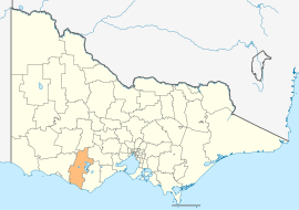 Location in Victoria | |||||||||||||
| Population | 15,671 (2015 est)[1] | ||||||||||||
| • Density | 3.5559/km2 (9.2098/sq mi) | ||||||||||||
| Established | 1994 | ||||||||||||
| Gazetted | 23 September 1994[2] | ||||||||||||
| Area | 4,407 km2 (1,701.6 sq mi) | ||||||||||||
| Mayor | Cr Chris O'Connor | ||||||||||||
| Council seat | Camperdown | ||||||||||||
| Region | Barwon South West | ||||||||||||
| State electorate(s) | |||||||||||||
| Federal Division(s) | Wannon | ||||||||||||
|
| |||||||||||||
| Website | Shire of Corangamite | ||||||||||||
| |||||||||||||
The Shire of Corangamite is a local government area in the Barwon South West region of Victoria, Australia, located in the south-western part of the state. It covers an area of 4,407 square kilometres (1,702 sq mi) and, at the 2011 Census, had a population of 16,376.[3] It includes the towns of Camperdown, Terang, Cobden, Timboon, Port Campbell and Skipton. It was formed in 1994 from the amalgamation of the Town of Camperdown, Shire of Hampden, Shire of Heytesbury, and parts of the Shire of Otway, Shire of Mortlake and Shire of Warrnambool.[2]
The Shire is governed and administered by the Corangamite Shire Council; its seat of local government and administrative centre is located at the council headquarters in Camperdown. The Shire is named after the major geographical feature in the region, Lake Corangamite, which is located on the eastern boundary of the LGA.
Council
Current composition
The council is composed of five wards and seven councillors, with three councillors elected to represent the Central Ward and one councillor per remaining ward elected to represent each of the other wards.[4]
| Ward | Councillor | Notes | |
|---|---|---|---|
| Central | Ruth Gstrein | ||
| Wayne Oakes | |||
| Chris O'Connor | Mayor (2013–15) | ||
| Coastal | Peter Harkin | ||
| North | Geoff Smith | ||
| South Central | Joanne Beard | ||
| South-West | Neil Trotter | ||
Administration and governance
The Council meets at the Killara Centre in Camperdown while its main Council offices are located at 181 Manifold Street.
See also
References
- ↑ "3218.0 – Regional Population Growth, Australia, 2014–15". Australian Bureau of Statistics. Retrieved 29 September 2016.
- 1 2 Victoria Government Gazette – Online Archive (1837–1997). "S63 of 1994". State Library of Victoria. State Government of Victoria (published 23 September 1994). pp. 3–4. Retrieved 10 January 2014.
|article=ignored (help) - ↑ Census QuickStats (2011). "Corangamite (S) – LGA21830". Australian Bureau of Statistics. Government of Australia. Retrieved 10 January 2014.
- ↑ Local Government in Victoria. "Corangamite Shire Council". Department of Transport, Planning and Local Infrastructure. State Government of Victoria. Retrieved 10 January 2014.
External links
![]() Media related to Shire of Corangamite at Wikimedia Commons
Media related to Shire of Corangamite at Wikimedia Commons
- Corangamite Shire Council official website
- Metlink local public transport map
- Link to Land Victoria interactive maps
Coordinates: 38°14′00″S 143°09′00″E / 38.23333°S 143.15000°E