Stoneville, North Carolina
| Stoneville, North Carolina | |
|---|---|
| Town | |
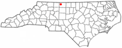 Location of Stoneville, North Carolina | |
| Coordinates: 36°27′57″N 79°54′23″W / 36.46583°N 79.90639°WCoordinates: 36°27′57″N 79°54′23″W / 36.46583°N 79.90639°W | |
| Country | United States |
| State | North Carolina |
| County | Rockingham |
| Named for | Stone family |
| Area | |
| • Total | 1.2 sq mi (3.2 km2) |
| • Land | 1.2 sq mi (3.2 km2) |
| • Water | 0.0 sq mi (0.0 km2) |
| Elevation | 830 ft (253 m) |
| Population (2010) | |
| • Total | 1,056 |
| • Density | 820.4/sq mi (316.8/km2) |
| Time zone | Eastern (EST) (UTC-5) |
| • Summer (DST) | EDT (UTC-4) |
| ZIP code | 27048 |
| Area code(s) | 336 |
| FIPS code | 37-65100[1] |
| GNIS feature ID | 0995543[2] |
| Website | Town Of Stoneville, NC |
Stoneville is a town in Rockingham County, North Carolina, United States.
History
Settlers came to the ridge between the Mayo and Dan rivers in the northwest Piedmont region in the early 1800s. In 1827, the Deep Springs Plantation was built for James Madison Scales and his wife Elizabeth Lesuer in what is now Stoneville.[3] In 1843 the R.H. Lewis Tobacco company was established in the south side of the land that was to become the town of Stoneville.[4] In the late 1850s, brothers Thomas and Pinkney Stone bought land in the area.. On March 5, 1877, the town was officially incorporated.[5] A natural stop on the Norfolk-Western rail line, Stoneville became the trade hub for the surrounding localities and profited off of tobacco, cotton and grist-milling industries.[6]
Two people in the town were killed during the 1998 Gainesville–Stoneville tornado outbreak.
Geography
Stoneville is located at 36°27′57″N 79°54′23″W / 36.46583°N 79.90639°W (36.465836, -79.906342).[7]
According to the United States Census Bureau, the town has a total area of 1.2 square miles (3.1 km2), all of it land.
Demographics
| Historical population | |||
|---|---|---|---|
| Census | Pop. | %± | |
| 1880 | 100 | — | |
| 1890 | 115 | 15.0% | |
| 1910 | 404 | — | |
| 1920 | 472 | 16.8% | |
| 1930 | 564 | 19.5% | |
| 1940 | 615 | 9.0% | |
| 1950 | 786 | 27.8% | |
| 1960 | 951 | 21.0% | |
| 1970 | 1,030 | 8.3% | |
| 1980 | 1,054 | 2.3% | |
| 1990 | 1,109 | 5.2% | |
| 2000 | 1,002 | −9.6% | |
| 2010 | 1,056 | 5.4% | |
| Est. 2015 | 1,038 | [8] | −1.7% |
As of the census[1] of 2010, there were 1,056 people, 469 households, and 292 families residing in the town. The population density was 820.4 people per square mile (317.1/km²). There were 518 housing units at an average density of 424.1 per square mile (163.9/km²). The racial makeup of the town was 77.64% White, 19.26% African American, 0.10% Pacific Islander, 2.10% from other races, and 0.90% from two or more races. Hispanic or Latino of any race were 3.59% of the population.
There were 469 households out of which 20.7% had children under the age of 18 living with them, 47.3% were married couples living together, 11.9% had a female householder with no husband present, and 37.7% were non-families. 35.2% of all households were made up of individuals and 20.0% had someone living alone who was 65 years of age or older. The average household size was 2.13 and the average family size was 2.73.
In the town the population was spread out with 20.0% under the age of 18, 5.8% from 18 to 24, 24.8% from 25 to 44, 25.9% from 45 to 64, and 23.6% who were 65 years of age or older. The median age was 45 years. For every 100 females there were 83.5 males. For every 100 females age 18 and over, there were 79.0 males.
The median income for a household in the town was $28,313, and the median income for a family was $39,375. Males had a median income of $26,167 versus $21,354 for females. The per capita income for the town was $17,255. About 8.2% of families and 12.7% of the population were below the poverty line, including 17.0% of those under age 18 and 20.9% of those age 65 or over.
Attractions
References
- 1 2 "American FactFinder". United States Census Bureau. Retrieved 2008-01-31.
- ↑ "US Board on Geographic Names". United States Geological Survey. 2007-10-25. Retrieved 2008-01-31.
- ↑ http://www.themarconline.org/deep-springs-historic-home
- ↑ "R.H. Lewis Tobacco Company". DigitalNC.org. North Carolina Digital Library. 1976. Retrieved 12 May 2016.
- ↑ http://www.town.stoneville.nc.us/
- ↑ Aheron, Piper (1997). From Avalon to Eden: A Postcard Tour of Rockingham County. Images of America (illustrated ed.). Arcadia Publishing. ISBN 9780752408248.
- ↑ "US Gazetteer files: 2010, 2000, and 1990". United States Census Bureau. 2011-02-12. Retrieved 2011-04-23.
- ↑ "Annual Estimates of the Resident Population for Incorporated Places: April 1, 2010 to July 1, 2015". Retrieved July 2, 2016.
- ↑ "Census of Population and Housing". Census.gov. Retrieved June 4, 2015.
External links
- Official website of Stoneville, NC
- The Madison Messenger, the area's community newspaper
- Stoneville's devastating tornado of March 20, 1998
Municipalities and communities of Rockingham County, North Carolina, United States | ||
|---|---|---|
| Cities | 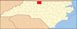 | |
| Towns | ||
| CDP | ||
| Unincorporated communities | ||