Shidler, Oklahoma
| Shidler, Oklahoma | |
|---|---|
| City | |
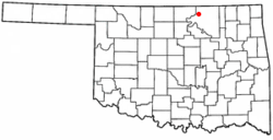 Location of Shidler, Oklahoma | |
| Coordinates: 36°46′49″N 96°39′43″W / 36.78028°N 96.66194°WCoordinates: 36°46′49″N 96°39′43″W / 36.78028°N 96.66194°W | |
| Country | United States |
| State | Oklahoma |
| County | Osage |
| Area | |
| • Total | 0.8 sq mi (2.0 km2) |
| • Land | 0.8 sq mi (2.0 km2) |
| • Water | 0.0 sq mi (0.0 km2) |
| Elevation | 1,168 ft (356 m) |
| Population (2010) | |
| • Total | 441 |
| • Density | 678.8/sq mi (262.1/km2) |
| Time zone | Central (CST) (UTC-6) |
| • Summer (DST) | CDT (UTC-5) |
| ZIP code | 74652 |
| Area code(s) | 539/918 |
| FIPS code | 40-67200[1] |
| GNIS feature ID | 1097990[2] |
Shidler is a city in Osage County, Oklahoma, United States. The population was 441 at the 2010 census, a 15.2 percent decrease from 520 at the 2000 census.[3]
History
Shidler was founded in December 1921 and named for Eugene S. Shidler, a Pawhuska, Oklahoma banker and rancher. The town grew rapidly to a population of about 5,000 due to the discovery of petroleum nearby (see Whizbang, Oklahoma) and the arrival of the Osage Railway (a branch of the Midland Valley Railway) in February 1922. In that year, Shidler had 19 oil-well supply businesses and six plants making gasoline. Shidler had a reputation for lawlessness with bank and highway robberies common. By the late 1920s, the oil boom had subsided and Shidler began to lose population. Shidler's population in the 1930 census was 1,177 and the downward trend continued. Shidler today is a quiet farming and ranching community although there is still some petroleum production in the area.[4]
During World War II, citizens of Shidler actively lobbied to prevent the internment of the Yamamoto family from Shidler (see Internment of Japanese Americans). Thanks to the efforts of US Senator Elmer Thomas, the internment order was lifted.[5]
Geography
Shidler is located at 36°46′49″N 96°39′43″W / 36.78028°N 96.66194°W (36.780342, -96.661844).[6] It is 29 miles (47 km) northwest of Pawhuska, the seat of Osage County.[4]
According to the United States Census Bureau, the city has a total area of 0.8 square miles (2.1 km2), all of it land.
Demographics
| Historical population | |||
|---|---|---|---|
| Census | Pop. | %± | |
| 1930 | 1,177 | — | |
| 1940 | 718 | −39.0% | |
| 1950 | 840 | 17.0% | |
| 1960 | 870 | 3.6% | |
| 1970 | 717 | −17.6% | |
| 1980 | 708 | −1.3% | |
| 1990 | 487 | −31.2% | |
| 2000 | 520 | 6.8% | |
| 2010 | 441 | −15.2% | |
| Est. 2015 | 436 | [7] | −1.1% |
As of the census[1] of 2000, there were 520 people, 231 households, and 148 families residing in the city. The population density was 678.8 people per square mile (260.7/km²). There were 278 housing units at an average density of 362.9 per square mile (139.4/km²). The racial makeup of the city was 81.35% White, 14.04% Native American, 0.96% from other races, and 3.65% from two or more races. Hispanic or Latino of any race were 2.50% of the population.
There were 231 households out of which 25.5% had children under the age of 18 living with them, 49.8% were married couples living together, 9.5% had a female householder with no husband present, and 35.9% were non-families. 31.6% of all households were made up of individuals and 17.3% had someone living alone who was 65 years of age or older. The average household size was 2.25 and the average family size was 2.78.
In the city the population was spread out with 23.5% under the age of 18, 9.6% from 18 to 24, 22.5% from 25 to 44, 23.1% from 45 to 64, and 21.3% who were 65 years of age or older. The median age was 41 years. For every 100 females there were 92.6 males. For every 100 females age 18 and over, there were 86.0 males.
The median income for a household in the city was $29,732, and the median income for a family was $35,156. Males had a median income of $31,932 versus $17,143 for females. The per capita income for the city was $16,245. About 11.0% of families and 15.9% of the population were below the poverty line, including 23.1% of those under age 18 and 13.5% of those age 65 or over.
Education
The town is home of the Shidler Public Schools Fighting Tigers. The school has about 250 students in kindergarten through 12th grade. The school brings in students from the surrounding towns of Grainola, Foraker, Webb City, Kaw City, and Burbank.
References
- 1 2 "American FactFinder". United States Census Bureau. Retrieved 2008-01-31.
- ↑ "US Board on Geographic Names". United States Geological Survey. 2007-10-25. Retrieved 2008-01-31.
- ↑ MuniNet Guide: Shidler Oklahoma
- 1 2 Jon D. May, "Shidler," Encyclopedia of Oklahoma History], Accessed 25 Feb 2011
- ↑ Jackson, Rachel C. "How it Should Be," Sugar Mule , Issue #35.
- ↑ "US Gazetteer files: 2010, 2000, and 1990". United States Census Bureau. 2011-02-12. Retrieved 2011-04-23.
- ↑ "Annual Estimates of the Resident Population for Incorporated Places: April 1, 2010 to July 1, 2015". Retrieved July 2, 2016.
- ↑ "Census of Population and Housing". Census.gov. Retrieved June 4, 2015.
External links
Municipalities and communities of Osage County, Oklahoma, United States | ||
|---|---|---|
| Cities | 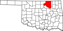 | |
| Towns | ||
| CDP | ||
| Unincorporated communities |
| |
| Footnotes | ‡This populated place also has portions in an adjacent county or counties | |