Sherwood, Oregon
| Sherwood, Oregon | |
|---|---|
| City | |
|
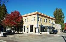
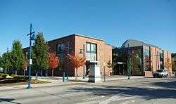
Building in downtown | |
| Nickname(s): Smockville | |
| Motto: Home of the Tualatin River National Wildlife Refuge | |
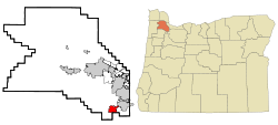 Location in Oregon | |
| Coordinates: 45°21′25″N 122°50′36″W / 45.35694°N 122.84333°WCoordinates: 45°21′25″N 122°50′36″W / 45.35694°N 122.84333°W | |
| Country | United States |
| State | Oregon |
| County | Washington |
| Incorporated | 1893 |
| Government | |
| • Type | Council-manager |
| • Mayor | Krisanna Clark |
| Area[1] | |
| • Total | 4.31 sq mi (11.16 km2) |
| • Land | 4.31 sq mi (11.16 km2) |
| • Water | 0 sq mi (0 km2) |
| Elevation | 193 ft (59 m) |
| Population (2010)[2] | |
| • Total | 18,194 |
| • Estimate (2014[3]) | 18,978 |
| • Density | 4,221.3/sq mi (1,629.9/km2) |
| Time zone | Pacific (UTC-8) |
| • Summer (DST) | Pacific (UTC-7) |
| ZIP code | 97140 |
| Area code(s) | 503 |
| FIPS code | 41-67100[2] |
| GNIS feature ID | 1126877[4] |
| Website | www.ci.sherwood.or.us |
Sherwood is a city in Washington County, Oregon, United States. Located in the southeast corner of the county, it is a residential community in the Tualatin Valley southwest of Portland. As of the 2010 census, Sherwood had a population of 18,194 residents. The city's population for 2014 was estimated to be 18,978 by the U.S. Census.[5] Sherwood was first incorporated in 1893 as a town. Originally named Smockville after its founder, James Christopher Smock, the town was given its current name by local businessman Robert Alexander in 1891, who likely named it after his hometown of Sherwood, Michigan.
History
What is now the Sherwood area was originally inhabited by the Atfalati band of the Kalapuya nation. The first significant wave of United States emigrants arrived in 1842.[6] Native Americans were relocated to reservations after the Donation Land Claim Act of 1850–55 gave American citizens exclusive ownership of these lands. The relocation process took place under the guidance of a series of federal employees, most notably Superintendent of Indian Affairs Joel Palmer, who was severely criticized for his humane treatment of the tribes.
The California Gold Rush of 1849 caused a dramatic shift in the area's economy. Oregon City, Oregon is along a stretch of the Willamette River that had always been attractive to trade since prehistoric times, when trading activity was dominated by the Chinookan tribe. When settlers of European extraction began arriving in large numbers, Oregon City became (arguably) the "End of the Oregon Trail". After the Gold Rush, however, Portland, Oregon, replaced Oregon City as the area's most important center of trade and commerce. Sherwood is within 20 miles (32 km) of both cities.
The name "Sherwood" arose from a declination of naming the town "Smock Ville" after its co-founders James Christopher and Mary Ellen Smock. In 1885, the Smocks gave a right-of-way on their property to the Portland and Willamette Valley Railway. The Smocks platted the town in 1889, the same year rail service began. Tradition has it that no one, not even the town's founders, liked the name "Smock Ville," and so a public meeting was held to rename the town.[7] Robert Alexander, who was both a local resident and prominent businessman, suggested the name "Sherwood." According to post office records, Alexander was from Sherwood, Michigan,[8] and also said the forest which surrounded the city was like Sherwood Forest in England. The U.S. Postal Department began sending mail to the Town of Sherwood, Oregon on July 5, 1891. Smock was the first postmaster. The Town of Sherwood was incorporated under Oregon Senate Bill 36 in 1893.[9]
The main industry in the 1890s was a pressed brick yard which closed in 1896, a victim of the deep recession of 1893.[10] The Klondike Gold Rush of 1897 revived Sherwood's economy. In 2013, Money ranked Sherwood fifth among the top fifty best places to live in the United States.[11] In August 2009, Family Circle named the city one of America's most "family friendly" small towns.
The population of the city in 1911 was 350 within a 1-square-mile (2.6 km2) city limit. The city has since expanded to nearly 4.5 square miles (12 km2).[12]
Geography
According to the United States Census Bureau, the city has a total area of 4.31 square miles (11.16 km2), all of it land.[1]
| Climate data for Sherwood, Oregon | |||||||||||||
|---|---|---|---|---|---|---|---|---|---|---|---|---|---|
| Month | Jan | Feb | Mar | Apr | May | Jun | Jul | Aug | Sep | Oct | Nov | Dec | Year |
| Average high °F (°C) | 49 (9) |
53 (12) |
58 (14) |
63 (17) |
69 (21) |
75 (24) |
81 (27) |
81 (27) |
77 (25) |
65 (18) |
54 (12) |
47 (8) |
64.3 (17.8) |
| Average low °F (°C) | 35 (2) |
35 (2) |
38 (3) |
41 (5) |
46 (8) |
50 (10) |
54 (12) |
54 (12) |
50 (10) |
43 (6) |
38 (3) |
34 (1) |
43.2 (6.2) |
| Average precipitation inches (mm) | 6.11 (155.2) |
4.62 (117.3) |
4.06 (103.1) |
2.99 (75.9) |
2.29 (58.2) |
1.77 (45) |
.56 (14.2) |
.64 (16.3) |
1.39 (35.3) |
3.12 (79.2) |
6.36 (161.5) |
6.82 (173.2) |
40.73 (1,034.4) |
| Source: [13] | |||||||||||||
Demographics
| Historical population | |||
|---|---|---|---|
| Census | Pop. | %± | |
| 1900 | 111 | — | |
| 1910 | 115 | 3.6% | |
| 1920 | 320 | 178.3% | |
| 1930 | 382 | 19.4% | |
| 1940 | 447 | 17.0% | |
| 1950 | 575 | 28.6% | |
| 1960 | 680 | 18.3% | |
| 1970 | 1,396 | 105.3% | |
| 1980 | 2,386 | 70.9% | |
| 1990 | 3,093 | 29.6% | |
| 2000 | 11,791 | 281.2% | |
| 2010 | 18,194 | 54.3% | |
| Est. 2015 | 19,283 | [14] | 6.0% |
| Sources:[2][15][16][17][18][19] | |||
2010 census
As of the census of 2010, there were 18,194 people, 6,316 households, and 4,857 families residing in the city. The population density was 4,221.3 inhabitants per square mile (1,629.9/km2). There were 6,569 housing units at an average density of 1,524.1 per square mile (588.5/km2). The racial makeup of the city was 88.5% White, 0.8% African American, 0.5% Native American, 3.5% Asian, 0.3% Pacific Islander, 2.7% from other races, and 3.7% from two or more races. Hispanic or Latino of any race were 7.0% of the population.[2]
There were 6,316 households of which 49.6% had children under the age of 18 living with them, 63.5% were married couples living together, 9.7% had a female householder with no husband present, 3.6% had a male householder with no wife present, and 23.1% were non-families. 19.0% of all households were made up of individuals and 6.7% had someone living alone who was 65 years of age or older. The average household size was 2.88 and the average family size was 3.31.[2]
The median age in the city was 34.3 years. 33.6% of residents were under the age of 18; 5% were between the ages of 18 and 24; 32.9% were from 25 to 44; 21.6% were from 45 to 64; and 6.8% were 65 years of age or older. The gender makeup of the city was 48.9% male and 51.1% female.[2]
The median income for a household in the city was $82,579, and the median income for a family was $90,492. Males had a median income of $66,052 versus $47,013 for females. The per capita income for the city was $31,047. About 2.2% of families and 4.1% of the population were below the poverty line, including 3.8% of those under age 18 and 1.0% of those age 65 or over.[2]
2000 census
As of the 2000 census, there were 11,791 people, 4,253 households, and 3,300 families residing in the city. The population density was 2,895.5 people per square mile (1,118.6/km²). There were 4,412 housing units at an average density of 1,083.4 per square mile (418.5/km²). The racial makeup of the city was 92.36% White, 0.43% African American, 0.51% Native American, 2.22% Asian, 0.04% Pacific Islander, 1.76% from other races, and 2.67% from two or more ethnicity. Hispanic or Latino of any ethnicity were 4.72% of the population.[2]
There were 4,253 households out of which 46.3% had children under the age of 18 living with them, 65.7% were married couples living together, 8.8% had a female householder with no husband present, and 22.4% were non-families. 17.0% of all households were made up of individuals and 5.4% had someone living alone who was 65 years of age or older. The average household size was 2.77 and the average family size was 3.14.[2]
In the city the population was spread out with 31.7% under the age of 18, 5.5% from 18 to 24, 41.2% from 25 to 44, 16.4% from 45 to 64, and 5.3% who were 65 years of age or older. The median age was 31 years. For every 100 females there were 95.4 males. For every 100 females age 18 and over, there were 92.9 males.[2]
The median income for a household in the city was $62,518, and the median income for a family was $67,277. Males had a median income of $47,920 versus $33,657 for females. The per capita income for the city was $25,793. About 1.5% of families and 2.7% of the population were below the poverty line, including 2.0% of those under age 18 and 11.7% of those age 65 or over.[2]
Schools
Sherwood has four elementary schools (J. Clyde Hopkins, Middleton, Archer Glen, Edy Ridge), two middle schools (Sherwood Middle School, Laurel Ridge), and one high school, Sherwood High School, in the Sherwood School District. Each elementary school holds around 600 students, Laurel Ridge has about 450 students, Sherwood Middle School has about 1000 students, and the high school has an enrollment of approximately 1300 students. The Sherwood School District also sponsors a program for at-risk youth in high school, and has an alternative school for teens having problems with the abuse of drugs or alcohol, and also caters to students in trouble with law enforcement. Within the confines of the city, there is also a private grade-school, a public charter k-8 school (Sherwood Charter School) as well as a private religious school (St. Francis Catholic School).
Notable people
- Del Baker, former Major League Baseball player and manager
- Jim Benning, general manager of the Vancouver Canucks
- Dave Edstrom, former Olympic decathlete
- A.C. Gibbs, 2nd Governor of Oregon
- Iain Harrison, competitive shooter
- Jiggs Parrott, baseball player
- Thomas H. Parrott, musician
- Tom Parrott, baseball player
- Bud Podbielan, baseball player
- Chuck Sun, former professional motocross racer
- Dave Mora, former internet star and current Moriboy Inc., CTO
See also
References
- 1 2 "US Gazetteer files 2010". United States Census Bureau. Retrieved 2012-12-21.
- 1 2 3 4 5 6 7 8 9 10 11 "American FactFinder". United States Census Bureau. Retrieved 2012-12-21.
- ↑ "Population Estimates". United States Census Bureau. Retrieved 2013-06-02.
- ↑ "US Board on Geographic Names". United States Geological Survey. 2007-10-25. Retrieved 2008-01-31.
- ↑ "Annual Estimates of the Resident Population for Incorporated Places: April 1, 2010 to July 1, 2014". Retrieved June 4, 2015.
- ↑
- ↑ http://www.clydeburger.com/map/subset/sherk/index.htm
- ↑ Engeman, Richard H. "The Oregon Companion: An Historical Gazetteer of the Useful, the Curious, and the Arcane" Timber Press, 2009, p. 341
- ↑ http://www.clydeburger.com/map/subset/documents/charter1893.htm Oregon Senate Bill 36
- ↑ http://eh.net/encyclopedia/article/whitten.panic.1893
- ↑ "Best Places to Live 2013". Money. Time. 2013. Retrieved 2015-04-11.
- ↑ "City History". City of Sherwood. Retrieved 2015-04-11.
- ↑ "Monthly Averages for Sherwood, OR (97140)". Weather.com. Retrieved March 19, 2012.
- ↑ "Annual Estimates of the Resident Population for Incorporated Places: April 1, 2010 to July 1, 2015". Retrieved July 2, 2016.
- ↑ "Population-Oregon" (PDF). U.S. Census 1910. U.S. Census Bureau. Retrieved 2013-11-22.
- ↑ "Population-Oregon" (PDF). 15th Census of the United States. U.S. Census Bureau. Retrieved 2013-11-27.
- ↑ "Number of Inhabitants: Oregon" (PDF). 18th Census of the United States. U.S. Census Bureau. Retrieved 2013-11-22.
- ↑ "Oregon: Population and Housing Unit Counts" (PDF). U.S. Census Bureau. 1990. Retrieved 2013-11-22.
- ↑ "Incorporated Places and Minor Civil Divisions Datasets: Subcounty Population Estimates: April 1, 2010 to July 1, 2012". U.S. Census Bureau. Retrieved 2013-11-25.
External links
| Wikimedia Commons has media related to Sherwood, Oregon. |
Municipalities and communities of Washington County, Oregon, United States | ||
|---|---|---|
| Cities | 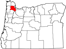 | |
| CDPs | ||
| Unincorporated communities |
| |
| Ghost towns | ||
| Footnotes | ‡This populated place also has portions in an adjacent county or counties | |