Sherikasare
| Sherikasare शेरीकासारे Sherikasari | |
|---|---|
| village | |
 Sherikasare  Sherikasare Location in Maharashtra, India | |
| Coordinates: 19°03′N 74°14′E / 19.05°N 74.23°ECoordinates: 19°03′N 74°14′E / 19.05°N 74.23°E | |
| Country |
|
| State | Maharashtra |
| District | Ahmadnagar |
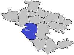
| Taluka | Parner |
| Government | |
| • Body |
ग्रामपंचायत शेरीकासारे सरपंच : उपसरपंच : |
| Population | |
| • Total |
661 area_magnitude= sq. km |
| Languages | |
| • Official | Marathi |
| Time zone | IST (UTC+5:30) |
| PIN | 414 305 |
| Telephone code | 02488 |
| Vehicle registration | MH-16, MH-17 |
| Nearest city | Parner, Shirur, Narayangaon, Sangamner, Junner, Nighoj. |
| Literacy | 75% |
| Lok Sabha constituency | Ahmednagar |
| Civic agency | Grampanchayat Sherikasare |
| Climate | Dry and hot (Köppen) |
| Avg. summer temperature | 40 °C (104 °F) |
| Avg. winter temperature | 15 °C (59 °F) |
| Website |
maharashtra |
Sherikasari, is newly separated small village from Alkuti village of Parner Taluka in Ahmednagar District of state of Maharashtra, India.[1]
Religion
The majority of the population in the village is Hindu. In India from the age of Ancient times, peoples of Maharashtra, Karnataka, Madhya Pradesh, Gujarat, Goa. etc. were worshiping Lord Shri Khondaba as Kuldevatha or Kuldaivath. Lord Shiva took avtar of Marthand Bhairav to defeat Mani and Malya Rakshas. That day was of Shudha Champasasthi. Since then Champasasthi is celebrated as "Khondaba Avatar Day".
Sherikasari- Parner
The India Village Sherikasari, is located in the taluk of Parner, district of Ahmednagar, in the State of Maharashtra.
About Sherikasari
- It belongs to Khandesh and Northern Maharashtra region
- It belongs to Nashik Division
- It is located 64 km towards west from District headquarters Ahmednagar
- 28 km from Parner
- 4 h 8 min (177.6 km) via NH61 Thane to Sherikasari
- 184 km (Thane) from State capital Mumbai Sherikasari Pin code is 414305 and postal head office is Alkuti
- Garkhindi (4 km), Kalas (5 km), Darodi (5 km), Shirapur (7 km), Lonimawala (7 km) are the nearby villages to Sherikasari
- Sherikasari is surrounded by Shirur Taluka towards south, Junnar Taluka towards west, Ambegaon Taluka towards west, Khed Taluka towards west
- Shirur, Manchar, Junnar, Ahmednagar are the nearby cities to Sherikasari
Places to Visit
Ozar- 35 km
Junnar- 45 km
Vadhu Tulapur- 55 km
Ahmednagar- 57 km
Malshej Ghat- 65 km
Sherikasari Nearby Places
Few nearby places of Sherikasari are listed below for your reference:
Cities
Shirur- 33 km
Manchar- 37 km
Junnar- 45 km
Ahmednagar- 59 km
Taluks
Shirur- 33 km
Junnar- 45 km
Ambegaon- 46 km
Khed- 47 km
District Head Quarters
Ahmednagar- 58 km
Pune- 81 km
Nashik- 125 km
Raigad- 136 km
Wadi
Down Site Mule Wadi, Up Site Mule Wadi, Zaap...
Nearby Villages of Sherikasari
   Alkuti
   Randhe
   Mhaskewadi
   Chincholi
   Wadzire
   Loni Mawala
   Pabal
   Padali Ale
   Renwadi
   Chombhut
   Shirapur
Temple
- Charangbaba Temple Utsav in भाद्रपद शुक्ल २ Every Year this Utsav Organization to Charangbaba Mitra Mandal.
 Charangbaba2013
 Charangbaba 2013
 - Hanuman Temple.
- Mukatabai Temple.

Economy
The majority of the population has farming as their primary occupation.
Agriculture
There are two seasons of cropping Kharif & Rabi. Wheat, Groundnut, Onions, Bajari are some of the main crops in khodad. But farmers in village are taking up the new way farming to yield non traditional crops like Tomato, Cabbage and making it success story
Education
Schools & Colleges
- Rayat Kshishan Sanstha's Shri SAINATH High School and Jr. College (Science, Arts and MCVC) Alkuti.
- SAI Education Socity's English Medium School Alkuti
- Ashram Shala Alkuti
- Art, Commerce & Science Senior College, Alkuti
- Jilha Parishad Primary School, Alkuti
- Jilha Parishad Primary School, (Bahirobawadi) Alkuti
Finance
Near Banks
State : Maharashtra
District : Ahmadnagar
Branch : Alkuti
IFSC Code : CBIN0282849 (5th character is zero)
Branch Code : 282849 (Last 6 Characters of the IFSC Code)
City : Alkuti
Address : At & P.o.alkuti, Tal.parner, Dist- Ahmednagar, Maharashtra-414 305
Contact : 02488-250218
- Ahmednagar District Central Co-Operative Bank
- Swami Samarth Bank, Nighoj-Alkuti
- Alkuti Gramin Patsanstha
- Senapati bapat Patsantha
- Parner Gramin Patsantha
- Kanhur Pathar Patsanstha
- Nighoj Gramin Patsanstha.
ATM
- HDFC Bank ATM Bangarwadi, Belhe, Tal: Junnar, Kalyan - Ahmednagar Highway, Bangarwadi, Maharashtra 412410, 21 min (12.2 km) via MH SH 51 (20 min without traffic)
- HDFC Bank ATM At/post - Rajuri, NH222, Maharashtra 412411, 23 min (15.9 km) via MH SH 51 and NH61 (22 min without traffic)
- IDBI Bank ATM At/post - Rajuri, NH222, Maharashtra 412411, 23 min (15.9 km) via MH SH 51 and NH61 (22 min without traffic)
- SBI ATM, Near SBI, NH222, Alephata, Maharashtra 412411, 31 min (21.7 km) via MH SH 51 and NH61
- Maharashtra Bank ATM, NH222, Alephata, Maharashtra 412411, 31 min (21.7 km) via MH SH 51 and NH61
- Bank of India ATM, Pune - Nashik Hwy, Alephata, Maharashtra 412411, 31 min (21.7 km) via MH SH 51 and NH61
- ICICI Bank ATM, Pune Road, Alephata, Maharashtra 412411, 31 min (21.7 km) via MH SH 51 and NH61
Religious Sites
Shree Kshetra Korthan Khandoba Devastan - Pimpalgaon Rotha
Sherikasari to Shree Kshetra Korthan Khandoba Devastan Pimpalgaon Rotha 7.1 km
About Devasthan
From ancient times Lord Khandoba has been worshiped in Maharashtra, Karnataka, Madhya Pradesh, Gujarat and Goa of India. His deity is a form of Lord Shiva.

On Hindu month Margashish and the day of "Shukla 6", Champashasti is celebrated as "Shree Khandoba Avtaar Diwas". On Paush poornima Shree Khandoba wed with Mhalsabai; thus we celebrate grand Yatra Mohotsav. On this day many people from Maharashtra as well as Madhya Pradesh, Gujrat, Karnataka, and Goa come. The statue of Khandoba is thought to not have been made by anyone, but rather is self-generated; thus it is called Kor than, here. Kor means "untouched".
Yatra
This temple has a grand yatra of the god Khandoba every year on the Hindu month of Paush and the day of the poornima.[2]
This grand celebration lasts three days. The second day of yatra has a very popular bullock cart race locally called the Gaade. This racing generally consists of a pair of bullocks with Bhandara on their whole body. Sometimes the bullocks are led by a horse and a man sitting on it. A specially dedicated track is made for this event on the right side of the temple. Then, the second new track is made at Bhandara Doongar (hill), but in 2011 this race was carried out at the far left of the temple.
The third day of the yatra is called Kathya. Kathya generally stands for the long wooden stick (nearly 35–50 feet), covered by various colored cloths, which is roped to give support. The first kadthi to arrive at the temple is of Pimpalgaon Rotha. The other villages kathya (from Belhe and Aale) follows it. When this kathya touches the top of temple (Kalash), the yatra of the God Khandoba is declared finished.
The third day of the yatra is called Kathya. Kathya generally stands for the long wooden stick (nearly 35–50 feet), covered by various colored cloths, which is roped to give support. The first kadthi to arrive at the temple is of Pimpalgaon Rotha. The other villages kathya (from Belhe and Aale) follows it. When this kathya touches the top of temple (Kalash), the yatra of the God Khandoba is declared finished.
Shani Shingnapur
About Shani Shingnapur
Shani Shingnapur is a village where there are no door frames and locks in homes. Natives believe that Shani Dev protect them and their houses from any kind of theft or crime. The village is visited by devotees as well as tourists on Shani Amavasya or no moon day falling on Saturdays. A temple is dedicated to Lord Shani and the idol enshrined is a slab of the rock. The premises of the temple have a tomb of Udasi Baba, a Sufi saint. Legends state that about two hundred years ago, the idol was found by a shepherd boy during the flood in the stream. One of the villagers had a dream that this rock was nothing but a Shani idol. Thus, the villagers established an open air shrine.
Takali is a small village in Parner district. We went to this place from Wadgaon Daryabai temple. Around 3 km from Takali village is Dhokeshwar mountain temple. We took tea and Misal-paav break on the way to Takali village.
We climbed the mountain stone stairs to reach the top. There is a beautiful cave temple on the top dates back in 5th – 6th century. Along with Shivlinga, nandi, it also has idols of Laxmi, Ganesh and Bhairav carved in black stones. We relaxed inside the temple. Cold breeze fade away our tiredness. Another must mention thing here is – the water source near the cave. It has water springs throughout the year. I can say I never tasted the water like that anywhere else. We got our water bottles filled and started climbing down.
Each place we visited in this trip was unique in its own way. It was already evening by then and we drove back to Pune with feelings of contentment.
Sai Baba of Shirdi
Amruteshwar Temple, Bhandardara
Amriteshwar Temple has been built as per the Hemadpanti architectural style and dates back to 1100 AD. The main attractions of the temple are its intricate carvings.
Shri Siddhivinayak Temple
About Shri Siddhivinayak Temple
Not Allowed: Pets
Timings - Opening & Closing: Monday - Friday: 6.00 AM - 6.00 PM, Saturday: 6.00 AM - 6.00 PM, Sunday: 6.00 AM - 6.00 PM, Public Holidays: 6.00 AM - 6.00 PM
Shri Siddhivinayak Temple is located at Siddhatek, one of the famous mountain peaks of the region. It is believed that the site was known as a place where Lord Vishnu performed penance to get a boon from Lord Siddheshwar Ganesh. Sage Moraya Gosavi from Chinchwad and Sage Narayan Maharaj from Kodgaon completed their penance and got siddhi from Lord Siddhivinayak at this place.
It is believed that when Lord Brahma was creating nature, two demons, namely Madhu and Kaitabh started harassing gods, goddesses and sages. Lord Vishnu fought with them for 5 thousand years and finally came to Siddhi Kshetra, presently known as Siddhatek, and requested Lord Ganesha to kill the demons.
At the site, he found right trunk of the idol of Lord Ganesha and entitled him as Siddhivinayak. The temple was cleaned by a cowherd who used to wash the idol with the water of River Bhima. The place is counted among one of the 21 holy places of Lord Ganesha that are mentioned in the puranas.
Takali Dhokeshwar - Cave Temple of Shiva
Takali Dhokeshwar Cave Temple (5th century) is located around 3 km from Takali village in Ahmednagar District, Maharashtra (near Shirur on Pune-Ahmednagar highway). The cave has a fortification around it. In the cave, there are Shiva, Parvati and Ganesh sculptures on side walls and two huge dwarpal sculptures at the two sides of the door frame of the gabhara. The Gabhara having main Shivalinga and has a dark passageway around it. There is a big Nandi idol situated on the right hand side & veergal (hero stone) at left sideof the passageway. There is a deepamala outside the cave & a meditation room (Vihara) just above the water tank, besides main cave. Youtube
Madhi
About Madhi
Not Allowed: Pets
Madhi is renowned for the Samadhi of Shri Chaitanya Kanifnath Maharaj, one of the nine nath persons. The samadhi is decorated with beautiful stones and carvings. Gopalas, the nomadic tribe of the region, set up community courts in the vicinity of the shrine for solving social and familial issues. A holy procession during Holi is held from the samadhi to gudhi padwa. One of the prime attractions of this procession is the Donkey Bazar.
Ranjangaon
Our day began with sacred darshan of Mahaganapati of Ranjangaon. Ranjangaon Ganesh is one of the eight holy Ganapatis i.e. Asthavinayak. Ranjangaon temple is in Shirur district and on main highway at 52 km from Pune. There is beautiful garden developed outside the temple. We had a quick tea break here and then proceeded towards Nighoj. While on the way to Nighoj, we came across birds like Shrike, Purple Sunbird and Black shouldered kite.
Nighoj
To reach Nighoj –
- Take Pune – Nagar Highway and drive up to “Ghodnadi” river bridge.
- Take immediate left turn after crossing the bridge. This is “Nighoj Phata”.
- Drive approx. 25 km to reach Nighoj village. The road is in OK condition.
- From village travel 3 km more to reach “Kukadi” river where you can see pot holes.
The entire bank of Kukdi River is turned into moon land of huge pot holes. The phenomenon behind its formation goes back to more than thousands of years. The river flow wears out the vesicular basalt’s upper layer and compact basalt layer of the rock. Then small hard pebbles vigorously swirl in these wear out areas due to flow of the water to create circular pot holes. There is huge gorge or canyon created in the river due to the whirl effect of stones for the ages. These are believed to be the largest natural pot holes in Asia. It is very amazing and interesting place. You just have to see this miracle with your eyes to believe it. There is small temple of “Malganga” on the bank on this river.
Only thing, which hurt, is that we don’t do anything to conserve this beauty. Not many people know about it.
Best time to visit: Summer (March–April). May month will be extremely hot.
Summer is best time to visit this place. As water level goes down, pot holes are easily visible. In monsoon, you merely can view gigantism of pot holes. It is said to be approx. 100 feet deep and 3 km long. Besides, it can be very dangerous to experience their gigantism otherwise. I took as many snaps as I could and also some live clippings of whirl effects for my folks. We started back and it was already time for food. We found a shady place and unwind mattresses. We enjoyed home made food and relaxed for some time. We had way to go
Vadgaon Daryabai
From Nighoj, we went to Wadgaon to see another marvel. Wadgaon is plain plateau, which is rich in calcium/limestone. On the way, we saw flock of Swallows. We reached the place and started climbing down stone stairs to go to Daryabai cave temple. Our ancestors warmly greeted us.
CAUTION – Be sure that you don’t carry any eatables to the Daryabai cave temple. There is entire gang of Bonnet monkeys and their IQ is as good as ours. They know how to snatch away and eat all that you carry from “coconut” to “peanuts” and “Cadbury’s Dairy Milk” to “Center fresh”.
Jokes apart, about another marvel called “Daryabai cave temple” – this temple is dark inside and has dripping water streams inside which gives birth to stalactite. A stalactite is type of cave formation that hangs from the ceiling or wall of limestone caves. It is sometimes referred to as dripstone. It is called as “Lavan kandya” in Marathi. Each stalactite takes thousands and lakhs of years to form. Unfortunately, people who visit this place break them for fun; get them home and then just throw away without knowing their importance.
Takali-Dhokeshwar
Takali is a small village in Parner district. We went to this place from Wadgaon Daryabai temple. Around 3 km from Takali village is Dhokeshwar mountain temple. We took tea and Misal-paav break on the way to Takali village.
We climbed the mountain stone stairs to reach the top. There is a beautiful cave temple on the top dates back in 5th – 6th century. Along with Shivlinga, nandi, it also has idols of Laxmi, Ganesh and Bhairav carved in black stones. We relaxed inside the temple. Cold breeze fade away our tiredness. Another must mention thing here is – the water source near the cave. It has water springs throughout the year. I can say I never tasted the water like that anywhere else. We got our water bottles filled and started climbing down.
Each place we visited in this trip was unique in its own way. It was already evening by then and we drove back to Pune with feelings of contentment.
Datta Temple
About Datta Temple
Not Allowed: Pets
Timings - Opening & Closing: Monday - Friday: 6.00 AM - 6.00 PM, Saturday: 6.00 AM - 6.00 PM, Sunday: 6.00 AM - 6.00 PM, Public Holidays: 6.00 AM - 6.00 PM
Datta Temple is situated in Devgad village and is situated on the banks of River Pravara. The site is popular as it was the home to Kisangiri Maharaj, a saint and messenger of Lord Datta. The temple stands between the gardened pathways, which lead to the inner sanctum of the temple. Apart from this shrine, a small temple of Kisangiri Maharaj is also situated on the banks of River Pravara
Popular
Ahmednagar Fort
About Ahmednagar Fort
Not Allowed: Pets
Timings - Opening & Closing: Monday - Friday: 9.30 AM - 6.00 PM, Saturday: 9.30 AM - 6.00 PM, Sunday: 9.30 AM - 6.00 PM, Public Holidays: 9.30 AM - 6.00 PM
Ahmednagar Fort was constructed by Malik Ahmed, the first sultan of the Nizam Shahi dynasty, during the 15th and the 16th century. The fort has 18 m high walls that are supported by 22 bastions. This fort was also used as a prison for keeping the captured soldiers. At present, the fort is under the control of the military command of India.
The fort has undergone many constructions and renovations during the reign of Hussain Nizam Shah from 1559 to 1562. After six years, he died and Chand Bibi, one of the famous queens, protected the fort. However, when Akbar attacked the fort in 1600, it was captured by the Mughals. The circumference of the fort is oval in shape. The fort has 24 citadels which are 30 m wide and a moat which is 4 to 6 m deep.
The fort was ruled by two main dynasties, namely the Marathas and the Scindias. Aurangzeb, the sixth Mughal Emperor, died in this fort in 1707. Moreover, Madhavrao II and Daulat Scindia died during their reign at this fort. During the Second Anglo-Maratha War in 1803, the fort was won by the British rulers from the Maratha forces and the East India Company captured the fort.
Used as a prison during the British rule, the fort served as a jail to the leaders of Indian National Congress during the Quit India Movement. The popular book named, 'The Discovery of India' was written by Jawaharlal Nehru during his imprisonment at Ahmednagar Fort.
Hidden Gems
Randha Falls
Umbrella Falls
Kid Friendly Attractions
Kalsubai Harishchandragad Wildlife Sanctuary
About Kalsubai Harishchandragad Wildlife Sanctuary
Entry: Paid
Not Allowed: Pets
Kalsubai Harishchandragad Wildlife Sanctuary is located in the Akole Tehsil of the Ahmednagar District. The wildlife sanctuary is situated in the Sahyadri hills. It has the Kalasubai Peak which is located at an average altitude of around 1,646 m. This peak is considered to be one of the highest peaks in the Western Ghats.
Gulchavi, Aashind, Hirda, Beheda, Siras, Avali, Chandawa, Lokhandi, Kharvel and Parjambhual are some of trees commonly found in the sanctuary. Dhaiti, Ber, Mandar, Rametha, Chilhar, Kadipatta and Karwand are the prominent bushes while Pawanya, Harali, Marvel, Surad and Dongari are the species of grasses found in the region.
Housing various species of reptiles, mammals and birds, the sanctuary is an ideal place for nature lovers and adventure enthusiasts. Palm civet, wolf, jackal, barking deer, leopard, mongoose, jungle cat, hyena and Indian giant squirrel are some of the common mammals found in the sanctuary. Reptiles like monitor lizard, fan-throated lizard, turtles and snakes can be seen in the sanctuary. Land and aquatic birds such as egrets, white necked storks, water hen, herons and black ibis are seen around the water bodies of the sanctuary.
Some of monuments located near the sanctuary are the Alang, Kalasubai, Kulanggad, Bahiroba, Harishchandragad, Mandangad and Ratangad.
Sightseeing
Mula Dam
Bhandardara Lake (Lake Aurthur Hill)
About Bhandardara Dam
Bhandardara Dam, one of the popular picnic spots of the region, is constructed on the River Pravara at Bhandardara village on the western coast of India. Constructed in 1926, the dam is considered to be one of the oldest dams in Asia. Situated at an average elevation of around 750 m from the mean sea level, the prime attraction of the destination is the Umbrella Falls. Another prominent waterfall known as the Randha Falls is situated at a distance of around 11 km from the dam.
Major Villages
For list of all villages Near by Sherikasari
The following are a few of the notable villages of Sherikasari:
- Hivare Korda is famous for the Malaganga Devi Mandir and famous for its YATRA utsav which is generally in summer days.
- Devibhoyare is famous for Navratra Ustav of Goddess Shree Devi Ambikamata. It is famous for state-level drama competition.
- Parner is the main city in the taluka.
- Tikhol is a small village in parner towards 14 km north of parner city.It is 3 km from National Highway.It is famous for Tikhol DAM
- Pimpalgaon Rotha is 7.1 km from Sherikasari. It is famous for Shree Kshetra Korthan Khandoba Devastan.
- Karegaon is a small village of approximately 550 people, on the west side of Parner Taluka, 2.5 km from National Highway NH-222. The Shree Kareshwar temple is located here.
- Goregaon is a model village of around 5,000 people, developing under the guidance of Babasaheb Tambe.
- Pimpri Jalsen is a village famous for education.
- Takali Dhokeshwar is one of the biggest village in the taluka. On NH-222, Takli Dhokeshwar is famous for the Lord Shiva temple near Dhoki, Nagar Road.
- Ralegan Siddhi is considered to be a model of environmental conservation under Anna Hazare.[3][4]
- Shahajapur village features 50-60 windmills.
- Karjule Hareshwar is 26 km northwest of Parner City. It is famous for the Hareshwar Temple and Mandhol Dam.
- Kalewdi village is 31 km northwest of parner city.IS famous for utsav "BUVAMAHARAJ" TEMPLE. and famous human unity and making bhavy samudayik sohala shivajirao group "shivajirao belkar"
- Randhe is famous for the Ambabai [Ambikadevi] Temple.
- Darodi is famous for the Shaikh Bahauddin Chishti Dargaah and Charangeshwar Temple and Khandoba Temple.
- Lonimavala is famous for having a big wall around the village, which was constructed during the times of Chhatrapati Shivaji.
- Babulwade is famous for its Lord Shiva temple, which is on the mountain. They celebrate Yatra on Maha Shivaratri.
- Dhawalpuri is famous for the Durgadevi Temple and Fakirbaba Uruse.
- Wadgaon Savtal is 30 km from Parner City. It is famous for the Shree Datta Savtal Baba Temple.
- Kanhur Pathar features a marketplace and the Bhiravnath Temple,MALGANGA TEMPAL & SHRAVANII BAIL POLA USTAV.
- Kakanewadi is a small village 3 km from Takali, Dhokeshwar. It is famous for the Shri Ram Mandir and Someshwar Mandir.Shri Ram Pol
- Kinhi is a small village 10 km from Parner Takali, Dhokeshwar. It is famous for the Shree Sadguru Omkar Baba Temple.
- Wesdare is a small village 3 km from Kanhur Pathar. It has a Bhairvnath temple and many other temples.
- Nandur Pathar is small village of about 2,500 people, It is 4 km from NH-222.
- Katalwedha is a small village 7 km from Ane and Ek Mukhi. Datta is a famous temple there. They celebrate Yatra at Chaitra Purnima.
- Padali Ale is small village 3 km from Alkuti there are temples of.The mahor Swayambhu Sangameshwara, Dakshin Mukhi Hanuman and Dharmanatha.
- Kamatwadi is small village with a population of 500. There is a jagrut temple of khandoba. It is 22 km from takli dhokeshwar.
- Walavne is a village in Parner Taluka. It is located 39 km towards west from District headquarters Ahmednagar. 194 km from State capital Mumbai. Walavne is surrounded by Shirur Taluka towards South, Nagar taluka towards East, Rahuri taluka towards North, Shrigonda Taluka towards South.
- Punewadi is village nearby parner.Major work is farming. Also well known for BHAIRAVNATH TEMPLE.
- Supe is a town in the Parner Taluka. MIDC in Parner taluka is situated in Supe. Famous wind mills of Shajapur are situated near Supe. It is situated at the Ahmednagar and Pune Highway.
- Pimpri Gawali is a village situated in Parner Taluka. It is 23 km away from Parner. This village has been awarded as 'Adarsh gaon'. PG Farmsys is the company which exports the agriculture produce of farmers in many countries.Many villagers are doing work in villages to get more awards to the village.
Petrol Pump
- HP PETROL PUMP - OM SAI KRISHI SEVA KENDRA GUT NO 715, AT Post Alkuti, Alkuti Belhe State Highway, TQ. Parner, Maharashtra 414303, Mob. 094227 27026, Open now: 5AM–11PM.
Transportation
Bus
Parner is served by the Maharashtra State Road Transport Corporation. These buses provide transportation for people throughout the state of Maharashtra.
By Road (Driving) Shirur is the Nearest Town to Sherikasari. Shirur is 42 km from Sherikasari. Road connectivity is there from Shirur to Sherikasari.
Nearby Railway Stations
There is no railway station near to Sherikasari in less than 10 km. However Pune Jn Rail Way Station is major railway station 79 km near to Sherikasari
- Railway Station Distance from Sherikasari to Ahnednagar 1 h 20 min (65.2 km) via Beed - Ahmednagar - Pune Rd/Kopargaon - Shirdi - Ahemdnagar - Pune Hwy
- Railway Station Distance from Sherikasari to Pune Junction Rail Way Station 2 h 31 min (86.2 km) via Beed - Ahmednagar - Pune Rd/Kopargaon - Shirdi - Ahemdnagar - Pune Hwy/Parner - Pune Highway
- Ranjangaon Rd- 49 km
- Sarola- 50 km
- Akolner- 51 km
- Visapur- 52 km
Airports
- Lohegaon Airport- 71 km
- Gandhinagar Airport- 122 km
- Chhatrapati Shivaji International Airport- 160 km
- Chikkalthana Airport- 168 km
See also
References
- ↑ Villages in Parner taluka-Glorious India
- ↑ Chandra, Anjana Motihar (2007), India condensed: 5000 years of history & culture, Marshall Cavendish, p. 171, ISBN 978-981-261-350-9