Sheridan Road
  | |
|---|---|
| Philip H. Sheridan Road | |
| Length | 62.1 mi (99.9 km) |
| South end | Diversey Parkway in Chicago, IL (2800 North) |
| North end | 25th and Racine Streets in Racine, WI |
Sheridan Road is a major north-south street that leads from Diversey Parkway[1] in Chicago, Illinois, north to the Illinois-Wisconsin border and beyond to Racine. Throughout most of its run, it is the easternmost north-south through street, closest to Lake Michigan. From Chicago, it passes through Chicago's wealthy lakeside North Shore suburbs, and then Waukegan and Zion, until it reaches the Illinois-Wisconsin state line in Winthrop Harbor. In Wisconsin, the road leads north through Pleasant Prairie and Kenosha, until it ends on the south side of Racine.
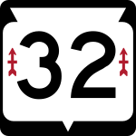
From North Chicago to the state line, Sheridan Road is signed as part of Illinois Route 137 in Illinois, and Wisconsin Highway 32 through Kenosha and Racine in Wisconsin. Sheridan Road is known for its historic sites, lakefront parks, and gracious mansion homes in Evanston through Lake Bluff.
Chicago path
- It runs at 400 west from 2800 north to 3181 north.
- It runs at 3900 north from 600 west to 956 west.
- It runs at 1000 west from 3900 north to 6356 north.
- It runs at 6400 north from 970 west to 1158 west.
- It runs at 1200 west from 6400 north to 6756 north.
- It runs from 1200 west at 6800 north to 1400 west at 7800 north. [2]
History
A suburban extension of Chicago's Lake Shore Drive to Waukegan was first promoted by the North Shore Improvement Association in the late 1880s.[3] In 1889 this road was named Sheridan Road for Philip Henry Sheridan,[4] a general in the Civil War who coordinated military relief efforts in Chicago following the Great Chicago Fire. Much of the route had been laid out by 1893,[5] and in 1894 it was proposed that the new road should be extended to Milwaukee, Wisconsin.[3] Progress on the construction of the road was slowed by local opposition in some of the communities that it was to pass through, and construction was not completed until 1918.[6] A statue of Sheridan by artist Gutzon Borglum was placed alongside Sheridan Road and Belmont Avenue in Chicago's Lincoln Park in 1924.[7]
Sheridan Road in Illinois was once signed as Illinois Route 42. The route was first shown on official maps in 1924; the original route ran along Sheridan Road from the Wisconsin border to Waukegan, then turned west before running south.[8] In 1925, Route 42 was realigned to include all of Sheridan Road in Illinois; the route continued south to the Indiana border at Hammond, and the old route became Illinois Route 42A.[9] In 1929, the southern terminus of Route 42 was changed to the south end of Sheridan Road, making the route coextensive with the Illinois portion of Sheridan Road.[10][11] Sheridan Road was marked as Route 42 until the highway was removed from the state highway system in 1972.[12][13]
Places of interest
There are several landmarks and places of interest along Sheridan Road. In order from southernmost to northernmost:
- Commonwealth Plaza Condominiums
- Philip Henry Sheridan Statue
- The Breakers at Edgewater Beach Apartments
- Park Tower Condominium
- The Renaissance (Building at 5510 North Sheridan)
- Edgewater Condominium Plaza, 5445 North Sheridan occupies the precise spot of Edgewater Beach Hotel; 5455 North Sheridan, its twin building is set at right angle to the street)
- Edgewater Beach Apartments
- Colvin House
- Mundelein College Skyscraper Building
- Loyola University, Lakeshore Campus
- Emil Bach House
- Calvary Cemetery
- Northwestern University
- Levere Memorial Temple, headquarters of Sigma Alpha Epsilon fraternity
- Grosse Point Lighthouse
- Bahá'í House of Worship
- Plaza del Lago
- Henry Demarest Lloyd House
- North Shore Congregation Israel
- Ravinia Festival
- North Shore Sanitary District Tower
- Willits House
- Fort Sheridan
- Barat College
- Lake Forest College
- Great Lakes Naval Training Center
Footnotes
- ↑ Google Maps
- ↑ Hayner, Don and Tom McNamee, Streetwise Chicago, "Sheridan Road", pp. 117, Loyola University Press, 1988, ISBN 0-8294-0597-6
- 1 2 Ebner, Michael H (1988). Creating Chicago's North Shore: A Suburban History. University of Chicago Press. pp. 105–114. ISBN 0-226-18205-3.
- ↑ "It Is 'Sheridan Road.' Chicago's New Drive Has Now A 'Local Habituation And A Name.'". Chicago Daily Tribune. February 24, 1889.
- ↑ "Winds Down Ravines. Completion of the Sheridan Road in the Woods". Chicago Daily Tribune. July 16, 1893.
- ↑ Smith, Ray (February 1918). "Sheridan Road, Connecting Chicago and Milwaukee, to be Completed in 1918". Municipal Engineering. 54 (2): 87. Retrieved August 21, 2010.
- ↑ "Sheridan Now Rides Forever on North Side". Chicago Daily Tribune. July 17, 1924.
- ↑ 1924 Illinois Road Map (Map). Illinois Automobile Department. 1924. Retrieved February 27, 2013.
- ↑ 1925 Illinois Road Map (Map). Illinois Automobile Department. 1925. Retrieved February 27, 2013.
- ↑ 1929 Illinois: Official Auto Road Map (Map). Illinois Automobile Department. 1929. Retrieved February 27, 2013.
- ↑ 1929 Official Illinois Highway Map (Map). Illinois Automobile Department. 1929. Retrieved February 27, 2013.
- ↑ 1971 Official Highway Map (Map). Illinois Automobile Department. 1971. p. 2. Retrieved February 27, 2013.
- ↑ 1972 Official Highway Map (Map). Illinois Automobile Department. 1971. p. 2. Retrieved February 27, 2013.