Interstate 895 (New York)
| ||||
|---|---|---|---|---|
| Arthur V. Sheridan Expressway | ||||
|
Map of the Bronx in New York City with I-895 highlighted in red | ||||
| Route information | ||||
| Maintained by NYSDOT | ||||
| Length: | 1.29 mi[1] (2.08 km) | |||
| History: | Completed in 1962 as I-278;[2] renumbered to I-895 on January 1, 1970[3] | |||
| Major junctions | ||||
| South end: |
| |||
| North end: |
| |||
| Highway system | ||||
| ||||

_Map.svg.png)
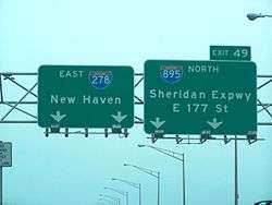
Interstate 895 (I-895), named the Arthur V. Sheridan Expressway (and locally known as the Sheridan Expressway or just The Sheridan), is a short freeway in the New York City borough of the Bronx, forming a short connecting link in the Interstate Highway System. Its south end is at a merge with the Bruckner Expressway (I-278) in the Hunts Point neighborhood, and its north end is at the Cross Bronx Expressway (I-95), with a short continuation connecting with local West Farms streets. The highway opened to traffic in 1962[2] and received its current Interstate route designation in 1970. It was named for the Bronx Borough Commissioner of Public Works Arthur V. Sheridan, who died in a motor car crash in 1952.[4]
Route description
I-895 begins at exit 49 on I-278, also known as the Bruckner Expressway, in the Hunts Point neighborhood of the Bronx. The 6-lane highway heads northward, paralleling the Bronx River and the Amtrak-owned Northeast Corridor railroad tracks. There is a lone interchange, which is for Westchester Avenue, at 0.6 miles (1.0 km) in. A frontage road begins to parallel the roadway until it terminates at a cul-de-sac in East Tremont. The Sheridan crosses over East 174th Street and officially ends at an interchange with the Cross Bronx Expressway (I-95) in East Tremont. The roadway continues beyond the Cross Bronx as a short connector to local West Farms streets.[5]
History
In 1941, the New York City Planning Department proposed a short expressway route to connect the Bronx Crosstown Highway (now the Cross Bronx Expressway) and the Southern Boulevard Express Highway (now the Bruckner Expressway). The purpose was to have a commercial-vehicle friendly alternate to the Bronx River Parkway. Construction began in 1958 and in October 1962, the $9.5 million expressway was opened to traffic.

Over the years, the expressway has received a number of Interstate designations. It was originally designated as I-695 in late 1958. In early 1959, the highway designation was changed to I-895. Later that year, however, I-278 was rerouted to use the Sheridan Expressway. This was the designation of the highway when it opened in 1962. On January 1, 1970, I-278 was realigned to follow the Bruckner Expressway east to the Bruckner Interchange while the Sheridan Expressway was redesignated as I-895.[3]
The Sheridan Expressway was originally planned to extend northeast to the Bruckner Expressway (I-95) at Co-op City, creating a shortcut toward New England.[2] This extension was, however, cancelled.[2] Because of the cancellation of the extension, the Sheridan is locally seen as a useless stub, serving the same movements as the Major Deegan Expressway (I-87) and Bronx River Parkway.[6][7]
Future
The 2017 New York State budget includes $97 million for decommissioning the Sheridan Expressway as recommended by the New York City Council and New York City Department of Transportation.[8]
The New York State Department of Transportation (NYSDOT) proposed expanding the highway in 1997.[9] The plan faced opposition rooted in claims of environmental justice from community groups, which proposed an alternative calling for the river-front expressway to be replaced with affordable housing, schools and green space.[10]
In August 2008 the alternative community plan was under consideration by NYSDOT.[11] The plan gained momentum in July 2010;[7] however, the state opposed the plan to demolish the highway, citing a study showing that local traffic would be worsened.[12] On June 11, 2012, the Daily News reported that the administration of New York City Mayor Michael Bloomberg was also opposed to the removal.[13] The dispute between the local community and the city and state governments has led to a stalemate, what the Daily News called a "crossroads" and "a road to nowhere".[14]
Exit list
The entire route is in the New York City borough of The Bronx. All exits are unnumbered.
| Location | mi[1][15] | km | Destinations | Notes | |
|---|---|---|---|---|---|
| Hunts Point | 0.00 | 0.00 | Exit 49 on I-278 | ||
| 0.20 | 0.32 | Bruckner Boulevard | Northbound entrance only | ||
| 0.61 | 0.98 | Westchester Avenue – Hunts Point Market | No southbound entrance | ||
| West Farms | 1.29 | 2.08 | No northbound entrance; exit 4A on I-95 | ||
| 1.40 | 2.25 | West Farms Road | Southbound exit ramp in planning stages | ||
| 1.50 | 2.41 | At-grade intersection | |||
1.000 mi = 1.609 km; 1.000 km = 0.621 mi
| |||||
See also
-
.svg.png) New York Roads portal
New York Roads portal
References
- 1 2 "2008 Traffic Volume Report for New York State" (PDF). New York State Department of Transportation. June 16, 2009. p. 247. Retrieved February 1, 2010.
- 1 2 3 4 Anderson, Steve. "Sheridan Expressway". NYCRoads. Retrieved March 18, 2010.
- 1 2 State of New York Department of Transportation (January 1, 1970). Official Description of Touring Routes in New York State (PDF). Retrieved July 13, 2010.
- ↑ "Sheridan Expressway – Historical Sign". New York City Department of Parks and Recreation. Retrieved April 4, 2010.
- ↑ Microsoft; Nokia (August 14, 2015). "overview map of I-895/Sheridan Expressway" (Map). Bing Maps. Microsoft. Retrieved August 14, 2015.
- ↑ "Southern Bronx River Watershed Alliance Stand On Sheridan During Rush Hour" (PDF) (Press release). Southern Bronx River Watershed Alliance. July 21, 2009. Retrieved July 13, 2010.
- 1 2 Dolnick, Sam (July 12, 2010). "Plan to Remove Bronx Expressway Gains Traction". The New York Times. Retrieved July 13, 2010.
- ↑ "Sheridan Expressway Removal Gets $97 Million Boost in State Budget". Retrieved August 14, 2016..
- ↑ "The Bruckner–Sheridan Environmental Impact Statement". Southern Bronx River Watershed Alliance. Retrieved July 20, 2010.
- ↑ "Sheridan Lands/Community Visions". Southern Bronx River Watershed Alliance. Retrieved July 20, 2010.
- ↑ Wiswall, Kyle (August 13, 2008). "One Less Reason to Keep the Sheridan Expressway". Mobilizing the Region. Retrieved July 20, 2010.
- ↑ Dolnick, Sam (July 13, 2010). "Local Traffic Would Worsen Without Sheridan, Study Shows". The New York Times. Retrieved August 9, 2010.
- ↑ Deekman, Daniel (June 11, 2012). "Transportation officials nix Sheridan Expressway removal". Daily News. New York City. Retrieved June 20, 2012.
- ↑ Beekman, Daniel (July 20, 2010). "Sheridan at crossroads: Local advocates want expressway closed, but DOT warns of traffic snafus". Daily News. New York City. Retrieved August 9, 2010.
- ↑ Google (January 9, 2016). "Sheridan Expressway" (Map). Google Maps. Google. Retrieved January 9, 2016.
External links
| Wikimedia Commons has media related to Interstate 895 (New York). |
- Interstate 895 at New York Routes
- Southern Bronx River Watershed Alliance A proposal to replace the Sheridan Expressway's 28-acre (110,000 m2) footprint with affordable housing, open space, and new economic development opportunities.
| ||