Shelburne, Vermont
| Shelburne, Vermont | |
|---|---|
| Town | |
|
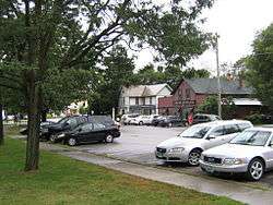
A section of central Shelburne | |
 Location in Chittenden County and the state of Vermont. | |
 Shelburne, Vermont Location in the United States | |
| Coordinates: 44°23′23″N 73°13′29″W / 44.38972°N 73.22472°WCoordinates: 44°23′23″N 73°13′29″W / 44.38972°N 73.22472°W | |
| Country | United States |
| State | Vermont |
| County | Chittenden |
| Area | |
| • Total | 45.1 sq mi (116.7 km2) |
| • Land | 24.3 sq mi (63.0 km2) |
| • Water | 20.8 sq mi (53.8 km2) |
| Elevation | 203 ft (62 m) |
| Population (2010) | |
| • Total | 7,144 |
| • Density | 294/sq mi (113.5/km2) |
| Time zone | Eastern (EST) (UTC-5) |
| • Summer (DST) | EDT (UTC-4) |
| ZIP code | 05482 |
| Area code(s) | 802 |
| FIPS code | 50-64300[1] |
| GNIS feature ID | 1462206[2] |
| Website |
www |
Shelburne is a town in southwestern Chittenden County, Vermont, in the United States. Along the shores of Lake Champlain, Shelburne is a suburb of Burlington, the largest city in Vermont. Shelburne's center of town lies approximately 7 miles (11 km) south of the city's center. The population of Shelburne was 7,144 at the 2010 census.[3]
The main settlement of Shelburne in the center of town is a census-designated place (CDP), with a population of 592 at the 2010 census.[4] The town is the wealthiest municipality in both Chittenden County and the Burlington metropolitan area.
History
Shelburne was chartered by New Hampshire, August 18, 1763, to Jesse Hallock and 64 associates by Governor Benning Wentworth. The name "Shelburne" or "Shelburn" was chosen to honor William Petty, 2nd Earl of Shelburne, a celebrated nobleman of the British Parliament and Prime Minister. According to the charter, the town was to have an area of 23,500 acres (95.1 km2), or a tract a little over 6 square miles (15.5 km2), but owing to a blunder on the part of the surveyors, it was shorn of a large portion of its possessions.
From the beginning, Shelburne's economy was based on farming. With the clearing of land and burning of logs the town experienced a potash boom. A carding and fulling mill, a gristmill, a sawmill, and a blacksmith shop were erected on the La Platte River at Shelburne Falls. In 1811, a few Merino sheep imported from Spain led to an upsurge in sheep raising. Orchards and fruit growing became a major source of income for the farmers, with some 17,740 trees in 1880. Following the War of 1812, commerce on the lake expanded rapidly.
The Lake Champlain Transportation Company established its shipyard at Shelburne Harbor and launched its first steamboat, the General Green, in 1825; this was followed by ten others before the Ticonderoga in 1906. In 1955, the Ticonderoga was moved overland to the Shelburne Museum, where it is now on display.[5]
Geography
According to the United States Census Bureau, the town has a total area of 45.1 square miles (116.7 km2), of which 24.3 square miles (63.0 km2) is land and 20.8 square miles (53.8 km2), or 46.06%, is water (primarily Lake Champlain, but also including Shelburne Pond in the eastern part of town).
Government and politics
The town had the highest voter turnout in Vermont in the general election of 2008 with 89.4%. It had the highest number of registered voters among the top ten towns with the highest turnout. It also had the second-highest percentage of people voting absentee of any town in Vermont, 50.2%.[6]
In the Vermont Democratic Party Presidential primary of 2016, the town was the worst-performing of all municipalities in both Chittenden County and the Burlington metro area for U.S. Senator Bernie Sanders of nearby Burlington. Bernie Sanders received 76.6% of the Democratic primary vote in the town and former Secretary of State Hillary Clinton received her highest level of support for any municipality in the county and metro area, at 23.1%.[7] Two Democrats represent the town in the Vermont House of Representatives.
Demographics
| Historical population | |||
|---|---|---|---|
| Census | Pop. | %± | |
| 1790 | 389 | — | |
| 1800 | 723 | 85.9% | |
| 1810 | 987 | 36.5% | |
| 1820 | 936 | −5.2% | |
| 1830 | 1,123 | 20.0% | |
| 1840 | 1,089 | −3.0% | |
| 1850 | 1,257 | 15.4% | |
| 1860 | 1,178 | −6.3% | |
| 1870 | 1,190 | 1.0% | |
| 1880 | 1,096 | −7.9% | |
| 1890 | 1,300 | 18.6% | |
| 1900 | 1,202 | −7.5% | |
| 1910 | 1,097 | −8.7% | |
| 1920 | 997 | −9.1% | |
| 1930 | 1,006 | 0.9% | |
| 1940 | 1,010 | 0.4% | |
| 1950 | 1,365 | 35.1% | |
| 1960 | 1,805 | 32.2% | |
| 1970 | 3,728 | 106.5% | |
| 1980 | 5,000 | 34.1% | |
| 1990 | 5,871 | 17.4% | |
| 2000 | 6,944 | 18.3% | |
| 2010 | 7,144 | 2.9% | |
| Est. 2014 | 7,736 | [8] | 8.3% |
| U.S. Decennial Census[9] | |||
As of the census[1] of 2000, there were 6,944 people, 2,632 households, and 1,845 families residing in the town. The population density was 285.6 people per square mile (110.3/km2). There were 2,741 housing units at an average density of 112.8 per square mile (43.5/km2). The racial makeup of the town was 97.60% White, 0.23% African American, 0.10% Native American, 1.01% Asian, 0.32% from other races, and 0.75% from two or more races. Hispanic or Latino of any race were 0.86% of the population.
There were 2,632 households out of which 37.6% had children under the age of 18 living with them, 61.3% were couples living together and joined in either marriage or civil union, 6.7% had a female householder with no husband present, and 29.9% were non-families. 22.9% of all households were made up of individuals and 11.7% had someone living alone who was 65 years of age or older. The average household size was 2.58 and the average family size was 3.08.
In the town the population was spread out with 27.6% under the age of 18, 3.9% from 18 to 24, 25.9% from 25 to 44, 27.2% from 45 to 64, and 15.4% who were 65 years of age or older. The median age was 41 years. For every 100 females there were 90.9 males. For every 100 females age 18 and over, there were 86.3 males.
Economy
The town contains businesses, including manufacturers, service providers, retail establishments and the state's largest continuing care retirement community. In 2007 a historic inn was converted into a mixed use array of offices, small retail, and a restaurant.
Personal income
The median income for a household in the town was $68,091, and the median income for a family was $78,492. Males had a median income of $50,085 versus $28,428 for females. The per capita income for the town was $37,210. About 2.9% of families and 4.9% of the population were below the poverty line, including 2.7% of those under age 18 and 7.6% of those age 65 or over.
Tourism
The town has three major tourist attractions: the Shelburne Museum, Shelburne Farms, and the Fiddlehead Brewery.[10]
The town maintains a beach on Lake Champlain which has a boat launch and nature park.
Transportation

U.S. Route 7 (Shelburne Road) crosses the center of town, leading north into Burlington and south towards Vergennes.
Bus service is provided by Chittenden County Transportation Authority.
Schools
Public:
- Shelburne Community School (elementary and middle school)
The town is part of the Chittenden South Supervisory Union School District and sends students of high school age to Champlain Valley Union High School, Hinesburg.
Private:
- The Renaissance School[11] (elementary and middle school; has a Shelburne campus)
- Lake Champlain Waldorf School
Notable people
- Frederic W. Allen, Chief Justice of the Vermont Supreme Court[12]
- John L. Barstow, Governor of Vermont
- Sam Bartlett, musician and author (1961–present)
- Michael Dante DiMartino, co-creator of Avatar: The Last Airbender and The Legend of Korra
- Leonard Knight, Creator of Salvation Mountain
- Madeleine Kunin, 77th governor of Vermont (1985–1991)
- Kevin Lepage, driver with NASCAR
- Lucius Lyon, first US senator from Michigan
- Ezra Meech (1773–1856), US congressman
- George A. Meigs (1816–1897), prominent entrepreneur and shipbuilder in the Washington Territory
- Barbara Snelling, 76th lieutenant governor of Vermont (1992–1996)
- Richard Snelling, 78th governor of Vermont (1977–1985, 1991)
- Jane Swift, former Acting Governor of Massachusetts and 69th Lieutenant Governor of Massachusetts
- Electra Havemeyer Webb (1888–1960), art collector and founder of the Shelburne Museum
- William Seward Webb (1851–1926), railroad executive and founder of Shelburne Farms
References
- 1 2 "American FactFinder". United States Census Bureau. Retrieved 2008-01-31.
- ↑ "US Board on Geographic Names". United States Geological Survey. 2007-10-25. Retrieved 2008-01-31.
- ↑ "Geographic Identifiers: 2010 Census Summary File 1 (G001): Shelburne town, Chittenden County, Vermont". U.S. Census Bureau, American Factfinder. Retrieved August 19, 2015.
- ↑ "Geographic Identifiers: 2010 Demographic Profile Data (G001): Shelburne CDP, Vermont". U.S. Census Bureau, American Factfinder. Retrieved August 19, 2015.
- ↑ Archived December 5, 2009, at the Wayback Machine.
- ↑ Hemmingway, Sam, Absentee voting sets Vermont record, Burlington Free Press, November 12, 2008
- ↑ "Vermont Primary Results". The New York Times. The New York Times Company. March 5, 2016. Retrieved March 6, 2016.
- ↑ "Annual Estimates of the Resident Population for Incorporated Places: April 1, 2010 to July 1, 2014". Retrieved June 4, 2015.
- ↑ "U.S. Decennial Census". United States Census Bureau. Retrieved May 16, 2015.
- ↑ Beer Advocate
- ↑ The Renaissance School
- ↑ "Obituary, Frederic W. Allen". Burlington Free Press. Burlington, VT. April 13, 2016.
External links
Municipalities and communities of Chittenden County, Vermont, United States | ||
|---|---|---|
| Cities | 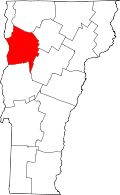 | |
| Towns | ||
| Villages | ||
| CDPs | ||
| Unincorporated communities | ||