Sheikh Zuweid
| Sheikh Zuweid | |
|---|---|
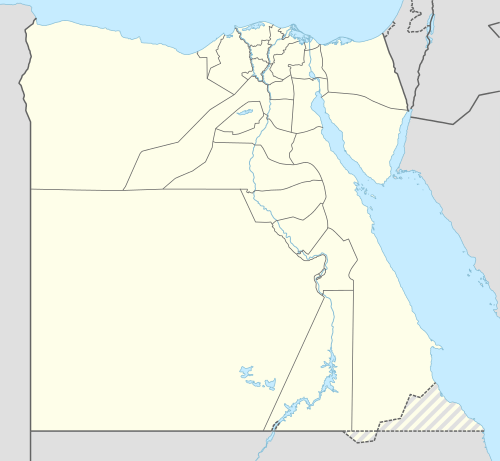 Sheikh Zuweid Location in Egypt | |
| Coordinates: 31°12′43″N 34°6′38″E / 31.21194°N 34.11056°E | |
| Country |
|
| Governorate | North Sinai |
| Population (2015) | |
| • Total | ~60,000 |
| Time zone | EST (UTC+2) |
| • Summer (DST) | not observed (UTC+2) |
Sheikh Zuweid (also spelled Sheikh Zoweid or Shaykh Zuwayd; Arabic: الشيخ زويد Egyptian Arabic pronunciation: [eʃˈʃeːx zeˈweːd, -zoˈwæjjed]) is a Bedouin town in the North Sinai Governorate of Egypt near the border with the Gaza Strip. It is situated between the cities of Arish and Rafah and is 334 kilometers (214 miles) northeast of Cairo. It has a population of around 60,000 as of 2015.[1]
History
Ancient Christian artifacts in the form of mosaic tiles were found in Sheikh Zuweid in 1913. They are currently preserved in a museum in Ismailia.[2] The 6th century Madaba Map shows a settlement called Betulion (Greek Β[ητ]υλιον) in this location, possibly the Bethulia where Judith beheaded Holofernes in biblical legend.[3]
The town is named after Sheikh Zuweid, a commander of the Rashidun Islamic army who fought during the Muslim conquest of Egypt alongside Amr ibn al-'As. He died at the site of the present town in 640.[4]
During the 2011 Egyptian revolution, protests against the government of Hosni Mubarak were held in Sheikh Zuweid. On 27 January, one protester was killed by security forces attempting to disperse the demonstrations.[5] On 14 May 2011, an unknown group bombed the Sufi shrine in Sheikh Zuweid.[4] As many as 70 ISIS affiliated militants using mortars and car bombs attacked five Army checkpoints just north of the city on July 1, 2015. The attacks killed 30 Egyptian soldiers and were part of a larger group of coordinated attacks across the Sinai. [6]
Climate
Köppen-Geiger climate classification system classifies its climate as hot desert (BWh),[7] as the rest of Egypt, but because it is close to the sea, its climate is highly moderated by prevailing Mediterranean Sea winds, typical to the north coast of Egypt and the east Mediterranean coast.
| Climate data for Sheikh Zuweid | |||||||||||||
|---|---|---|---|---|---|---|---|---|---|---|---|---|---|
| Month | Jan | Feb | Mar | Apr | May | Jun | Jul | Aug | Sep | Oct | Nov | Dec | Year |
| Average high °C (°F) | 17.2 (63) |
18 (64) |
20.5 (68.9) |
23.1 (73.6) |
26.1 (79) |
28.4 (83.1) |
29.8 (85.6) |
30.7 (87.3) |
29.2 (84.6) |
27.6 (81.7) |
23.7 (74.7) |
19.2 (66.6) |
24.46 (76.01) |
| Daily mean °C (°F) | 12.7 (54.9) |
13.4 (56.1) |
15.6 (60.1) |
18.2 (64.8) |
21.1 (70) |
23.7 (74.7) |
25.3 (77.5) |
26.1 (79) |
24.7 (76.5) |
22.6 (72.7) |
18.7 (65.7) |
14.5 (58.1) |
19.72 (67.51) |
| Average low °C (°F) | 8.2 (46.8) |
8.9 (48) |
10.7 (51.3) |
13.3 (55.9) |
16.1 (61) |
19 (66) |
20.9 (69.6) |
21.6 (70.9) |
20.3 (68.5) |
17.7 (63.9) |
13.7 (56.7) |
9.9 (49.8) |
15.02 (59.03) |
| Average precipitation mm (inches) | 37 (1.46) |
29 (1.14) |
22 (0.87) |
6 (0.24) |
3 (0.12) |
0 (0) |
0 (0) |
0 (0) |
0 (0) |
7 (0.28) |
31 (1.22) |
40 (1.57) |
175 (6.9) |
| Source: Climate-Data.org (altitude: 30m)[7] | |||||||||||||
See also
References
- ↑ Hellyer, H. A. (2015-07-02). "Egypt looks for answers after brutal Sinai attack". BBC News. Retrieved 2015-07-02.
- ↑ Ashkeloni, p.219.
- ↑ Madaba Map Project, Franciscan Order in Jerusalem
- 1 2 Unkown (sic) assailants attack Sheikh Zuweid Shrine. Ahram Online. 2011-05-15.
- ↑ Egypt police shoot Bedouin protester dead. Reuters. 2011-01-27.
- ↑ "Stratfor".
- 1 2 "Climate: Sheikh Zuwayid - Climate graph, Temperature graph, Climate table". Climate-Data.org. Retrieved 2014-02-08.