Sheberghan Airfield
| Sheberghan Airport د شبرغان هوائی ډګر | |||||||||||||||
|---|---|---|---|---|---|---|---|---|---|---|---|---|---|---|---|
| IATA: none – ICAO: OASG | |||||||||||||||
| Summary | |||||||||||||||
| Airport type | Public | ||||||||||||||
| Operator | Afghanistan Ministry of Transport and Civil Aviation | ||||||||||||||
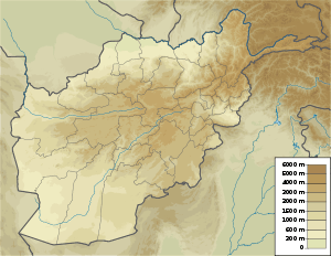
| Location | Sheberghan, Afghanistan | ||||||||||||||
| Elevation AMSL | 1,100 ft / 335 m | ||||||||||||||
| Coordinates | 36°45′4.7″N 65°54′45.3″E / 36.751306°N 65.912583°ECoordinates: 36°45′4.7″N 65°54′45.3″E / 36.751306°N 65.912583°E | ||||||||||||||
| Map | |||||||||||||||
 OASG Location of airport in Afghanistan | |||||||||||||||
| Runways | |||||||||||||||
| |||||||||||||||
Sheberghan Airfield (ICAO: OASG) is located in the Jowzjan Province in the northwest part of Afghanistan. The airfield is located in a plain adjacent to a river, 17 nautical miles (31 km) northeast of Sheberghan, 12 nautical miles (22 km) west of Aqchah, and 40 nautical miles (74 km) east of Andkhoy.[1]
Facilities
The airport resides at an elevation of 1,100 feet (335 m) above mean sea level. It has two parallel runways: 06L/24R with an asphalt surface measuring 8,600 by 80 feet (2,621 m × 24 m) and 06R/24L with a gravel surface measuring 6,939 by 100 feet (2,115 m × 30 m).[1]
The downward sloping runway is gravel base with a small cement run-up pad at the south end. The runway is slightly damaged. There aren't any facilities.
See also
References
- 1 2 3 "Sheberghan (OASG)". Afghanistan Ministry of Transport and Civil Aviation. Retrieved 1 January 2013.
- ↑ "Sheberghan". Afghanistan Ministry of Transport and Civil Aviation. 27 August 2006. Archived from the original on 27 September 2007.
- ↑ Airport information for OASG: Sheberghan, Afghanistan at Great Circle Mapper.
- ↑ Airport record for Sheberghan Airfield at Landings.com. Retrieved 2013-8-1
External links
- Accident history for OASG at Aviation Safety Network
- Airport record for Sheberghan Airfield at Landings.com.