Shashe Dam
| Shashe Dam | |
|---|---|
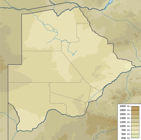 Location of Shashe Dam in Botswana | |
| Country | Botswana |
| Location | North-East District |
| Coordinates | 21°22′01″S 27°25′42″E / 21.366988°S 27.428268°ECoordinates: 21°22′01″S 27°25′42″E / 21.366988°S 27.428268°E |
| Purpose | Urban water supply |
| Construction began | 1970 |
| Opening date | 1973 |
| Dam and spillways | |
| Type of dam | Zoned embankment |
| Height | 27 metres (89 ft) |
| Length | 3.5 kilometres (2.2 mi) |
| Reservoir | |
| Total capacity | 85,000,000 cubic metres (3.0×10⁹ cu ft) |
| Surface area | 3,200 hectares (7,900 acres) |
| Max. length | 15 kilometres (9.3 mi) |
| Max. width | 4.2 kilometres (2.6 mi) |
| Normal elevation | 1,000 metres (3,300 ft) |
The Shashe Dam is a dam on the Shashe River in Botswana that was built to supply water to the industrial city of Selebi-Phikwe.[1] The large village of Tonota is just south of the dam.
Location and capacity
The dam is about 25 kilometres (16 mi) southwest of Francistown.[1] It is about 80 kilometres (50 mi) northwest of Selebi-Phikwe.[2] The dam impounds the Shashe River. The Mairoro, Lunyi and Swiki tributaries of the Shashe also enter the reservoir.[3] The artificial lake is 15 kilometres (9.3 mi) long and up to 4.2 kilometres (2.6 mi) wide. When full, the open-water surface covers almost 3,200 hectares (7,900 acres).[4] It has a capacity of 85,000,000 cubic metres (3.0×10⁹ cu ft).[5]
Construction
The dam was built as part of a major investment in infrastructure required to exploit copper-nickel ore reserves at Selebi and Pikwe, estimated in October 1969 to total 45.7 million short tons. The 3.5 kilometres (2.2 mi) long, 27 metres (89 ft) high zoned embankment was completed in 1973.[1] Water from the dam is brought to Selebi-Pikwe by an underground pipeline.[2]
In 1982 it was found that groundwater from the local wells in Francistown had high levels of nitrate, and was also inadequate to meet public demand, so the public water supply for that city was changed over to using water from the Shashe Dam.[6] The Shashe Dam water works, off the Francistown road to the north of the Tonota Development Plan Area, also supplies potable water to Tonota.[7]
Reservoir usage
The total potential yield of fish from the reservoir has been estimated at over 50 tonnes per year.[8] The reservoir is used for subsistence, commercial and sports fishing. The reservoir is also used by sailing club. Turtles, fish, otters, Nile monitors and many different birds use the reservoir. The dam shows traces of human pollution such as litter around and in the water.[3] In February 2009 the Water Utilities Corporation was forced to suspend all activities at the dam after an outbreak of cholera was traced to its water.[9]
References
Citations
- 1 2 3 Knight 1990, p. 402.
- 1 2 Sillery 1974, p. 171.
- 1 2 Gabathuse & Maganu-Edwin 2011.
- ↑ Hughes & Hughes 1992, p. 626.
- ↑ Central Statistics Office 2009, p. 3.
- ↑ Schmoll 2006, p. 284.
- ↑ Tonota-Shashe development plan, p. 109.
- ↑ vanden Bossche & Bernacsek 1990, p. 20.
- ↑ WUC Suspends Activities...
Sources
- Central Statistics Office (October 2009). "BOTSWANA WATER STATISTICS". Archived from the original on July 7, 2010. Retrieved 2012-09-18.
- Europa Publications (2003-12-09). Africa South of the Sahara 2004. Psychology Press. p. 98. ISBN 978-1-85743-183-4. Retrieved 2012-09-18.
- Gabathuse, Ryder; Maganu-Edwin, Patricia (15 April 2011). "The dancing reeds of the Shashe Dam". Retrieved 2012-09-18.
- Hughes, R. H.; Hughes, J. S. (1992). A Directory of African Wetlands. IUCN. p. 626. ISBN 978-2-88032-949-5. Retrieved 2012-09-18.
- Knight, D.J. (1990-06-01). "The proven usefulness of instrumentation systems on varied dam projects". Geotechnical Instrumentation in Practice: Purpose, Performance and Interpretation : Proceedings of the Conference Geotechnical Instrumentation in Civil Engineering Projects. Thomas Telford. ISBN 978-0-7277-1515-9. Retrieved 2012-09-18.
- Schmoll, Oliver (2006). Protecting Groundwater for Health: Managing the Quality of Drinking-Water Sources. World Health Organization. p. 284. ISBN 978-92-4-154668-3. Retrieved 2012-09-18.
- Sillery, Anthony (1974). Botswana; a Short Political History. Methuen (Distributed in the U.S.A. by Harper & Row Publishers, Barnes & Noble Import Division). p. 171. ISBN 978-0-416-75650-0. Retrieved 2012-09-18.
- Tonota-Shashe development plan (2000-2024): development plan. Ministry of Lands, Housing and Environment. 2001. Retrieved 2012-09-18.
- vanden Bossche, J.-P.; Bernacsek, G. M. (1990). Source Book for the Inland Fishery Resources of Africa. Food & Agriculture Org. ISBN 978-92-5-102983-1. Retrieved 2012-09-18.
- "WUC Suspends Activities at Shashe Dam". The Voice, Francistown. 10 February 2009. Retrieved 2012-09-18.