Shands Bridge
| Shands Bridge | |
|---|---|
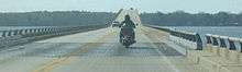 Westbound on the Shands Bridge | |
| Coordinates | 29°59′00″N 81°37′00″W / 29.9833°N 81.6167°WCoordinates: 29°59′00″N 81°37′00″W / 29.9833°N 81.6167°W |
| Carries | 2 general purpose lanes (SR 16)) |
| Crosses | St. Johns River |
| Locale | Green Cove Springs, Florida |
| Official name | Alvin G. Shands Bridge |
| Maintained by | Florida Department of Transportation |
| ID number | 780056 |
| Characteristics | |
| Design | steel stringer/multi-beam or girder bridge |
| Total length | 2030.6 meters (6662 feet) |
| Width | 10.4 meters (34 feet) |
| Longest span | 39.6 meters (130 feet) |
| Clearance above | 13.7 meters (45 feet)(vertical) x 27.7 meters (91 feet)(horizontal) |
| History | |
| Opened | 1963 |
The Shands Bridge is a highway bridge over the St. Johns River near Jacksonville, Florida. The span was first opened in 1929. It was located just north of the current span, crossing from Orangedale to the present Shands pier on the west side of the river. On October 7, the eastern approach to the bridge was eroded by Hurricane Matthew, so the bridge was closed to traffic for an indefinite time period. On October 9, the bridge reopened.[1]
The current bridge was dedicated on October 30, 1963, and features a beam-type construction for a total of two lanes. The bridge is part of SR 16 and until the building of the I-295 Buckman Bridge was the only crossing of the St. Johns River between Jacksonville and Palatka.
In 2004, proposals were made to replace or upgrade the span. Problems cited include increasing traffic in the Clay County and St. Johns County areas, safety, and the inability of large boats to travel upriver. One plan would put a new bridge north of the existing one, connecting to extensions of SR 9B and SR 23. In the fall of 2005, the railings of the bridge were upgraded to solid concrete barriers in an effort to reduce over-bridge fatalities.
Gallery
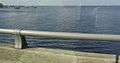 View of the old bridge from the new one
See also
-
 Bridges portal
 -
 Florida portal
 - List of crossings of the St. Johns River
References
- ↑ "Shands Bridge reopens after storm". jacksonville.com. Retrieved 2016-10-16.
External links
| Crossings of the St. Johns River | ||||
|---|---|---|---|---|
| ||||