Shallowater, Texas
| Shallowater, Texas | |
|---|---|
| Community | |
|
Shallowater welcome sign | |
 Shallowater Location of Shallowater in Texas | |
| Coordinates: 33°41′20″N 101°59′54″W / 33.68889°N 101.99833°WCoordinates: 33°41′20″N 101°59′54″W / 33.68889°N 101.99833°W[1] | |
| Country |
|
| State |
|
| County | Lubbock |
| Region | Llano Estacado |
| Established | 1909 |
| Elevation[1] | 3,294 ft (1,004 m) |
| Population (2010) | |
| • Total | 2,484 |
| Time zone | CST (UTC-6) |
| ZIP code | 79363 |
| Area code | 806 |
| Website | http://www.shallowatertx.us/ |


Shallowater is a city in Lubbock County, Texas, United States. Shallowater is on U.S. Route 84 and the Burlington Northern Santa Fe line, 12 miles (19 km) northwest of Lubbock. The population was 2,484 at the 2010 census.[2] It is part of the Lubbock Metropolitan Statistical Area.
Geography
Shallowater is located on the high plains of the Llano Estacado at 33°41′20″N 101°59′54″W / 33.68889°N 101.99833°W (33.6889728 -101.9982275).[1]
According to the United States Census Bureau, the city has a total area of 1.5 square miles (4.0 km2), all of it land.[2]
Climate
According to the Köppen Climate Classification system, Shallowater has a semi-arid climate, abbreviated "BSk" on climate maps.[3]
History
As early as 1909 J. C. (Jim) Bowles, whose ranch was adjacent to the site of what is now Shallowater, persuaded Bob Crump, a member of a ranching family, to help form a townsite company and attract a railroad to go through the area. Land was purchased for the townsite on May 18, 1909. A school was built at that time. After Santa Fe railroad officials received a bonus from rancher George W. Littlefield of the Yellow House Ranch, negotiations were finally completed. The originators of the plan, and other interested individuals, formed the Ripley Townsite Company, which was named after a Santa Fe railroad official and was incorporated on May 22, 1909. The company decided to name the new town Shallowater to attract settlers. On June 26, 1913, a celebration was held to note the founding of the town and completion of the railroad. By the time the town was established, the ranching industry in the area was waning and many of the large ranches were being divided into smaller lots for farmers. Cotton became an important cash crop. During the 1920s Shallowater grew rapidly, and the town had a hotel, a lumberyard, and various filling stations, grocery stores, cotton gins, drugstores, barbershops, garages, blacksmith shops, and other businesses. Several churches and schools were also built. A county park with a clubhouse was established, a public well was constructed, and a real depot building was built to replace the boxcar the town had been using for years. From 1920 to 1922 the railroad station was known as Pacita. In 1928 the town had an estimated population of 250. In 1955 Shallowater was incorporated with a mayor-council form of city government, and during the 1960s the town had five churches, a school, a bank, a library, and a newspaper. The community in 1970 had thirty businesses, including one of the largest hatcheries in the county. The population of Shallowater was 1,001 in 1960 and 1,339 in 1970. In the late 1980s Shallowater had a post office, seventeen businesses, and a population of 2,107. It was a farm marketing center with processing and storing facilities. In 2010 the population was 2,484. Class of 2018 is the biggest class in the history of Shallowater.[4]
Demographics
| Historical population | |||
|---|---|---|---|
| Census | Pop. | %± | |
| 1960 | 1,001 | — | |
| 1970 | 1,339 | 33.8% | |
| 1980 | 1,932 | 44.3% | |
| 1990 | 1,708 | −11.6% | |
| 2000 | 2,086 | 22.1% | |
| 2010 | 2,484 | 19.1% | |
| Est. 2015 | 2,555 | [5] | 2.9% |
As of the census[7] of 2000, there were 2,084 people, 745 households, and 590 families residing in the city. The population density was 2,272.7 people per square mile (875.4/km²). There were 784 housing units at an average density of 854.2 per square mile (329.0/km²). The racial makeup of the city was 90.99% White, 0.67% African American, 0.86% Native American, 0.24% Asian, 6.42% from other races, and 0.81% from two or more races. Hispanic or Latino of any race were 16.20% of the population.
There were 745 households out of which 42.6% had children under the age of 18 living with them, 65.1% were married couples living together, 11.4% had a female householder with no husband present, and 20.8% were non-families. 19.5% of all households were made up of individuals and 10.1% had someone living alone who was 65 years of age or older. The average household size was 2.80 and the average family size was 3.21.
In the city the population was spread out with 29.8% under the age of 18, 8.4% from 18 to 24 males.
The median income for a household in the city was $38,750, and the median income for a family was $44,491. Males had a median income of $32,383 versus $21,964 for females. The per capita income for the city was $16,752. About 8.6% of families and 9.4% of the population were below the poverty line, including 11.1% of those under age 18 and 9.5% of those age 65 or over.
Education
Shallowater is served by the Shallowater Independent School District. Shallowater is home to the 2004 Boys and Girls State Championship basketball teams.
Religion
The City of Shallowater is served by five churches: First Baptist Church (www.firstshallowater.org), New Hope Community Church, First United Methodist (www.shallowaterumc.org), St. Philip Catholic Church, and the Twelfth Street Church of Christ. The churches meet once a year for a community Thanksgiving service.
See also
References
- 1 2 3 "Shallowater". Geographic Names Information System. United States Geological Survey.
- 1 2 "Geographic Identifiers: 2010 Demographic Profile Data (G001): Shallowater city, Texas". U.S. Census Bureau, American Factfinder. Retrieved January 17, 2013.
- ↑ Climate Summary for Shallowater, Texas
- ↑ Handbook of Texas Online, s.v. "," http://www.tshaonline.org/handbook/online/articles/hts08 (accessed January 12, 2009).
- ↑ "Annual Estimates of the Resident Population for Incorporated Places: April 1, 2010 to July 1, 2015". Retrieved July 2, 2016.
- ↑ "Census of Population and Housing". Census.gov. Retrieved June 4, 2015.
- ↑ "American FactFinder". United States Census Bureau. Retrieved 2008-01-31.
External links
- City of Shallowater official website
- Shallowater, TX from the Handbook of Texas Online
- U.S. Geological Survey Geographic Names Information System: Shallowater, Texas
- Photos of the Llano Estacado
Municipalities and communities of Lubbock County, Texas, United States | ||
|---|---|---|
| Cities | 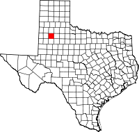 | |
| Towns | ||
| Village | ||
| Unincorporated communities | ||
| Ghost town | ||
| Footnotes | ‡This populated place also has portions in an adjacent county or counties | |