Shali, Bhutan
| Khamdang, Bhutan Khamdang | |
|---|---|
| Linear; scattered; clustered | |
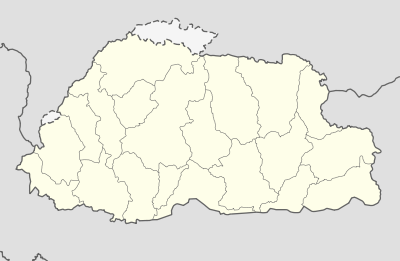 Khamdang, Bhutan Location in Bhutan | |
| Coordinates: 27°29′N 91°34′E / 27.483°N 91.567°ECoordinates: 27°29′N 91°34′E / 27.483°N 91.567°E | |
| Country |
|
| District | Trashi Yangtse District |
| Area | |
| • Urban | 18 sq mi (45 km2) |
| Population (2010) | |
| • Linear; scattered; clustered | 4,000 |
| • Density | 0.5/sq mi (0.2/km2) |
| Time zone | BTT (UTC+6) |
| Area code(s) | 08 |
| Website | http://www.trashiyangtse.gov.bt/gewogDetail.php?id=6 |
Khamdang, Bhutan is a town in Trashigang District in eastern Bhutan.[1]
References
- ↑ "NGA GeoName Database". National Geospatial Intelligence Agency. Archived from the original on 2008-06-08. Retrieved 2008-07-05.
External links
This article is issued from Wikipedia - version of the 2/8/2012. The text is available under the Creative Commons Attribution/Share Alike but additional terms may apply for the media files.