Shakawe Airport
| Shakawe Airport | |||||||||||
|---|---|---|---|---|---|---|---|---|---|---|---|
| IATA: SWX – ICAO: FBSW | |||||||||||
| Summary | |||||||||||
| Airport type | Public | ||||||||||
| Owner | Department of Civil Aviation | ||||||||||
| Location | Shakawe, Botswana | ||||||||||
| Elevation AMSL | 3,380 ft / 1,030 m | ||||||||||
| Coordinates | 18°22′27″S 021°49′52″E / 18.37417°S 21.83111°ECoordinates: 18°22′27″S 021°49′52″E / 18.37417°S 21.83111°E | ||||||||||
| Website | www.dca.gov.bw/... | ||||||||||
| Map | |||||||||||
 Shakawe Location of airport in Botswana | |||||||||||
| Runways | |||||||||||
| |||||||||||
|
Sources: Department of Civil Aviation[1] | |||||||||||
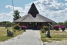
Terminal Building

Apron
Shakawe Airport (IATA: SWX, ICAO: FBSW) is an aerodrome serving Shakawe,[1] a village in the North-West District of Botswana. It is the gateway to the northern part of the Okavango Delta and the Linyati area. Direct charter flights are operated to the aerodrome. It is owned by the Department of Civil Aviation.[1]
Facilities
The airport resides at an elevation of 3,380 feet (1,030 m) above mean sea level. It has one runway designated 11/29 with an bitumen surface measuring 1,400 by 18 metres (4,593 ft × 59 ft). The runway handles aircraft with MAUW of up to 5,700 kilograms (12,600 lb).[1]
References
- 1 2 3 4 Airports: Shakawe Aerodrome. Botswana Department of Civil Aviation.
External links
- Current weather for Shakawe, Botswana (FBSW) at NOAA/NWS
- Accident history for Shakawe Airport (SWX / FBSW) at Aviation Safety Network
This article is issued from Wikipedia - version of the 11/27/2016. The text is available under the Creative Commons Attribution/Share Alike but additional terms may apply for the media files.