Shajapur
This article is about the municipality in Madhya Pradesh, India. For its namesake district, see Shajapur District.
| Shajapur | |
|---|---|
| city | |
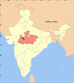
 Shajapur  Shajapur Location in Madhya Pradesh, India | |
| Coordinates: 23°26′N 76°16′E / 23.43°N 76.27°ECoordinates: 23°26′N 76°16′E / 23.43°N 76.27°E | |
| Country |
|
| State | Madhya Pradesh |
| District | Shajapur |
| Founded by | Shahjahan |
| Named for | shahjahan |
| Elevation | 443 m (1,453 ft) |
| Population (2001) | |
| • Total | 50,086 |
| Languages | |
| • Official | Hindi |
| Time zone | IST (UTC+5:30) |
| Website | http://www.shajapur.nic.in/ |
Shajapur is a City in Malwa region of Madhya Pradesh state in west-central India.
Geography
Shajapur is located at 23°26′N 76°16′E / 23.43°N 76.27°E.[1] It has an average elevation of 443 metres (1453 ft).The highest peak is known as bhairo dungri.

Aerialview of Shajapur from Bhairo Dungri
Demographics
As of 2011 India census,[2] Shajapur district had a population of 1,290,685, with 669,852 males and 620,833 females.
The most common language spoken is Hindi, but people still speak Malvi, a local language similar to Hindi in dialect and script.
Tourism
The town contains numerous places of interest including:
- The Raj-Rajeshwari Temple is one of Famous Shakti Temple Sculpture of temple is about 10th century A.D. Age of Parmars.situated Near the A.B, Road- It is estimated to have been built between 1007 and 1009 by Raja Bhoj. Mangal Nath Temple is just Behind the Raj Raeshvari Temple and near the Bank of Chilar River.
- The Karedi Mata temple, which was built by Karan (MAHABHARATa)(15 km From Distt HQ situated In UJJAIN-Shajapur Distt Boundaries)"mahakaleswar temple" is situated in "sundersi".it was from ancient time.sundersi is a historical place.in the honor of 'sunderbai"sister of "maharaja vikramaditya"this place is known as "sundergarh'.
- The old fort near the bank of the Chiler river built by the Mughal Emperor. The fort used to contain the district court but it is now home to the Central School of Shajapur.
- Pale wale Baba ka Mandir (Khardon Kalan) & mata Vijyasan Mandir (Lasudliya Patla) are at 110 km from Shajapur.
- Pandu Kho (Near LalGhati) where Pandwas (Mahabharat) was stay during him Vanvas.
- Bapu Ki Kutia is situated near collectrate at AB ROAD shajapur (Temple & Samadhi)
- Muradpura Temple (Old Femous Temple of God Hanuman)
- Mankamneshwar Mahadev Temple (Kumharia Khas) is very old Temple of God Shiva.
- Baba Baijnath Temple (Agar) is 70 km from Distt HQ.
- Mata Baglamukhi Temple (Nalkheda) is one of the shaktipith in India and a very famous temple of nalkheda tehsil(now in newly made distt. AGAR).
- Nityanand Ashram is situated at AB Road Shajapur
- bhairo dungri. it is a high mountain peak and having a temple at the top.
- Fort, and jama masjid.
- mazare e sherif,the famous mazare is situated near at kashinagar shajapur.
Gallery
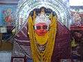 Raj Rajeshwari Temple
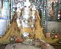 Mata Baglamukhi Temple
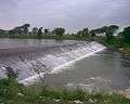 Chillar Dam
 Pandu Kho
 Muradpura Hanuman Temple
References
- ↑ Falling Rain Genomics, Inc - Shajapur
- ↑ "Census of India 2001: Data from the 2001 Census, including cities, villages and towns (Provisional)". Census Commission of India. Archived from the original on 2004-06-16. Retrieved 2008-11-01.
- ↑
- ↑ http://sheetalmedicalshajapur.co.nf/gallery.html
- "Census of India: District Details". censusindia.gov.in. Retrieved 2014-06-10.
- "Shajapur: District Details". District Administration Shajapur. Retrieved 2016-03-03.
This article is issued from Wikipedia - version of the 11/2/2016. The text is available under the Creative Commons Attribution/Share Alike but additional terms may apply for the media files.