Sha Tau Kok
| Sha Tau Kok | |||||||||||||||
|
Pier of Sha Tau Kok and Starling Inlet with Tin Hau Temple on the left | |||||||||||||||
| Traditional Chinese | 沙頭角 | ||||||||||||||
|---|---|---|---|---|---|---|---|---|---|---|---|---|---|---|---|
| Simplified Chinese | 沙头角 | ||||||||||||||
| |||||||||||||||

Sha Tau Kok (traditional Chinese: 沙頭角; simplified Chinese: 沙头角; Sidney Lau: Sa1 Tau4 Gok3) is a border town in northeastern New Territories, Hong Kong, straddling the border with mainland China.
Geography

The small rural village of Sha Tau Kok is located on the northern shoreline of Starling Inlet, 10 km north-east of Fanling. The town centre is by the sea and the northern part of the town encompasses the hill known as Yuen Tuen Shan (元墩山).
The town today
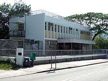
Sha Tau Kok on the Hong Kong side of the border is a rural town, part of North District and lies within the Frontier Closed Area. It has a post office, a bank, a few shops and a small population. Most of its residents are from Hakka farming or Hoklo (Hokkien) fishing backgrounds. Both farming and fishing have declined in the past few decades, with the better educated younger people moving to live and work in urban areas. Older villagers, however, remain, most living in the government housing complex in Sha Tau Kok or in other nearby villages. Many working families return to visit on weekends or during festivals or holidays.
Border

Sha Tau Kok is one of the five official border crossings between Hong Kong and Shenzhen, China, the other four being Man Kam To, Lo Wu, Shenzhen Bay and Lok Ma Chau.
The border between mainland China and Hong Kong runs along Chung Ying Street. There is a perception of it being a notorious point of goods trafficking. When the checkpoint opened a flow of Chinese nationals enter Chung Ying Street with visiting permits. Some may make several trips a day acquiring goods and abusing the custom tariff limits on goods. These traffickers then unload their burden to collect their pay inside mainland Shatoujiao. Although there are a lot of goods leaving Hong Kong from Sha Tau Kok via Chung Ying Street there is also an inflow of foodstuffs and other commodities that come through from China into Hong Kong throughout the day, and only limited by the closure of the Chinese custom post.
The control point of the access to Shenzhen is located northwest of the hill in Shan Tsui (山咀).
An influx of mainland China workers flow into Chung Ying Street from 7am when the custom post is opened. Residents from the Chung Ying Street area are free to pass in and out of the Chinese border post, because they have residency passes. Other non-residents must be issued permits to enter, from the Chinese authorities. Since the early 1990s Chung Ying Street has been an established tourist site famous for imported products via Hong Kong, with prices may be higher than within China.
It is possible to travel into Shatoujiao on the China side, via Sha Tau Kok border. Coaches run at a regular schedule from Luen Wo Hui Bus Terminus, situated near the recently opened Luen Wo Market and Library complex, and from Fanling MTR Station. Tickets cost HK$20 for each passenger as of 2005. Travellers are taken through the Shek Chung Au (石涌凹) border checkpoint without permit search, then heading directly to the Sha Tau Kok Control Point.
Here, passengers alight, go through customs, and have their documents processed, before reboarding the coach to be driven to the mainland border immigration checkpoint. They alight and take all their belongings through the mainland Chinese customs and again have their documents processed. Travellers from outside China are advised to obtain entry visas from the appropriate authorities, or via a travel agent before attempting the entry. Hong Kong residents of Chinese nationality should hold Home Return Permits (回鄉證) for entry into China.
On 27 January 2005, it was announced that street maps for tourists were put up around Shatoujiao, to aid tourists' navigation. A museum situated near the harbour in Chung Ying Street was built to celebrate the transfer of the sovereignty of Hong Kong. It has on display a history of Sha Tau Kok and its place in the incorporation of territory into British Hong Kong at the end of the 19th century. A bronze Peace Bell was installed nearby.
Public housing

Sha Tau Kok Chuen (Chinese: 沙頭角邨) is a public housing estate within the Closed Area[1] built to accommodate the residents affected by the clearance in Sha Tau Kok Closed Area.[2] It consists of 51 low-rise blocks completed in 1988, 1989 and 1991, and it is the public housing estate with the most number of blocks in Hong Kong.[3][4]
Transport

The terminus of Sha Tau Kok Railway, which ceased to operate on 1 April 1929 and was replaced by Sha Tau Kok Road, was located in the town. Sha Tau Kok Railway was built from the original narrow gauge of the KCR British Section, which was replaced by standard gauge. Since then, however, the area formerly occupied by the terminus is still known as the train station or fo cha teu in the local dialects (火車頭 Pinyin:huŏchētóu). Currently, both KMB and minibus services Sha Tau Kok. There are a few shops nearby, at Sha Tau Kok Chuen.
Today, Sha Tau Kok has a bus station served by the KMB Route 78K service as well as the smaller sixteen-seater minibus or public light bus service route number 55k. Both begin in Sheung Shui and pass through Luen Wo Hui before terminating at Sha Tau Kok. However, passengers may not proceed through the Closed Area border checkpoint if they do not carry a valid permit. Police personnel will board the bus at the checkpoint to check the ID Card or identification documents and the required Frontier Closed Area permit of each passenger. If passengers do not possess these documents, they will be asked to leave the bus by police personnel.
Notable people
- Lee Wai Lim (Hong Kong First Division footballer)
- Lee Hong Lim (Hong Kong First Division footballer)
See also
- List of buildings, sites and areas in Hong Kong
- List of villages in Hong Kong
- Kuk Po
- Lai Chi Wo
- Yim Liu Ha
- MacIntosh Forts
References
External links
| Wikimedia Commons has media related to Sha Tau Kok. |
- Details of Sha Tau Kok from HK-place.com
- Details of the rural area of Sha Tau Kok from HK-place.com
- PH. Hase: "Eastern Peace: Sha Tau Kok Market in 1925"
Mainland China–Hong Kong border crossings | |||||||
|---|---|---|---|---|---|---|---|
| Mainland China |
| ||||||
| Hong Kong |
| ||||||
| Hong Kong Island | |||||||||||||||||||||||||||||||||||
|---|---|---|---|---|---|---|---|---|---|---|---|---|---|---|---|---|---|---|---|---|---|---|---|---|---|---|---|---|---|---|---|---|---|---|---|
| Kowloon | |||||||||||||||||||||||||||||||||||
| New Territories |
| ||||||||||||||||||||||||||||||||||
| |||||||||||||||||||||||||||||||||||
Coordinates: 22°33′N 114°13′E / 22.550°N 114.217°E