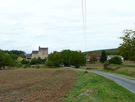
Sergeac
| Sergeac | |
|---|---|
 | |
 Sergeac | |
|
Location within Nouvelle-Aquitaine region  Sergeac | |
| Coordinates: 45°00′12″N 1°06′26″E / 45.0033°N 1.1072°ECoordinates: 45°00′12″N 1°06′26″E / 45.0033°N 1.1072°E | |
| Country | France |
| Region | Nouvelle-Aquitaine |
| Department | Dordogne |
| Arrondissement | Sarlat-la-Canéda |
| Canton | Montignac |
| Intercommunality | Vallée de la Vézère |
| Government | |
| • Mayor (2008–2014) | Jean-Pierre Lagarde |
| Area1 | 10.71 km2 (4.14 sq mi) |
| Population (2008)2 | 198 |
| • Density | 18/km2 (48/sq mi) |
| Time zone | CET (UTC+1) |
| • Summer (DST) | CEST (UTC+2) |
| INSEE/Postal code | 24531 / 24290 |
| Elevation |
66–271 m (217–889 ft) (avg. 70 m or 230 ft) |
|
1 French Land Register data, which excludes lakes, ponds, glaciers > 1 km² (0.386 sq mi or 247 acres) and river estuaries. 2 Population without double counting: residents of multiple communes (e.g., students and military personnel) only counted once. | |
Sergeac is a commune in the Dordogne department in Nouvelle-Aquitaine in southwestern France.
Population
The area of Sergeac is 10,71 km2 for a growing population density of approximately 17,93 habs/km2.[1] From the twenty-first century on, the actual census of municipalities with fewer than 10000 inhabitants are held every five years. For Sergeac, this corresponds to 2004, 2009, etc. Other dates "censuses" (2006, etc.) are legal estimates.
| Historical population | ||
|---|---|---|
| Year | Pop. | ±% |
| 1962 | 169 | — |
| 1968 | 137 | −18.9% |
| 1975 | 142 | +3.6% |
| 1982 | 133 | −6.3% |
| 1990 | 156 | +17.3% |
| 1999 | 172 | +10.3% |
| 2008 | 198 | +15.1% |
Gallery
 Neolithic polished ax - Muséum de Toulouse.
See also
References
- ↑ Map France. "Sergeac Housing". Map-France.com. Retrieved 16 February 2012.
External links
| Wikimedia Commons has media related to Sergeac. |
This article is issued from Wikipedia - version of the 11/9/2016. The text is available under the Creative Commons Attribution/Share Alike but additional terms may apply for the media files.