Seonginbong
| Seonginbong | |
|---|---|
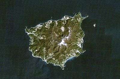 NASA Landsat7 image of Seonginbong and Ulleung-do (north oriented at top) | |
| Highest point | |
| Elevation | 984 m (3,228 ft) |
| Prominence | 984 m (3,228 ft) |
| Coordinates | 37°30′12″N 130°51′58″E / 37.50333°N 130.86611°ECoordinates: 37°30′12″N 130°51′58″E / 37.50333°N 130.86611°E |
| Geography | |
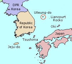 Location of Ulleung-do | |
| Location | Ulleung County, North Gyeongsang, South Korea |
| Geology | |
| Mountain type | Stratovolcano |
| Last eruption | 2990 BCE ± 40 years |
Seonginbong is a mountain located on the South Korean island of Ulleungdo, in North Gyeongsang Province, off the eastern coast of the mainland Korean Peninsula. It is the tallest mountain on the island and has an elevation of 984 metres.[1]
See also
References
This article is issued from Wikipedia - version of the 9/3/2016. The text is available under the Creative Commons Attribution/Share Alike but additional terms may apply for the media files.