Seneca, Oregon
| Seneca, Oregon | |
|---|---|
| City | |
|
Hayfield in Seneca | |
 Location in Oregon | |
| Coordinates: 44°8′8″N 118°58′19″W / 44.13556°N 118.97194°WCoordinates: 44°8′8″N 118°58′19″W / 44.13556°N 118.97194°W | |
| Country | United States |
| State | Oregon |
| County | Grant |
| Incorporated | 1970 |
| Government | |
| • Mayor | Andrea Combs |
| Area[1] | |
| • Total | 0.80 sq mi (2.07 km2) |
| • Land | 0.80 sq mi (2.07 km2) |
| • Water | 0 sq mi (0 km2) |
| Elevation | 4,690 ft (1,430 m) |
| Population (2010)[2] | |
| • Total | 199 |
| • Estimate (2012[3]) | 197 |
| • Density | 248.8/sq mi (96.1/km2) |
| Time zone | Pacific (UTC-8) |
| • Summer (DST) | Pacific (UTC-7) |
| ZIP code | 97873 |
| Area code(s) | 541 |
| FIPS code | 41-66200[2] |
| GNIS feature ID | 1149228[4] |
_(graDA0034).jpg)
Seneca is a city in Grant County, Oregon, United States. It is located in the Blue Mountains about 23 miles (37 km) south of Canyon City, on U.S. Route 395, on the edge of the Malheur National Forest.[5] The population was 199 at the 2010 census.
History
Seneca post office was established in 1895 and named by postmaster Minnie Southworth for her brother-in-law, prominent Portland judge Seneca Smith.[6][7]
While early homesteaders moved into the valley in the late 1800s, Seneca only began growing in the 1929 when it became the northern terminus of the now-vacated Oregon and Northwestern Railroad, owned by the Edward Hines Lumber Company, which extended south to Burns.[7] At that time, large-scale shipping of Ponderosa Pine logs from Seneca and the surrounding national forest began to the Hines sawmill in Hines.[7] The company established a planing mill and railroad shops in Seneca, and it became essentially a company town.[7] In 1940 Seneca's population was 275.[8] Logging in the area began to decline in the 1970s, and the Hines company ceased operations of its lumber mills and railroad in 1984.[7] The town was incorporated as a city in 1970 as lumber company control began to wane.[7] According to the 1980 census, Seneca's population was 285.[7] The estimated population in 2007 was 270.[7]
Geography
According to the United States Census Bureau, the city has a total area of 0.80 square miles (2.07 km2), all land.[1]
Situated at the confluence of Bear Creek and the Silvies River, Seneca is in Bear Valley at the northern edge of the Great Basin.[5]
Climate
Seneca has a semi-arid influenced subarctic climate (Köppen climate classification Dsc) with warm daytime temperatures in summer and cool to cold nighttime temperatures all year. Average high temperatures throughout the year are relatively mild for a subarctic climate. It is right on the border of the regular semi-arid continental climate with the fourth warmest month of the year straddling 50 °F (10 °C).
Seneca experiences the coolest weather in Grant County and has the distinction of the coldest official temperature recorded in Oregon: −54 °F (−48 °C) in 1933.[7][9]
| Climate data for Seneca | |||||||||||||
|---|---|---|---|---|---|---|---|---|---|---|---|---|---|
| Month | Jan | Feb | Mar | Apr | May | Jun | Jul | Aug | Sep | Oct | Nov | Dec | Year |
| Record high °F (°C) | 58 (14) |
64 (18) |
74 (23) |
83 (28) |
89 (32) |
104 (40) |
104 (40) |
100 (38) |
96 (36) |
90 (32) |
72 (22) |
63 (17) |
104 (40) |
| Average high °F (°C) | 34.5 (1.4) |
39.2 (4) |
45.3 (7.4) |
53.4 (11.9) |
61.6 (16.4) |
70.8 (21.6) |
81.8 (27.7) |
80.6 (27) |
72.2 (22.3) |
60.4 (15.8) |
45.4 (7.4) |
36.4 (2.4) |
56.8 (13.78) |
| Daily mean °F (°C) | 21.8 (−5.7) |
25.8 (−3.4) |
32.2 (0.1) |
39.7 (4.3) |
46.6 (8.1) |
53.3 (11.8) |
59.8 (15.4) |
57.7 (14.3) |
49.8 (9.9) |
41.2 (5.1) |
31.5 (−0.3) |
24.1 (−4.4) |
40.29 (4.6) |
| Average low °F (°C) | 9.2 (−12.7) |
12.4 (−10.9) |
19.0 (−7.2) |
25.9 (−3.4) |
31.5 (−0.3) |
35.9 (2.2) |
37.8 (3.2) |
34.9 (1.6) |
27.5 (−2.5) |
21.9 (−5.6) |
17.8 (−7.9) |
11.7 (−11.3) |
23.79 (−4.57) |
| Record low °F (°C) | −43 (−42) |
−54 (−48) |
−26 (−32) |
2 (−17) |
6 (−14) |
16 (−9) |
19 (−7) |
13 (−11) |
1 (−17) |
−11 (−24) |
−31 (−35) |
−48 (−44) |
−54 (−48) |
| Average precipitation inches (mm) | 1.46 (37.1) |
1.07 (27.2) |
1.20 (30.5) |
1.05 (26.7) |
1.47 (37.3) |
1.08 (27.4) |
0.52 (13.2) |
0.67 (17) |
0.64 (16.3) |
0.89 (22.6) |
1.40 (35.6) |
1.67 (42.4) |
13.11 (333) |
| Average snowfall inches (cm) | 14.8 (37.6) |
10.2 (25.9) |
7.2 (18.3) |
2.4 (6.1) |
0.7 (1.8) |
0.0 (0) |
0.0 (0) |
0.0 (0) |
0.0 (0) |
1.1 (2.8) |
6.4 (16.3) |
15.0 (38.1) |
57.8 (146.8) |
| Average precipitation days (≥ 0.01 in) | 11 | 9 | 9 | 8 | 8 | 7 | 3 | 3 | 4 | 6 | 10 | 12 | 90 |
| Source: WRCC,[10] Weatherbase [11] | |||||||||||||
Demographics
| Historical population | |||
|---|---|---|---|
| Census | Pop. | %± | |
| 1980 | 285 | — | |
| 1990 | 191 | −33.0% | |
| 2000 | 223 | 16.8% | |
| 2010 | 199 | −10.8% | |
| Est. 2015 | 193 | [12] | −3.0% |
2010 census
As of the census of 2010, there were 199 people, 95 households, and 60 families residing in the city. The population density was 248.8 inhabitants per square mile (96.1/km2). There were 128 housing units at an average density of 160.0 per square mile (61.8/km2). The racial makeup of the city was 99.0% White, 0.5% African American, and 0.5% from two or more races. Hispanic or Latino of any race were 1.0% of the population.[2]
There were 95 households of which 21.1% had children under the age of 18 living with them, 51.6% were married couples living together, 11.6% had a female householder with no husband present, and 36.8% were non-families. 31.6% of all households were made up of individuals and 15.8% had someone living alone who was 65 years of age or older. The average household size was 2.09 and the average family size was 2.53.[2]
The median age in the city was 52.5 years. 16.1% of residents were under the age of 18; 7.9% were between the ages of 18 and 24; 15% were from 25 to 44; 35.6% were from 45 to 64; and 25.1% were 65 years of age or older. The gender makeup of the city was 52.3% male and 47.7% female.[2]
2000 census
As of the census of 2000, there were 223 people, 95 households, and 64 families residing in the city. The population density was 267.8 people per square mile (103.7/km2). There were 115 housing units at an average density of 138.1 per square mile (53.5/km2). The racial makeup of the city was 99.10% White, 0.45% Asian, and 0.45% from two or more races. Hispanic or Latino of any race were 0.90% of the population.[2]
There were 95 households out of which 29.5% had children under the age of 18 living with them, 58.9% were married couples living together, 6.3% had a female householder with no husband present, and 32.6% were non-families. 29.5% of all households were made up of individuals and 10.5% had someone living alone who was 65 years of age or older. The average household size was 2.35 and the average family size was 2.89.[2]
In the city the population was spread out with 26.0% under the age of 18, 4.9% from 18 to 24, 25.1% from 25 to 44, 31.4% from 45 to 64, and 12.6% who were 65 years of age or older. The median age was 41 years. For every 100 females there were 110.4 males. For every 100 females age 18 and over, there were 96.4 males.[2]
The median income for a household in the city was $27,333, and the median income for a family was $26,806. Males had a median income of $30,000 versus $23,750 for females. The per capita income for the city was $12,636. About 24.0% of families and 19.8% of the population were below the poverty line, including 22.5% of those under the age of 18 and none of those 65 or over.[2]
Economy
The main industries in Seneca are cattle ranching and timber production.[8]
Education
Seneca is served by the Grant County School District (formerly the John Day School District). Seneca School is a K-6 school. After 6th grade students attend Grant Union High School in John Day. Seneca School was built in the 1930s to serve the employees of the Hines Lumber Company.[14] As of 2011, the school had 58 students.[14]
References
- 1 2 "US Gazetteer files 2010". United States Census Bureau. Retrieved 2012-12-21.
- 1 2 3 4 5 6 7 8 9 "American FactFinder". United States Census Bureau. Retrieved 2012-12-21.
- ↑ "Population Estimates". United States Census Bureau. Retrieved 2013-06-02.
- ↑ "US Board on Geographic Names". United States Geological Survey. 2007-10-25. Retrieved 2008-01-31.
- 1 2 Oregon Atlas & Gazetteer (7th ed.). Yarmouth, Maine: DeLorme. 2008. p. 78. ISBN 0-89933-347-8.
- ↑ McArthur, Lewis A.; McArthur, Lewis L. (2003) [1928]. Oregon Geographic Names (7th ed.). Portland, Oregon: Oregon Historical Society Press. p. 860. ISBN 978-0875952772.
- 1 2 3 4 5 6 7 8 9 Engeman, Richard H. (2009). The Oregon Companion: An Historical Gazetteer of The Useful, The Curious, and The Arcane. Portland, Oregon: Timber Press. pp. 337–338. ISBN 978-0-88192-899-0.
- 1 2 Writers' Program of the Work Projects Administration in the State of Oregon (1940). Oregon: End of the Trail. American Guide Series. Portland, Oregon: Binfords & Mort. pp. 421–422. OCLC 4874569.
- ↑ http://ggweather.com/climate/extremes_us.htm, Retrieved 2010-11-25.
- ↑ "Monthly Normals for Seneca". WRCC. Retrieved 2012-02-28.
- ↑ "Historical Weather for Seneca, Oregon, United States of America". Weatherbase. Retrieved 2012-02-28.
- ↑ "Annual Estimates of the Resident Population for Incorporated Places: April 1, 2010 to July 1, 2015". Retrieved July 2, 2016.
- ↑ "Census of Population and Housing". Census.gov. Retrieved June 4, 2015.
- 1 2 "Seneca School". Grant County School District. Retrieved 2011-01-17.
Further reading
- Friedman, Ralph (1978). "Sawdust at Seneca". Tracking Down Oregon. Caldwell, Idaho: The Caxton Printers, Ltd. pp. 251–53. ISBN 0-87004-257-2.
External links
- Entry for Seneca in the Oregon Blue Book
- Seneca Community Profile from the Oregon Business Development Commission
- Seneca History Project from Seneca School
- Historic images of Seneca from Salem Public Library
Municipalities and communities of Grant County, Oregon, United States | ||
|---|---|---|
| Cities | 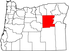 | |
| Unincorporated communities | ||
| Ghost towns | ||