Sembabule
| Sembabule | |
|---|---|
 Sembabule Map of Uganda showing the location of Sembabule. | |
|
Coordinates: | |
| Region | Central Region of Uganda |
| District | Sembabule District |
| Elevation | 1,180 m (3,870 ft) |
| Population (2011 Estimate) | |
| • Total | 4,800 |
| Time zone | EAT (UTC+3) |
Sembabule is a town in Sembabule District in the Central Region of Uganda. The town is the main municipal, administrative, and commercial center of the district and the site of the district headquarters.
Location
Sembabule is approximately 48 kilometres (30 mi), by road, northwest of Masaka, the largest city in the sub-region.[1] This is approximately 160 kilometres (99 mi), by road, southwest of Kampala, the capital and largest city of Uganda.[2] The coordinates of the town are 0°04'48.0"S, 31°27'36.0"E (Latitude:-0.0800; Longitude:31.4600).[3]
Population
The 2002 national census estimated the population of the town to be 4,010. In 2010, the Uganda Bureau of Statistics (UBOS) estimated the population at 4,700. In 2011, UBOS estimated the mid-year population at 4,800.[4]
Points of interest
The following additional points of interest lie within town or near the town limits:
- offices of Sembabule Town Council
- Sembabule central Market
- Bigo bya Mugenyi, a prehistoric human settlement, dating back to the Iron Age, circa (1200–1000 BC)
References
- ↑ "Distance Between Masaka And Sembabule With Map". Globefeed.com. Retrieved 27 May 2014.
- ↑ "Map Showing Kampala And Sembabule With Distance Marker". Globefeed.com. Retrieved 27 May 2014.
- ↑ Google (19 July 2015). "Location of Sembabule at Google Maps" (Map). Google Maps. Google. Retrieved 19 July 2015.
- ↑ UBOS. "Estimated Population of Sembabule In 2002, 2010 & 2011" (PDF). Uganda Bureau of Statistics (UBOS). Retrieved 27 May 2014.
External links
Capital: Sembabule | ||
| Counties and sub-counties | 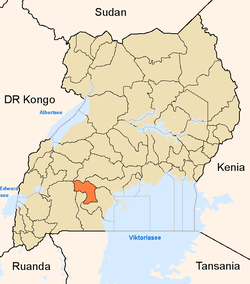 | |
| Towns and villages | ||
| Notable landmarks | ||
| Transport |
| |
| Notable people | ||
Coordinates: 00°04′48″S 31°27′36″E / 0.08000°S 31.46000°E