Seisia, Queensland
| Seisia Queensland | |
|---|---|
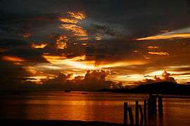 Sunset at Seisia | |
 Seisia | |
| Coordinates | 10°51′S 142°22′E / 10.850°S 142.367°ECoordinates: 10°51′S 142°22′E / 10.850°S 142.367°E |
| Population | 165 (2006 census)[1] |
| Postcode(s) | 4876 |
| Location | |
| LGA(s) | Northern Peninsula Area Region |
| State electorate(s) | Cook |
| Federal Division(s) | Leichhardt |
Seisia /ˈseɪʃə/ is an area north of New Mapoon and west of Bamaga at the tip of Cape York Peninsula in Queensland, Australia. At the 2006 census, Seisia had a population of 165.[1]
Seisia Island Community lies within a small DOGIT area granted in 1986 by the Queensland Government at Red Island Point. The community has a permanent population of about 100 people and is situated at the most northerly deep-water port on Cape York Peninsula. Seisia is popular as a destination for anglers and a number of fishing charter operators use Seisia as their base. A campground at Seisia is utilized by about 50 per cent of camping travelers to Northern Cape York Peninsula.
The majority of tourist services in the Northern Peninsula Area are provided under lease arrangements with the Seisia Island Council. Seisia is becoming increasingly well known as the "Gateway to the Torres Strait" and as a base on the mainland to educate and inform visitors about Torres Strait Islander culture. Tours linking Seisia with a number of Torres Strait islands (including the market days on Saibai) have commenced, capitalizing on opportunities to educate visitors as to the historical links between Seisia and the Torres Strait. A number of recreational fishing guides can be contacted through the Seisia Village campground.
See also
References
- 1 2 Australian Bureau of Statistics (25 October 2007). "Seisia (Seisia Island) (State Suburb)". 2006 Census QuickStats. Retrieved 2009-07-25.
List of Torres Strait topics | |||||||||||||||||||||||||||||||||||
|---|---|---|---|---|---|---|---|---|---|---|---|---|---|---|---|---|---|---|---|---|---|---|---|---|---|---|---|---|---|---|---|---|---|---|---|
| Torres Strait Islands, islets, and cays |
| ||||||||||||||||||||||||||||||||||
| People, culture, communities and languages |
| ||||||||||||||||||||||||||||||||||
| Governance and legal matters |
| ||||||||||||||||||||||||||||||||||
| Buildings and structures | |||||||||||||||||||||||||||||||||||
| Other | |||||||||||||||||||||||||||||||||||