Sedgwick, Colorado
| Sedgwick, Colorado | |
|---|---|
| Town | |
 Location in Sedgwick County and the state of Colorado | |
| Coordinates: 40°56′9″N 102°31′31″W / 40.93583°N 102.52528°WCoordinates: 40°56′9″N 102°31′31″W / 40.93583°N 102.52528°W | |
| Country |
|
| State |
|
| County[1] | Sedgwick County |
| Incorporated | January 28, 1918[2] |
| Government | |
| • Type | Statutory Town[1] |
| Area | |
| • Total | 0.3 sq mi (0.9 km2) |
| • Land | 0.3 sq mi (0.9 km2) |
| • Water | 0 sq mi (0 km2) |
| Elevation[3] | 3,586 ft (1,093 m) |
| Population (2000) | |
| • Total | 191 |
| • Density | 636.7/sq mi (212.2/km2) |
| Time zone | MST (UTC-7) |
| • Summer (DST) | MDT (UTC-6) |
| ZIP code[4] | 80749 |
| Area code(s) | 970 |
| FIPS code | 08-68930 |
| GNIS feature ID | 0182694 |
Sedgwick is a statutory town in Sedgwick County, Colorado, United States. The population was 191 at the 2000 census.
History
The town was named for Fort Sedgwick, which was named after John Sedgwick, who was a Major General in the Union Army during the American Civil War.[5][6]
Geography
Sedgwick is located at 40°56′9″N 102°31′31″W / 40.93583°N 102.52528°W (40.935706, -102.525272).[7] According to the United States Census Bureau, the town has a total area of 0.3 square miles (0.78 km2), all of it land.
Climate
According to the Köppen Climate Classification system, Sedgwick has a semi-arid climate, abbreviated "BSk" on climate maps. July 1954 was one of Sedgwick's warmest months to date. The town had 16 days of temperatures at or above 100 °F (38 °C) and on July 11, 1954, Sedgwick saw its temperature rise to 114 °F (46 °C). The frost-free period averages 153 days.[8]
| Climate data for Sedgwick 5 S, Colorado (1981–2010 normals) | |||||||||||||
|---|---|---|---|---|---|---|---|---|---|---|---|---|---|
| Month | Jan | Feb | Mar | Apr | May | Jun | Jul | Aug | Sep | Oct | Nov | Dec | Year |
| Record high °F (°C) | 73 (23) |
77 (25) |
86 (30) |
94 (34) |
100 (38) |
110 (43) |
110 (43) |
106 (41) |
103 (39) |
94 (34) |
81 (27) |
72 (22) |
110 (43) |
| Average high °F (°C) | 38.8 (3.8) |
42.6 (5.9) |
51.9 (11.1) |
61.0 (16.1) |
70.5 (21.4) |
81.6 (27.6) |
89.2 (31.8) |
86.7 (30.4) |
78.1 (25.6) |
64.1 (17.8) |
49.3 (9.6) |
38.3 (3.5) |
62.7 (17.1) |
| Average low °F (°C) | 13.8 (−10.1) |
16.6 (−8.6) |
23.6 (−4.7) |
31.9 (−0.1) |
42.9 (6.1) |
53.2 (11.8) |
58.7 (14.8) |
57.2 (14) |
47.2 (8.4) |
34.5 (1.4) |
23.1 (−4.9) |
13.7 (−10.2) |
34.7 (1.5) |
| Record low °F (°C) | −26 (−32) |
−26 (−32) |
−16 (−27) |
6 (−14) |
21 (−6) |
33 (1) |
42 (6) |
40 (4) |
17 (−8) |
3 (−16) |
−9 (−23) |
−30 (−34) |
−30 (−34) |
| Average precipitation inches (mm) | 0.40 (10.2) |
0.53 (13.5) |
1.11 (28.2) |
1.95 (49.5) |
2.90 (73.7) |
3.03 (77) |
2.53 (64.3) |
2.29 (58.2) |
1.41 (35.8) |
1.30 (33) |
0.65 (16.5) |
0.43 (10.9) |
18.30 (464.8) |
| Average snowfall inches (cm) | 5.8 (14.7) |
6.3 (16) |
6.4 (16.3) |
4.7 (11.9) |
0.1 (0.3) |
0 (0) |
0 (0) |
0 (0) |
0.4 (1) |
1.8 (4.6) |
5.1 (13) |
5.7 (14.5) |
35.2 (89.4) |
| Average precipitation days (≥ 0.01 in) | 3 | 4 | 6 | 7 | 9 | 8 | 7 | 7 | 6 | 5 | 4 | 3 | 69 |
| Average snowy days (≥ 0.1 in) | 2 | 3 | 3 | 2 | 0 | 0 | 0 | 0 | 0 | 1 | 2 | 3 | 15 |
| Source: NOAA (extremes 1958–present)[9] | |||||||||||||
Demographics
| Historical population | |||
|---|---|---|---|
| Census | Pop. | %± | |
| 1920 | 380 | — | |
| 1930 | 444 | 16.8% | |
| 1940 | 373 | −16.0% | |
| 1950 | 332 | −11.0% | |
| 1960 | 299 | −9.9% | |
| 1970 | 208 | −30.4% | |
| 1980 | 258 | 24.0% | |
| 1990 | 183 | −29.1% | |
| 2000 | 191 | 4.4% | |
| 2010 | 146 | −23.6% | |
| Est. 2015 | 148 | [10] | 1.4% |
As of the census[12] of 2000, there were 191 people, 81 households, and 55 families residing in the town. The population density was 576.1 people per square mile (223.5/km²). There were 111 housing units at an average density of 334.8 per square mile (129.9/km²). The racial makeup of the town was 95.29% White, 1.05% African American, 2.09% Asian, 1.05% from other races, and 0.52% from two or more races. Hispanic or Latino of any race were 2.62% of the population.
There were 81 households out of which 30.9% had children under the age of 18 living with them, 63.0% were married couples living together, 3.7% had a female householder with no husband present, and 30.9% were non-families. 30.9% of all households were made up of individuals and 16.0% had someone living alone who was 65 years of age or older. The average household size was 2.36 and the average family size was 2.91.
In the town the population was spread out with 26.2% under the age of 18, 4.2% from 18 to 24, 25.1% from 25 to 44, 24.1% from 45 to 64, and 20.4% who were 65 years of age or older. The median age was 41 years. For every 100 females there were 117.0 males. For every 100 females age 18 and over, there were 113.6 males.
The median income for a household in the town was $26,875, and the median income for a family was $30,313. Males had a median income of $19,792 versus $16,042 for females. The per capita income for the town was $13,903. About 7.7% of families and 9.0% of the population were below the poverty line, including 9.8% of those under the age of eighteen and 8.0% of those sixty five or over.
See also
- Outline of Colorado
- State of Colorado
- Fort Sedgwick
References
- 1 2 "Active Colorado Municipalities". State of Colorado, Department of Local Affairs. Retrieved 2007-09-01.
- ↑ "Colorado Municipal Incorporations". State of Colorado, Department of Personnel & Administration, Colorado State Archives. 2004-12-01. Retrieved 2007-09-02.
- ↑ "US Board on Geographic Names". United States Geological Survey. 2007-10-25. Retrieved 2008-01-31.
- ↑ "ZIP Code Lookup" (JavaScript/HTML). United States Postal Service. Retrieved January 1, 2008.
- ↑ "Profile for Sedgwick, Colorado". ePodunk. Retrieved 2010-06-15.
- ↑ Exploring Colorado Highways: Trip Trivia. Exploring America's Highway. 2007. p. 106. ISBN 978-0-9777301-0-0.
- ↑ "US Gazetteer files: 2010, 2000, and 1990". United States Census Bureau. 2011-02-12. Retrieved 2011-04-23.
- ↑ http://www.ncdc.noaa.gov/cdo-web/quickdata Retrieved 16 June 2015.
- ↑ "NowData - NOAA Online Weather Data". National Oceanic and Atmospheric Administration. Retrieved May 30, 2016.
- ↑ "Annual Estimates of the Resident Population for Incorporated Places: April 1, 2010 to July 1, 2015". Retrieved July 2, 2016.
- ↑ "Census of Population and Housing". Census.gov. Retrieved June 4, 2015.
- ↑ "American FactFinder". United States Census Bureau. Retrieved 2008-01-31.
External links
| Wikimedia Commons has media related to Sedgwick, Colorado. |
Municipalities and communities of Sedgwick County, Colorado, United States | ||
|---|---|---|
| Towns | 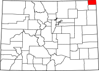 | |
