Sedalia, Texas
| Sedalia, Texas | |
|---|---|
| Populated place | |
 Sedalia, Texas  Sedalia, Texas Location within the state of Texas | |
| Coordinates: 33°23′46″N 96°28′41″W / 33.39611°N 96.47806°WCoordinates: 33°23′46″N 96°28′41″W / 33.39611°N 96.47806°W | |
| Country |
|
| State |
|
| Counties | Collin, |
| Area | |
| • Water | 0.0 sq mi (0 km2) |
| Elevation | 718 ft (219 m) |
| Population (2000) | |
| • Total | 25 |
| Time zone | Central (CST) (UTC-6) |
| • Summer (DST) | CDT (UTC-5) |
| ZIP code | 75495 |
| Area code(s) | 214, 469, 972 |
| FIPS code | 48-66560[1] |
| GNIS feature ID | 2034686[2] |
Sedalia is a populated place in Collin County, Texas, United States. It is near the border of Grayson County and two miles from Westminster.
Population
In 1896 Sedalia had an estimated population of 100, but since 1940 the population has been estimated at 20-25. In 1990 it was 25. The population remained unchanged in 2000.[3]
History
Sedalia was previously known as Yakima. It had a post office from January 15, 1889, and by 1896 had two churches and several other facilities. The mail service ceased in 1903 and ran thereafter through Van Alstyne in Grayson County.[3]
References
- ↑ "American FactFinder". United States Census Bureau. Retrieved 2008-01-31.
- ↑ "US Board on Geographic Names". United States Geological Survey. 2007-10-25.
- 1 2 "Sedalia, Texas". Texas State Historical Association. Retrieved March 15, 2013.
External links
Municipalities and communities of Collin County, Texas, United States | ||
|---|---|---|
| Cities | 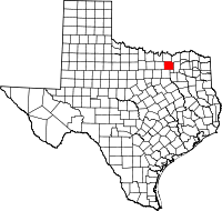 | |
| Towns | ||
| CDP | ||
| Other unincorporated communities |
| |
| Historical communities | ||
| Ghost towns | ||
| Footnotes | ‡This populated place also has portions in an adjacent county or counties | |

This article is issued from Wikipedia - version of the 11/16/2016. The text is available under the Creative Commons Attribution/Share Alike but additional terms may apply for the media files.