Sebring, Ohio
| Sebring, Ohio | |
|---|---|
| Village | |
|
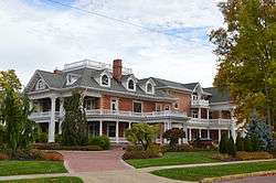
Frank Sebring House | |
 Location of Sebring, Ohio | |
 Location of Sebring in Mahoning County | |
| Coordinates: 40°55′25″N 81°1′27″W / 40.92361°N 81.02417°WCoordinates: 40°55′25″N 81°1′27″W / 40.92361°N 81.02417°W | |
| Country | United States |
| State | Ohio |
| County | Mahoning |
| Township | Smith |
| Government | |
| • Mayor | J. Michael Pinkerton |
| Area[1] | |
| • Total | 2.52 sq mi (6.53 km2) |
| • Land | 2.50 sq mi (6.47 km2) |
| • Water | 0.02 sq mi (0.05 km2) |
| Elevation[2] | 1,099 ft (335 m) |
| Population (2010)[3] | |
| • Total | 4,420 |
| • Estimate (2012[4]) | 4,355 |
| • Density | 1,768.0/sq mi (682.6/km2) |
| Time zone | Eastern (EST) (UTC-5) |
| • Summer (DST) | EDT (UTC-4) |
| ZIP code | 44672 |
| Area code(s) | 330 |
| FIPS code | 39-71220[5] |
| GNIS feature ID | 1049163[2] |
| Website | http://www.sebringohio.net/ |
Sebring is a village in Mahoning County, Ohio, United States. The population was 4,420 at the 2010 census. It is part of the Youngstown-Warren-Boardman, OH-PA Metropolitan Statistical Area.
Sebring is served by a branch of the Public Library of Youngstown and Mahoning County.
History
Sebring was platted in 1899 by the four Sebring brothers, who in 1900 established a pottery factory at the site.[6]
Geography
Sebring is located at 40°55′25″N 81°1′27″W / 40.92361°N 81.02417°W (40.923552, -81.024233).[7]
According to the United States Census Bureau, the village has a total area of 2.52 square miles (6.53 km2), of which 2.50 square miles (6.47 km2) is land and 0.02 square miles (0.05 km2) is water.[1]
Demographics
| Historical population | |||
|---|---|---|---|
| Census | Pop. | %± | |
| 1900 | 387 | — | |
| 1910 | 2,104 | 443.7% | |
| 1920 | 3,541 | 68.3% | |
| 1930 | 3,949 | 11.5% | |
| 1940 | 3,902 | −1.2% | |
| 1950 | 4,045 | 3.7% | |
| 1960 | 4,439 | 9.7% | |
| 1970 | 4,954 | 11.6% | |
| 1980 | 5,078 | 2.5% | |
| 1990 | 4,848 | −4.5% | |
| 2000 | 4,912 | 1.3% | |
| 2010 | 4,420 | −10.0% | |
| Est. 2015 | 4,266 | [8] | −3.5% |
2010 census
As of the census[3] of 2010, there were 4,420 people, 1,898 households, and 1,098 families residing in the village. The population density was 1,768.0 inhabitants per square mile (682.6/km2). There were 2,291 housing units at an average density of 916.4 per square mile (353.8/km2). The racial makeup of the village was 97.8% White, 0.2% African American, 0.1% Native American, 0.2% Asian, 0.4% from other races, and 1.2% from two or more races. Hispanic or Latino of any race were 0.7% of the population.
There were 1,898 households of which 25.7% had children under the age of 18 living with them, 41.7% were married couples living together, 10.1% had a female householder with no husband present, 6.1% had a male householder with no wife present, and 42.1% were non-families. 37.6% of all households were made up of individuals and 25.1% had someone living alone who was 65 years of age or older. The average household size was 2.23 and the average family size was 2.90.
The median age in the village was 45.3 years. 20.4% of residents were under the age of 18; 8.4% were between the ages of 18 and 24; 21% were from 25 to 44; 23.4% were from 45 to 64; and 26.9% were 65 years of age or older. The gender makeup of the village was 45.7% male and 54.3% female.
2000 census
As of the census[5] of 2000, there were 4,912 people, 2,088 households, and 1,252 families residing in the village. The population density was 2,395.0 people per square mile (925.1/km²). There were 2,252 housing units at an average density of 1,098.0 per square mile (424.1/km²). The racial makeup of the village was 98.37% White, 0.47% African American, 0.08% Native American, 0.16% Asian, 0.02% Pacific Islander, 0.24% from other races, and 0.65% from two or more races. Hispanic or Latino of any race were 0.77% of the population.
There were 2,088 households out of which 24.9% had children under the age of 18 living with them, 47.2% were married couples living together, 9.0% had a female householder with no husband present, and 40.0% were non-families. 37.0% of all households were made up of individuals and 25.9% had someone living alone who was 65 years of age or older. The average household size was 2.25 and the average family size was 2.95.
In the village the population was spread out with 21.6% under the age of 18, 6.7% from 18 to 24, 24.4% from 25 to 44, 19.3% from 45 to 64, and 28.0% who were 65 years of age or older. The median age was 43 years. For every 100 females there were 81.1 males. For every 100 females age 18 and over, there were 74.9 males.
The median income for a household in the village was $32,019, and the median income for a family was $41,020. Males had a median income of $31,601 versus $20,256 for females. The per capita income for the village was $17,103. About 8.4% of families and 10.9% of the population were below the poverty line, including 12.8% of those under age 18 and 9.8% of those age 65 or over.
Transportation
Airport
Tri-City Airport is a public use airport located one nautical mile (2 km) southeast of the central business district of Sebring.[10]
Notable people
- Viktor Schreckengost — industrial designer
- Rose Mary Woods — secretary to U.S. President Richard Nixon
References
- 1 2 "US Gazetteer files 2010". United States Census Bureau. Retrieved 2013-01-06.
- 1 2 "US Board on Geographic Names". United States Geological Survey. 2007-10-25. Retrieved 2008-01-31.
- 1 2 "American FactFinder". United States Census Bureau. Retrieved 2013-01-06.
- ↑ "Population Estimates". United States Census Bureau. Retrieved 2013-06-17.
- 1 2 "American FactFinder". United States Census Bureau. Retrieved 2008-01-31.
- ↑ Sanderson, Thomas W. (1907). Twentieth Century History of Youngstown and Mahoning County. Biographical Publishing Company. p. 226.
- ↑ "US Gazetteer files: 2010, 2000, and 1990". United States Census Bureau. 2011-02-12. Retrieved 2011-04-23.
- ↑ "Annual Estimates of the Resident Population for Incorporated Places: April 1, 2010 to July 1, 2015". Retrieved July 2, 2016.
- ↑ "Census of Population and Housing". Census.gov. Retrieved June 4, 2015.
- ↑ FAA Airport Master Record for 3G6 (Form 5010 PDF). Federal Aviation Administration. Effective May 31, 2012.
External links
Municipalities and communities of Mahoning County, Ohio, United States | ||
|---|---|---|
| Cities | 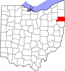 | |
| Villages | ||
| Townships | ||
| CDPs | ||
| Unincorporated communities |
| |
| Footnotes | ‡This populated place also has portions in an adjacent county or counties | |