Seabrook Island, South Carolina
| Seabrook Island, South Carolina | |
|---|---|
| Town | |
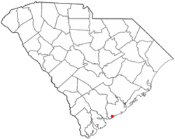 Location of Seabrook Island in South Carolina | |
| Coordinates: 32°34′56″N 80°9′48″W / 32.58222°N 80.16333°WCoordinates: 32°34′56″N 80°9′48″W / 32.58222°N 80.16333°W | |
| Country | United States |
| State | South Carolina |
| County | Charleston |
| Government | |
| • Mayor Pro-Tem | Terry Ahearn |
| Area | |
| • Total | 7.0 sq mi (18.1 km2) |
| • Land | 6.0 sq mi (15.5 km2) |
| • Water | 1.0 sq mi (2.7 km2) |
| Elevation | 5 ft (2 m) |
| Population (2010) | |
| • Total | 1,714 |
| • Density | 287/sq mi (110.8/km2) |
| Time zone | EST (UTC-5) |
| • Summer (DST) | EDT (UTC-4) |
| ZIP code | 29455 |
| Area code(s) | 843 |
| FIPS code | 45-64712[1] |
| GNIS feature ID | 1253570[2] |
| Website |
www |
Seabrook Island is a barrier island in Charleston County, South Carolina, United States. The population was 1,714 at the 2010 census,[3] up from 1,250 at the 2000 census.
Seabrook Island is part of the Charleston-North Charleston-Summerville metropolitan area.
Geography
Seabrook Island is located in southwestern Charleston County at 32°34′56″N 80°9′48″W / 32.58222°N 80.16333°W (32.582173, -80.163332),[4] bordered to the south by the Atlantic Ocean, to the west by the North Edisto River, and to the north by Bohicket Creek. The town extends to the east along the Atlantic shoreline as far as the Kiawah River, across which is the town of Kiawah Island. Most of the eastern border of the town, however, is next to unincorporated land. The city of Charleston is 25 miles (40 km) to the northeast.
According to the United States Census Bureau, the town of Seabrook Island has a total area of 7.0 square miles (18.1 km2), of which 6.0 square miles (15.5 km2) is land and 1.0 square mile (2.7 km2), or 14.74%, is water.[3]
History
In 1666, British subject Lt. Col. Robert Sanford arrived on Seabrook as an explorer in royal service to King Charles II. By 1684, the local Stono Indians were "persuaded" to cede their lands to the proprietary government, which in turn sold the property to English settlers.
During the American Revolutionary years, the island was used as a staging area for Hessian and British troops. In 1816, the island was sold to William Seabrook of nearby Edisto Island, hence the present name. Under Seabrook's ownership, the island was used for growing cotton. At the height of the Civil War, Seabrook sold the island to William Gregg, who rented the land to Charles Andell.
After the turn of the century, the island was sold to sportsmen for hunting, fishing, and recreation. In 1939, the Episcopal Diocese of South Carolina rented land on Seabrook to establish a summer camp for underprivileged children. In 1951, about 1,408 acres (5.70 km2) of land were given to the church.
In 1970, the diocese sold about 1,100 acres (4.5 km2) to private developers who planned the private, residential community that Seabrook Island is today. Eighteen years later, the town of Seabrook was incorporated, and it celebrated a decade of private ownership and self-government in 1997.
In 2005 Seabrook Island Club membership became a requirement for new purchasers of property on Seabrook. This requirement raised the economic growth and vitality of the Island, resulting in a strong financial positions for the Seabrook Island Club. In 2010 the Horizon Plan, a complete reconstruction of island amenities, was completed, providing property owners and guests with a new fitness/community center, racquet club, full-service clubhouse, beach club and renovated equestrian center, pools and golf practice facility.
The switch to mandatory membership has been controversial with some owners contending that the requirement has depressed real estate sales and prices.
Seabrook Island amenities include two championship golf courses, nationally recognized racquet club with 15 Har Tru tennis courts and two pickle ball courts, equestrian center offering trail and beach rides, ocean-front dining venues, swimming pools, fitness center and expansive banquet/private dining venues.
Demographics
| Historical population | |||
|---|---|---|---|
| Census | Pop. | %± | |
| 1880 | 50 | — | |
| 1990 | 948 | — | |
| 2000 | 1,250 | 31.9% | |
| 2010 | 1,714 | 37.1% | |
| Est. 2015 | 1,844 | [5] | 7.6% |
As of the census[1] of 2000, there were 1,250 people, 660 households, and 465 families residing in the town. The population density was 206.0 people per square mile (79.5/km²). There were 1,649 housing units at an average density of 271.7 per square mile (104.9/km²). The racial makeup of the town was 97.04% White, 1.44% African American, 0.40% Native American, 0.08% Asian, 0.40% Pacific Islander, 0.32% from other races, and 0.32% from two or more races. Hispanic or Latino of any race were 0.88% of the population.
There were 660 households out of which 3.6% had children under the age of 18 living with them, 68.2% were married couples living together, 2.3% had a female householder with no husband present, and 29.4% were non-families. 24.8% of all households were made up of individuals and 11.8% had someone living alone who was 65 years of age or older. The average household size was 1.86 and the average family size was 2.14.
In the town the population was spread out with 3.0% under the age of 18, 3.1% from 18 to 24, 11.8% from 25 to 44, 40.9% from 45 to 64, and 41.2% who were 65 years of age or older. The median age was 62 years. For every 100 females there were 89.7 males. For every 100 females age 18 and over, there were 89.2 males.
The median income for a household in the town was $66,548, and the median income for a family was $84,392. Males had a median income of $50,446 versus $40,000 for females. The per capita income for the town was $49,863. About 2.1% of families and 3.8% of the population were below the poverty line, including none of those under age 18 and 4.6% of those age 65 or over.
Government
The city is run by an elected mayor–council government system.
Mayor
Ronald Ciancio
Council members
Skip Crane, John Wells, John Gregg, John Turner
References
- 1 2 "American FactFinder". United States Census Bureau. Retrieved 2008-01-31.
- ↑ "US Board on Geographic Names". United States Geological Survey. 2007-10-25. Retrieved 2008-01-31.
- 1 2 "Geographic Identifiers: 2010 Census Summary File 1 (G001): Seabrook Island town, South Carolina". U.S. Census Bureau, American Factfinder. Retrieved June 30, 2015.
- ↑ "US Gazetteer files: 2010, 2000, and 1990". United States Census Bureau. 2011-02-12. Retrieved 2011-04-23.
- ↑ "Annual Estimates of the Resident Population for Incorporated Places: April 1, 2010 to July 1, 2015". Retrieved July 2, 2016.
- ↑ "Census of Population and Housing". Census.gov. Retrieved June 4, 2015.
External links
- Town of Seabrook Island official website
- Seabrook Island website
- The Island Connection, bi-weekly newspaper serving Seabrook and Kiawah Island
- Beachwalker Rentals, Inc., Vacation Home Rentals on Seabrook Island
Municipalities and communities of Charleston County, South Carolina, United States | ||
|---|---|---|
| Cities | 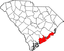 | |
| Towns | ||
| CDP | ||
| Unincorporated communities | ||
| Footnotes | ‡This populated place also has portions in an adjacent county or counties | |