Scribner, Nebraska
| Scribner, Nebraska | |
|---|---|
| City | |
|
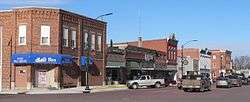
Downtown Scribner | |
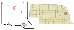 Location of Scribner, Nebraska | |
| Coordinates: 41°39′58″N 96°39′45″W / 41.66611°N 96.66250°WCoordinates: 41°39′58″N 96°39′45″W / 41.66611°N 96.66250°W | |
| Country | United States |
| State | Nebraska |
| County | Dodge |
| Area[1] | |
| • Total | 0.66 sq mi (1.71 km2) |
| • Land | 0.64 sq mi (1.66 km2) |
| • Water | 0.02 sq mi (0.05 km2) |
| Elevation | 1,253 ft (382 m) |
| Population (2010)[2] | |
| • Total | 857 |
| • Estimate (2012[3]) | 854 |
| • Density | 1,339.1/sq mi (517.0/km2) |
| Time zone | Central (CST) (UTC-6) |
| • Summer (DST) | CDT (UTC-5) |
| ZIP code | 68057 |
| Area code(s) | 402 |
| FIPS code | 31-44280[4] |
| GNIS feature ID | 0833325[5] |
Scribner is a city in Dodge County, Nebraska, United States. The population was 857 at the 2010 census.
History
Scribner was platted in 1870 when the railroad was extended to that point.[6] It was named for publishing magnate Charles Scribner I.[7][8]
Geography
Scribner is located at 41°39′58″N 96°39′45″W / 41.66611°N 96.66250°W (41.666040, -96.662541).[9]
According to the United States Census Bureau, the city has a total area of 0.66 square miles (1.71 km2), of which, 0.64 square miles (1.66 km2) is land and 0.02 square miles (0.05 km2) is water.[1]
Climate
This climatic region is typified by large seasonal temperature differences, with warm to hot (and often humid) summers and cold (sometimes severely cold) winters. According to the Köppen Climate Classification system, Scribner has a humid continental climate, abbreviated "Dfa" on climate maps.[10]
Demographics
| Historical population | |||
|---|---|---|---|
| Census | Pop. | %± | |
| 1880 | 193 | — | |
| 1890 | 664 | 244.0% | |
| 1900 | 827 | 24.5% | |
| 1910 | 891 | 7.7% | |
| 1920 | 1,021 | 14.6% | |
| 1930 | 1,066 | 4.4% | |
| 1940 | 904 | −15.2% | |
| 1950 | 913 | 1.0% | |
| 1960 | 1,021 | 11.8% | |
| 1970 | 1,031 | 1.0% | |
| 1980 | 1,011 | −1.9% | |
| 1990 | 950 | −6.0% | |
| 2000 | 971 | 2.2% | |
| 2010 | 857 | −11.7% | |
| Est. 2015 | 846 | [11] | −1.3% |
2010 census
As of the census[2] of 2010, there were 857 people, 385 households, and 222 families residing in the city. The population density was 1,339.1 inhabitants per square mile (517.0/km2). There were 443 housing units at an average density of 692.2 per square mile (267.3/km2). The racial makeup of the city was 95.7% White, 0.5% African American, 0.8% Native American, 0.7% Asian, 0.5% from other races, and 1.9% from two or more races. Hispanic or Latino of any race were 0.9% of the population.
There were 385 households of which 24.9% had children under the age of 18 living with them, 46.0% were married couples living together, 7.3% had a female householder with no husband present, 4.4% had a male householder with no wife present, and 42.3% were non-families. 39.5% of all households were made up of individuals and 25.2% had someone living alone who was 65 years of age or older. The average household size was 2.13 and the average family size was 2.86.
The median age in the city was 50.4 years. 21.6% of residents were under the age of 18; 5.2% were between the ages of 18 and 24; 16.6% were from 25 to 44; 26.5% were from 45 to 64; and 30% were 65 years of age or older. The gender makeup of the city was 48.8% male and 51.2% female.
2000 census
As of the census[4] of 2000, there were 971 people, 389 households, and 245 families residing in the city. The population density was 1,523.2 people per square mile (585.8/km²). There were 428 housing units at an average density of 671.4 per square mile (258.2/km²). The racial makeup of the city was 98.35% White, 0.31% African American, 0.10% Native American, 0.72% from other races, and 0.51% from two or more races. Hispanic or Latino of any race were 0.93% of the population.
There were 389 households out of which 28.5% had children under the age of 18 living with them, 53.0% were married couples living together, 7.7% had a female householder with no husband present, and 37.0% were non-families. 32.4% of all households were made up of individuals and 19.8% had someone living alone who was 65 years of age or older. The average household size was 2.31 and the average family size was 2.94.
In the town the population was spread out with 23.3% under the age of 18, 6.7% from 18 to 24, 22.0% from 25 to 44, 17.4% from 45 to 64, and 30.6% who were 65 years of age or older. The median age was 43 years. For every 100 females there were 79.2 males. For every 100 females age 18 and over, there were 77.8 males.
As of 2000 the median income for a household in the city was $30,455, and the median income for a family was $40,625. Males had a median income of $31,389 versus $18,553 for females. The per capita income for the city was $16,173. About 6.1% of families and 9.4% of the population were below the poverty line, including 8.6% of those under age 18 and 13.3% of those age 65 or over.
Notable people
- J. Martin Klotsche, educator and historian
- Gregg Olson, Baseball player
References
- 1 2 "US Gazetteer files 2010". United States Census Bureau. Retrieved 2012-06-24.
- 1 2 "American FactFinder". United States Census Bureau. Retrieved 2012-06-24.
- ↑ "Population Estimates". United States Census Bureau. Retrieved 2013-05-29.
- 1 2 "American FactFinder". United States Census Bureau. Retrieved 2008-01-31.
- ↑ "US Board on Geographic Names". United States Geological Survey. 2007-10-25. Retrieved 2008-01-31.
- ↑ "Scribner, Dodge County". Center for Advanced Land Management Information Technologies. University of Nebraska. Retrieved 7 August 2014.
- ↑ Chicago and North Western Railway Company (1908). A History of the Origin of the Place Names Connected with the Chicago & North Western and Chicago, St. Paul, Minneapolis & Omaha Railways. p. 123.
- ↑ "Profile for Scribner, NE". ePodunk. Retrieved 7 August 2014.
- ↑ "US Gazetteer files: 2010, 2000, and 1990". United States Census Bureau. 2011-02-12. Retrieved 2011-04-23.
- ↑ Climate Summary for Scribner, Nebraska
- ↑ "Annual Estimates of the Resident Population for Incorporated Places: April 1, 2010 to July 1, 2015". Retrieved July 2, 2016.
- ↑ "Census of Population and Housing". Census.gov. Retrieved June 4, 2015.
Municipalities and communities of Dodge County, Nebraska, United States | ||
|---|---|---|
| Cities | ||
| Villages | ||
| Townships | ||
| CDPs | ||
| Unincorporated communities | ||
| Ghost towns | ||
| Footnotes | ‡This populated place also has portions in an adjacent county or counties | |