Scipio, New York
| Scipio, New York | |
|---|---|
| Town | |
|
Howland Cobblestone Store, Sherwood, NY | |
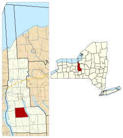 Location within Cayuga County and New York | |
 Scipio Location within the state of New York | |
| Coordinates: 42°48′12″N 76°34′17″W / 42.80333°N 76.57139°WCoordinates: 42°48′12″N 76°34′17″W / 42.80333°N 76.57139°W | |
| Country | United States |
| State | New York |
| County | Cayuga |
| Government | |
| • Type | Town Council |
| • Town Supervisor | Keith M. Batman (D) |
| • Town Council |
Members' List
|
| Area | |
| • Total | 39.3 sq mi (101.8 km2) |
| • Land | 36.6 sq mi (94.7 km2) |
| • Water | 2.7 sq mi (7.1 km2) |
| Elevation | 1,214 ft (370 m) |
| Population (2010) | |
| • Total | 1,713 |
| • Density | 46.9/sq mi (18.1/km2) |
| Time zone | Eastern (EST) (UTC-5) |
| • Summer (DST) | EDT (UTC-4) |
| ZIP code | 13147 |
| Area code(s) | 315 |
| FIPS code | 36-65816 |
| GNIS feature ID | 0979476 |
| Website |
www |

Scipio is a town in Cayuga County, New York, United States. The population was 1,713 at the 2010 census.[1] The town name was provided by a clerk with an interest in the classics. Scipio is centrally located in the southern half of the county, south of Auburn.
History
Scipio was part of the Central New York Military Tract, which was land reserved for veterans of the Revolutionary War. The first settler arrived around 1790, and the town was formed in 1798 when Cayuga County was formed. The town was named after the Roman general Scipio Africanus.[2] In 1823, part of Scipio was used to form the towns of Springport and Venice.[3]
Geography
According to the United States Census Bureau, the town has a total area of 39.3 square miles (101.8 km2), of which 36.6 square miles (94.7 km2) is land and 2.7 square miles (7.1 km2), or 7.00%, is water.[1]
The east town line is marked by Owasco Lake, one of the Finger Lakes.
New York State Route 34, New York State Route 34B, and New York State Route 38 are north-south highways in Scipio.
Demographics
| Historical population | |||
|---|---|---|---|
| Census | Pop. | %± | |
| 1820 | 8,105 | — | |
| 1830 | 2,691 | −66.8% | |
| 1840 | 2,255 | −16.2% | |
| 1850 | 2,135 | −5.3% | |
| 1860 | 2,066 | −3.2% | |
| 1870 | 2,070 | 0.2% | |
| 1880 | 2,093 | 1.1% | |
| 1890 | 1,836 | −12.3% | |
| 1900 | 1,657 | −9.7% | |
| 1910 | 1,470 | −11.3% | |
| 1920 | 1,218 | −17.1% | |
| 1930 | 991 | −18.6% | |
| 1940 | 1,104 | 11.4% | |
| 1950 | 1,202 | 8.9% | |
| 1960 | 1,143 | −4.9% | |
| 1970 | 1,290 | 12.9% | |
| 1980 | 1,471 | 14.0% | |
| 1990 | 1,517 | 3.1% | |
| 2000 | 1,537 | 1.3% | |
| 2010 | 1,713 | 11.5% | |
| Est. 2014 | 1,674 | [4] | −2.3% |
As of the census[6] of 2000, there were 1,537 people, 571 households, and 424 families residing in the town. The population density was 41.9 people per square mile (16.2/km²). There were 702 housing units at an average density of 19.1 per square mile (7.4/km²). The racial makeup of the town was 97.59% White, 0.20% African American, 0.85% Native American, 0.59% Asian, 0.20% from other races, and 0.59% from two or more races. Hispanic or Latino of any race were 1.30% of the population.
There were 571 households out of which 36.6% had children under the age of 18 living with them, 60.6% were married couples living together, 7.7% had a female householder with no husband present, and 25.7% were non-families. 20.0% of all households were made up of individuals and 8.8% had someone living alone who was 65 years of age or older. The average household size was 2.69 and the average family size was 3.11.
In the town the population was spread out with 29.0% under the age of 18, 6.8% from 18 to 24, 28.2% from 25 to 44, 24.7% from 45 to 64, and 11.5% who were 65 years of age or older. The median age was 37 years. For every 100 females there were 99.9 males. For every 100 females age 18 and over, there were 93.6 males.
The median income for a household in the town was $44,491, and the median income for a family was $50,395. Males had a median income of $34,671 versus $22,625 for females. The per capita income for the town was $17,705. About 2.8% of families and 6.7% of the population were below the poverty line, including 6.7% of those under age 18 and 6.7% of those age 65 or over.
Arts and culture
Tourism
The Howland Cobblestone Store, also known as the Howland Stone Store Museum, is located in Scipio. The 19th-century store is significant for its cobblestone architecture and was listed on the National Register of Historic Places in 1994.[7]
Notable people
- Sayles Jenks Bowen, Mayor of Washington DC. Noted civil rights advocate, born in Scipio. Son of Josiah Bowen and Deborah Jenks
- Thomas J. Drake, justice of Utah Territorial Supreme Court and third Lieutenant Governor of Michigan, born in Scipio,[8]
- Henry Farnam, philanthropist and railroad president, born in Scipio[9]
- James Strang, founder of the Church of Jesus Christ of Latter Day Saints (Strangite), a faction of the Latter Day Saint movement, born in Scipio. In addition to serving as president of his church, Strang also served as the self-proclaimed king of a now-defunct ecclesiastical monarchy he established on Beaver Island, Michigan, and also served 1 1⁄2 terms in the Michigan House of Representatives prior to his murder in 1856 at the hands of two disgruntled followers. His Ancient and Modern Michimilimackinac was published by the Smithsonian Institution, and remained the definitive work of Beaver Island flora and fauna for nearly a century. Strang also served at various times as a postmaster, schoolteacher, temperance lecturer, newspaper correspondent, and lawyer. Strang did not spend much of his life in Scipio, having left the town with his parents by the time he was three.[10]
Hocus Pocus
The town is the setting of the Kurt Vonnegut novel Hocus Pocus.[11] Many details about the town are fictionalized for the novel.
Communities and locations in Scipio
- Ashland – A hamlet on Owasco Lake in the southeast part of Scipio by NY-38.
- Bolts Corners – A location in the southwest part of Scipio, east of Sherwood.
- Botsford Corners – A location near the south town line, west of Ashland.
- Casowasco – A hamlet on the shore of Owasco Lake in the southeast part of Scipio. Operated as a Camp & Retreat Center by the Upper New York Conference of the United Methodist Church
- Covey Corners – A location near the south town line, west of Ashland.
- Edgewater – A hamlet on Owasco Lake in the southeast part of Scipio.
- Elmwood – A hamlet on Owasco Lake and NY-38 in the northeast part of Scipio.
- Kings Corners – A location near the west town line on NY-34B.
- Merrifield – A hamlet between Scipio Center and Scipioville.
- Number One – A location near the west town line on NY-34B, north of Kings Corners.
- Owasco Lake Station – A hamlet at the northeast corner of Scipio on Owasco Lake.
- Scipio Center – A hamlet located on NY-34 near the town center.
- Scipioville – A hamlet located on NY-34B, west of Scipio Center.
- Sherwood – A hamlet on NY-34B near the south town line, south of Scipioville.
References
- 1 2 "Geographic Identifiers: 2010 Demographic Profile Data (G001): Scipio town, Cayuga County, New York". U.S. Census Bureau, American Factfinder. Retrieved November 13, 2014.
- ↑ "Scipio, New York". ePodunk. Retrieved May 30, 2014.
- ↑ "Town of Scipio". Town of Scipio. Retrieved May 30, 2014.
- ↑ "Annual Estimates of the Resident Population for Incorporated Places: April 1, 2010 to July 1, 2014". Retrieved June 4, 2015.
- ↑ "Census of Population and Housing". Census.gov. Retrieved June 4, 2015.
- ↑ "American FactFinder". United States Census Bureau. Retrieved 2008-01-31.
- ↑ National Park Service (2009-03-13). "National Register Information System". National Register of Historic Places. National Park Service.
- ↑ "Thomas Jefferson Drake". Ancestry.com. Retrieved May 30, 2014.
- ↑ "Scipio, New York". City-Data.com. Retrieved May 30, 2014.
- ↑ Rodgers, Bradley A. (1996). Guardian of the Great Lakes: The U.S. Paddle Frigate Michigan. University of Michigan Press. p. 60.
- ↑ "Still Asking the Embarassing [sic] Questions". The New York Times. Retrieved May 30, 2014.
External links
| Wikimedia Commons has media related to Scipio, New York. |
Municipalities and communities of Cayuga County, New York, United States | ||
|---|---|---|
| City | 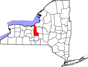 | |
| Towns | ||
| Villages | ||
| CDP | ||
| Other hamlets | ||
| Footnotes | ‡This populated place also has portions in an adjacent county or counties | |