Schwäbisch Gmünd
| Schwäbisch Gmünd | ||
|---|---|---|
|
View from Mt. Zeiselberg | ||
| ||
 Schwäbisch Gmünd | ||
Location of Schwäbisch Gmünd within Ostalbkreis district  | ||
| Coordinates: 48°48′N 9°48′E / 48.800°N 9.800°ECoordinates: 48°48′N 9°48′E / 48.800°N 9.800°E | ||
| Country | Germany | |
| State | Baden-Württemberg | |
| Admin. region | Stuttgart | |
| District | Ostalbkreis | |
| Government | ||
| • Lord Mayor | Richard Arnold | |
| Area | ||
| • Total | 113.78 km2 (43.93 sq mi) | |
| Population (2015-12-31)[1] | ||
| • Total | 59,840 | |
| • Density | 530/km2 (1,400/sq mi) | |
| Time zone | CET/CEST (UTC+1/+2) | |
| Postal codes | 73525–73529 | |
| Dialling codes | 07171 | |
| Vehicle registration | AA, GD | |
| Website | www.schwaebisch-gmuend.de | |

Schwäbisch Gmünd (German pronunciation: [ˈʃvɛːbɪʃ ˈɡmʏnt], until 1934: Gmünd) is a town in the eastern part of the German state of Baden-Württemberg. With a population of around 60,000, the town is the second largest in the Ostalb district and the whole East Württemberg region after Aalen. The town is a Große Kreisstadt since 1956, i.e. a chief town under district administration; it was the administrative capital of its own rural district until the local government reorganisation on 1 January 1973.
Schwäbisch Gmünd was a self-ruling free imperial city from the 13th century until its annexation to Württemberg in 1802.
Geography

Schwäbisch Gmünd is situated within the northern foothills of the Swabian Jura Mountains on the Rems river, about 50 kilometres (31 miles) east of the state capital Stuttgart. The municipal area comprises the localities (Ortschaften) of Bargau, Bettringen, Degenfeld, Großdeinbach, Herlikofen, Hussenhofen, Lindach, Rechberg, Rehnenhof-Wetzgau, Straßdorf, and Weiler.
History
From about 85 AD, the Neckar-Odenwald line was part of the northern frontier of the Roman Empire. The Romans built the Limes Germanicus to secure this border, i.e. a line of fortifications in regular distances, which included a small castrum on the site of the present-day Schirenhof field in Schwäbisch Gmünd. A first major settlement in this area arose around the 2nd century AD, when Roman soldiers were deployed near the Upper Germanic Limes. From 223 onwards the border lines were assaulted and taken by the Alemanni, who settled down in the areas abandoned by the Romans.
In the 8th century a counterfeit document in the name of Charlemagne, prepared at the Abbey of St Denis near Paris mentioned a monk's cell called Gamundias built by Abbot Fulrad of St Denis. Whether or not this refers to Gmünd is uncertain. There are no archaeological indications for a cell of this type in Gmünd.


| Imperial City of [Swabian] Gmünd | ||||||||||
| Reichsstadt [Schwäbisch] Gmünd | ||||||||||
| Free Imperial City of the Holy Roman Empire | ||||||||||
| ||||||||||
| Capital | Schwäbisch Gmünd | |||||||||
| Government | Republic | |||||||||
| Historical era | Middle Ages | |||||||||
| • | Founded | mid-12th century | ||||||||
| • | Gained Reichsfreiheit | 1268 | ||||||||
| • | Mediatised to Württemberg | 1802 | ||||||||
| ||||||||||
The town of Gmünd was first mentioned in a 1162 deed issued at nearby Lorch Abbey, then under the rule of the Hohenstaufen emperor Frederick Barbarossa. The self-proclaimed Stauferstadt achieved the status of an Imperial City in 1268, which it held until 1802, when it was mediatised to the Electorate of Württemberg.
By the end of the 14th century, the name "Etzel castle" was used for the remains of the Roman fort, which had been built to protect the Neckar-Odenwald border of the Roman Empire. In a Baroque chronicle of the city of Schwäbisch Gmünd, written by the councillor Friedrich Vogt (1623–1674), the "Castle" was mentioned in ancient writings as "Etzel castle". Even at the time of Vogt, the Roman remains were cheaper than stones from quarry, and these were thus removed to the ground. Only parts of the moat would still be visible.
The demesne officer, wine expert and archaeologist Carl Friedrich Christoph Gok (1776–1849), a half brother of the poet Friedrich Hölderlin, suspected in 1847, that the alleged castle on the Schirenhof manor had probably once been a Roman fort.[2] The first modern and scientific excavations took place under the guidance of retired army chief of staff of the Württemberg army, General Eduard von Kallee and by Major Heinrich Steimle in the years 1886 to 1888, i.e. before the Empire-Limes-Commission (Reichslimeskommision) had been set up. The so-called Schirenhof Castrum is now part of the UNESCO World Heritage Site Limes Germanicus.
U.S. Army
From 1963 to November 1968, the United States Army's 56th Field Artillery Group, equipped with Pershing missiles, was headquartered at the Hardt Kaserne along with A and D batteries of the 4th Battalion, 41st Artillery. Headquarters & Headquarters Battery then moved down the hill to the Bismarck Kaserne in November 1968. Family housing and the commissary waere across the street from the Hardt Kaserne and overlooked a hill above Bismarck Kaserne. The Hardt Kaserne, formerly Adolf Hitler Kaserne, which was finished in 1937 and used to train officers for the war, was later home to the 4th Battalion, then in 1972 reactivated as 1st battalion 41st Field Artillery, Headquarters, B, C and Service Batteries, Headquarters and Headquarters Battery 56th Field Artillery Brigade, and long tom selftA Company, 55th Support Battalion. The brigade command had four additional support units: an aviation company, a signal battalion, an infantry battalion, and a forward support battalion. In 1986 the name of the brigade was changed to 56th Field Artillery Command (Pershing).
In 1955 the 70th field artillery was there.
The 3d Battalion, 17th Field Artillery was stationed at Hardt Kaserne until late 1963. The unit's mission was reinforcing fire for the 7th Army Light and medium Artillery units. The 8", M-55 Howitzer (SP) was considered the most accurate weapon in the Army's arsenal.
Spring 2016 Storm
On some of the last days of May 2016, a major storm that hit parts of France and southwestern Germany resulted in extensive flooding and damage to Schwäbisch Gmünd and the death of at least two people in the town. [3][4] [5]
Institutions
The University of Maryland University College opened a four-year German campus on the Bismarck Kaserne in 1992, which closed in 2002 due to financial difficulties and a lack of students.[6] Festival Europäische Kirchenmusik was established in 1989.
In 2004, the state of Baden-Württemberg opened the Landesgymnasium für Hochbegabte (State Grammar School for the Highly Gifted) in some of the renovated buildings of the Bismarck Kaserne.[7]
Local industry
Since the 17th century, Schwäbisch Gmünd has been home to producers of gold and silver handicrafts. An almost forgotten craft was the so-called "Silberporzellan", "Metallporzellan" or "Silberbelagwaren". Today it is known as Silver overlay and Schwäbisch Gmünd was home of inventor Friedrich Deusch who began to decorate not only porcelain but also glass with this unique technique in the end of 19th century. All the important items which are dealt on the art market today are originated in Schwäbisch Gmünd. The town is also home to the Forschungsinstitut für Edelmetalle und Metallchemie, an institute for precious metal work and surface technology. Other important industries include automotive suppliers like Robert Bosch Automotive Steering, manufacturers of machinery and glass, and a large subsidiary of the Swiss toiletries and medicine producer Weleda.[8]
Notable people
- Juri Herter (born 1987), politician
- Peter Parler (c. 1330–1399), architect
- Hans Judenkönig (c. 1450–1526), lutenist
- Jerg Ratgeb (c. 1480–1526), painter
- Hans Baldung (1484/85–1545), painter
- Veit Warbeck (c. 1490–1534), scientist and diplomat
- Jakob Woller (c. 1510–1564), sculptor
- Emanuel Leutze (1816–1868), history painter[9]
- Johannes Scherr (1817–1886), novelist and literary critic
- Hermann Pleuer (1863-1911), Impressionist and landscape artist
- Robert von Ostertag (1864-1940), veterinarian
- Emil Molt (1876-1936), businessman, social reformer and anthroposophist
- Hermann Weller (1878-1956), Indiologist and neo-Latin poet
- Alfred Haag (1904–1982), politician
- Lina Haag (1907–2012), anti-Fascist activist
- Theodor Schwenk (1910–1986), anthroposophist, engineer and pioneering water researcher
- Karl Ramsayer (1911–1982), geodesist
- Albert Bürger (1913–1996), Luftwaffe officer and fireman
- Norbert Barthle (born 1952), politician
- Michael Braungart (born 1958), chemist
- Aron Strobel (born 1958), lead guitarist for Münchener Freiheit
- Uwe Messerschmidt (born 1962), track cyclist and road bicycle racer
- Simon Tischer (born 1982), volleyball player
- Andreas Hofmann (born 1986), football player
- Daniel Hägele (born 1989), football player
- Julian Grupp (born 1991), football player
- Carina Vogt (born 1992), ski jumper
Twin towns – Sister cities

Schwäbisch Gmünd is twinned with:
-
 Barnsley, South Yorkshire, England, United Kingdom, since 1971[10]
 -
 Antibes, Alpes-Maritimes, Provence-Alpes-Côte d'Azur, France, since 1976
 -
 Bethlehem, Pennsylvania, United States, since 1991
 -
 Székesfehérvár, Hungary, since 1991[11]
 -
 Faenza, Ravenna, Emilia-Romagna, Italy, since 2001
References
- ↑ "Gemeinden in Deutschland nach Fläche, Bevölkerung und Postleitzahl am 30.09.2016". Statistisches Bundesamt (in German). 2016.
- ↑ Hans Ulrich Nuber: Schwäbisch Gmünd in frühgeschichtlicher Zeit. In: Geschichte der Stadt Schwäbisch Gmünd. Konrad Theiss Verlag, Stuttgart 1984, ISBN 3-8062-0399-7, S. 26.
- ↑ http://www.9news.com.au/national/2016/05/30/15/40/flash-flood-devastates-german-town-schwabisch-gmund-killing-four
- ↑ http://www.dw.com/en/heavy-rains-cause-deadly-flooding-in-southern-germany/a-19292399
- ↑ http://www.independent.ie/world-news/europe/four-feared-dead-as-germany-hit-by-massive-floods-and-thunderstorms-34757948.html
- ↑ Schwäbisch Gmünd Closure, from the University of Maryland University College, on the Wayback Machine
- ↑ Landesgymnasium für Hochbegabte Schwäbisch Gmünd
- ↑ See Weleda (Unternehmen) on the German Wikipedia
- ↑ Marter, Joan M. (2011). The Grove Encyclopedia of American Art. Oxford University Press. p. 144. ISBN 978-0-19-533579-8.
- ↑ "Town twinning Information about town twinning". Barnsley Metropolitan Borough Council. 12 November 2012. Retrieved 14 July 2013.
- ↑ Bozsoki, Agnes. "Partnervárosok Névsora Partner és Testvérvárosok Névsora" [Partner and Twin Cities List]. City of Székesfehérvár (in Hungarian). Archived from the original on 8 December 2012. Retrieved 5 August 2013.
External links
| Wikimedia Commons has media related to Schwäbisch Gmünd. |
| Wikisource has the text of the 1911 Encyclopædia Britannica article Gmünd. |
- Official website
- Schwäbisch Gmünd Live Webcam
- Schwäbisch Gmünd — The oldest Staufertown (English)
- Schwäbisch Gmünd portal, links, image gallery, artists (English) (German)
- Wikisource (German) - some hundred of PD texts
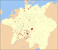
| Imperial cities |  | |
|---|---|---|
| Nobility | St George's Shield (Gesellschaft von Sanktjörgenschild) | |
| Territories | ||
| Ecclesiastical |  | |
|---|---|---|
| Secular | ||
| Prelates | ||
| Counts Lords |
| |
| Cities | ||
Circles est. 1500: Bavarian, Swabian, Upper Rhenish, Lower Rhenish–Westphalian, Franconian, (Lower) Saxon Circles est. 1512: Austrian, Burgundian, Upper Saxon, Electoral Rhenish · Unencircled territories | ||
Towns and municipalities in Ostalb (district) | ||
|---|---|---|
| ||