Schuttrange
| Schuttrange Schëtter | ||
|---|---|---|
| Commune | ||
 | ||
| ||
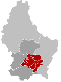
 Map of Luxembourg with Schuttrange highlighted in orange, and the canton in dark red | ||
| Coordinates: 49°37′15″N 6°16′20″E / 49.6208°N 6.2722°ECoordinates: 49°37′15″N 6°16′20″E / 49.6208°N 6.2722°E | ||
| Country |
| |
| Canton | Luxembourg | |
| Government | ||
| • Mayor | Jean-Pierre Kauffmann | |
| Area | ||
| • Total | 16.1 km2 (6.2 sq mi) | |
| Area rank | 73rd of 105 | |
| Highest elevation | 373 m (1,224 ft) | |
| • Rank | 74th of 105 | |
| Lowest elevation | 241 m (791 ft) | |
| • Rank | 49th of 105 | |
| Population (2014) | ||
| • Total | 3,923 | |
| • Rank | 37th of 105 | |
| • Density | 240/km2 (630/sq mi) | |
| • Density rank | 28th of 105 | |
| Time zone | CET (UTC+1) | |
| • Summer (DST) | CEST (UTC+2) | |
| LAU 2 | LU00011007 | |
| Website | schuttrange.lu | |

Schuttrange (Luxembourgish: Schëtter, German: Schüttringen) is a commune and small town in southern Luxembourg. It is located east of Luxembourg City.
As of 2005, the town of Schuttrange, which lies in the centre of the commune, has a population of 825. Other towns within the commune include Munsbach, Neuhäusgen, Schrassig, and Übersyren.
External links
-
 Media related to Schuttrange at Wikimedia Commons
 |
Niederanven | Betzdorf (G) | | |
| Sandweiler | |
Flaxweiler (G) Lenningen (G) | ||
| ||||
| | ||||
| Contern |
 | ||
This article is issued from Wikipedia - version of the 12/1/2016. The text is available under the Creative Commons Attribution/Share Alike but additional terms may apply for the media files.