Schimatari
| Schimatari Σχηματάρι | |
|---|---|
 Schimatari | |
|
Location within the regional unit 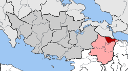 | |
| Coordinates: 38°21′N 23°35′E / 38.350°N 23.583°ECoordinates: 38°21′N 23°35′E / 38.350°N 23.583°E | |
| Country | Greece |
| Administrative region | Central Greece |
| Regional unit | Boeotia |
| Municipality | Tanagra |
| • Municipal unit | 38.285 km2 (14.782 sq mi) |
| Elevation | 95 m (312 ft) |
| Population (2011)[1] | |
| • Municipal unit | 7,173 |
| • Municipal unit density | 190/km2 (490/sq mi) |
| Time zone | EET (UTC+2) |
| • Summer (DST) | EEST (UTC+3) |
| Vehicle registration | ΒΙ |
Schimatari (Greek: Σχηματάρι) is a town and a former municipality in Boeotia, Greece. Since the 2011 local government reform it is part of the municipality Tanagra, of which it is the seat and a municipal unit.[2] The municipal unit has an area of 38.285 km2.[3] Population 7,173 (2011). It is situated in the wide valley of the river Asopos, at 6 km from the South Euboean Gulf coast. The Motorway 1 (Athens - Lamia - Thessaloniki) passes north of Schimatari. Schimatari is located 13 km south of Chalcis, 23 km east of Thebes and 43 km north-northwest of Athens. The Tanagra Airport lies to the south.
An agricultural settlement until the 1980s, its proximity to Athens has led to a significant growth in industrial activities and population.
Subdivisions
The municipal unit Schimatari consists of one single community Schimatari, which contains the villages Oinoi, Plaka Dilesi and Schimatari.
Population
| Year | Town population | Municipal unit population |
|---|---|---|
| 1981 | 3,287 | - |
| 1991 | 4,136 | - |
| 2001 | 4,725 | 8,095 |
| 2011 | 4,035 | 7,173 |
Twin cities
 Pozzoleone, Italy
 Ennistymon, Ireland
See also
External links
References
- ↑ "Απογραφή Πληθυσμού - Κατοικιών 2011. ΜΟΝΙΜΟΣ Πληθυσμός" (in Greek). Hellenic Statistical Authority.
- ↑ Kallikratis law Greece Ministry of Interior (Greek)
- ↑ "Population & housing census 2001 (incl. area and average elevation)" (PDF) (in Greek). National Statistical Service of Greece.