Sawpit, Colorado
| Town of Sawpit, Colorado | |
|---|---|
| Town | |
 Location in San Miguel County and the state of Colorado | |
| Coordinates: 37°59′41″N 108°0′04″W / 37.99472°N 108.00111°WCoordinates: 37°59′41″N 108°0′04″W / 37.99472°N 108.00111°W | |
| Country |
|
| State |
|
| County[1] | San Miguel County |
| Incorporated | 1896 |
| Government | |
| • Type | Statutory Town[1] |
| Area | |
| • Total | 0.0307 sq mi (0.0796 km2) |
| • Land | 0.0307 sq mi (0.0796 km2) |
| • Water | 0 sq mi (0 km2) |
| Elevation[2] | 7,592 ft (2,314 m) |
| Population (2010) | |
| • Total | 40 |
| • Density | 1,333/sq mi (515/km2) |
| Time zone | MST (UTC-7) |
| • Summer (DST) | MDT (UTC-6) |
| ZIP codes[3] | 81430, 81435 |
| Area code(s) | 970 |
| FIPS code | 08-68655 |
| GNIS feature ID | 0202389 |
|
| |
The Town of Sawpit is a Statutory Town located in San Miguel County, Colorado, United States. The town population was 40 at the 2010 census, making Sawpit the fourth least populous incorporated town in the state of Colorado.[4] The Telluride Post Office (ZIP Code 81435) serves Sawpit.[3]
Geography
Sawpit is located at 37°59′41″N 108°00′00″W / 37.994820°N 108.000068°W.[5]
According to the United States Census Bureau, the town has a total area of 0.031 square miles (0.080 km2), all land.
Demographics
| Historical population | |||
|---|---|---|---|
| Census | Pop. | %± | |
| 1900 | 94 | — | |
| 1910 | 121 | 28.7% | |
| 1960 | 30 | — | |
| 1970 | 26 | −13.3% | |
| 1980 | 41 | 57.7% | |
| 1990 | 36 | −12.2% | |
| 2000 | 25 | −30.6% | |
| 2010 | 40 | 60.0% | |
| Est. 2015 | 40 | [6] | 0.0% |
As of the census[4] of 2010, there were 40 people, 18 households, and 13 families residing in the town. The population density was 1333 people per square mile (515/km²). There were 23 housing units at an average density of 749 per square mile (288/km²). The racial makeup of the town was 95.00% white.
There were 18 households out of which 38.9% had children under the age of 18 living with them, 55.6% were married couples living together, and 27.8% were non-families. 22.2% of all households were made up of individuals living alone. The average household size was 2.22 and the average family size was 2.46.
In the town the population was spread out with 22.5% under the age of 19, 22.5% from 25 to 44, 52.5% from 45 to 64. The median age was 46 years. 42.5% of the population was female and 57.5% was male.
See also
References
- 1 2 "Active Colorado Municipalities". State of Colorado, Department of Local Affairs. Retrieved 2007-09-01.
- ↑ "US Board on Geographic Names". United States Geological Survey. 2007-10-25. Retrieved 2008-01-31.
- 1 2 "ZIP Code Lookup" (JavaScript/HTML). United States Postal Service. December 14, 2006. Retrieved December 14, 2006.
- 1 2 "American FactFinder". United States Census Bureau. Retrieved 2015-11-19.
- ↑ "US Gazetteer files: 2010, 2000, and 1990". United States Census Bureau. 2011-02-12. Retrieved 2011-04-23.
- ↑ "Annual Estimates of the Resident Population for Incorporated Places: April 1, 2010 to July 1, 2015". Retrieved July 2, 2016.
- ↑ "Census of Population and Housing". Census.gov. Retrieved June 4, 2015.
External links
Municipalities and communities of San Miguel County, Colorado, United States | ||
|---|---|---|
| Towns | 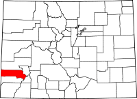 | |
| Unincorporated communities | ||
| Ghost town | ||
