Florida State Road 869
| ||||
|---|---|---|---|---|
|
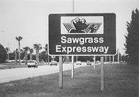
Sawgrass Expressway Sawgrass Tollway Southeast 10th Street | ||||
| Route information | ||||
| Maintained by FTE and FDOT | ||||
| Length: |
23.987 mi[1][2] (38.603 km) 21.242 mi (34.186 km) tolled freeway 2.745 mi (4.418 km) at-grade boulevard 1.4 mi (2.3 km) without designation | |||
| Existed: | July 3, 1986[3] – present | |||
| Major junctions | ||||
| South end: |
| |||
|
| ||||
| East end: |
| |||
| Location | ||||
| Counties: | Broward | |||
| Highway system | ||||
| ||||


Florida State Road 869 (SR 869) is a 24-mile-long (39 km) state road located in Broward County, Florida. The road acts as a de facto bypass of Fort Lauderdale and northern coastal Broward County, Florida, extending north from a junction of Interstate 75 (SR 93), Interstate 595 (SR 862) in Sunrise, to Coral Springs before heading eastward towards Florida's Turnpike and intersecting Interstate 95 before terminating at Southwest 6th Avenue in Deerfield Beach. The 21.242-mile (34.186 km) section west of the Turnpike is known as the Sawgrass Expressway or the Sawgrass Tollway, a six-lane, limited-access, all-electronic toll road; the 2.745-mile (4.418 km) section east of the Turnpike is a surface street known as Southwest 10th Street. The expressway opened in 1986 and was added to Florida's Turnpike Enterprise in 1990. The at-grade section east of the Turnpike is maintained by FDOT.[1][2][4][5][6]
Route description
The highway begins at the north end of the I-75/I-595 interchange in Sunrise, with the Everglades to the west and newer residential and commercial developments to the east of the expressway for the first 12 miles. After a welcome sign, the expressway passes its lone free interchange to Sunrise Boulevard (SR 838), connecting to the Sawgrass Mills outlet mall. It then passes through the Sunrise Toll Gantry, the first of two toll gantries on the road before reaching the BB&T Center exit (no southbound exit). After intersecting with Oakland Park Boulevard (SR 816), it enters Tamarac, intersecting with Commercial Boulevard (SR 870), and then enters Coral Springs. After interchanges at Atlantic Blvd (SR 814), and Sample Road (SR 834), it curves 90 degrees east, switching to an east–west orientation, with housing and other developments surrounding both sides of the highway. Still in Coral Springs, the highway's next interchange and last exit before additional tolls (both directions) is Coral Ridge Drive. Afterwards, it continues eastward, acting as the border between Parkland to the north of the expressway and Coral Springs to the south of it towards the interchange with University Drive (SR 817). Three miles east of the University Drive exit, the expressway has an interchange with US 441 / SR 7, which forms the borders between Coconut Creek to the east and Parkland and Coral Springs to the west. The expressway then enters Coconut Creek at the interchange, with an exit with Lyons Road before entering Deerfield Beach and approaching the Deerfield Toll Gantry just west of Florida's Turnpike.[1][4][7][8][9][10]
After crossing the Turnpike, the tollway reverts to a six lane surface street, Southwest 10th Street, still heading east in Deerfield Beach. It has intersections with two residential streets before reaching Powerline Road (SR 845). East of Powerline Road, SR 869 passes by residential and commercial zones, crossing several local streets for the remainder of its length, with SR 869 intersecting I-95 about two miles east of Powerline Road and terminating at Southwest 6th Avenue about 0.4-mile (0.64 km) east of I-95.[1][4][7][9][10] There have been plans to extend the expressway east of the Turnpike to I-95 since the early 1990s, but local opposition has prevented it from going forward.[11][12]
Tolls
The Sawgrass Expressway is an all electronic, cashless toll road, using overhead toll gantries in the place of the former toll plazas. Users pay by either SunPass transponders or by a toll by plate system for a slightly higher fee. The cost to travel the entire expressway costs $2.12 with SunPass, and $2.64 with toll by plate as of July 2015. For travel over only part of the expressway, a graduated toll system is in place.[8]
History

Originally planned to be the University-Deerfield Expressway when it was first proposed in 1960, it was supposed to be the northernmost part of a chain of expressways from Deerfield Beach to Coral Gables, but the proposed Snake Creek Expressway (in Broward County) became part of the Florida's Turnpike Extension and the LeJeune-Douglas Expressway (in Dade County) failed in the 1970s as the result of a county wide expressway revolt.[13][14][15] On the other hand, the rerouting of Interstate 75 from the Tamiami Trail to Alligator Alley in 1973 increased the necessity of a northern/western bypass of Broward County and in 1983, the newly created Broward County Expressway Authority proposed the Sawgrass-Deerfield Expressway in its current alignment.[16][17] A series of cost-cutting measures for the proposed toll road included removal of all planned rest stops and a shortening of the name of the road to Sawgrass Expressway (A consultant stated in an interview, "Those overhead signs are damn expensive").[18]
The Sawgrass Expressway broke ground on November 2, 1984, and opened to traffic on July 3, 1986, at a cost of $200 million.[19][20] The section between I-75 and Sunrise Boulevard opened on August 4, 1988.[3] Bonds were sold in 1984 to finance construction and again in 1986 to partially refund the 1984 bonds.[21][22] By 1990, however, the Sawgrass Expressway was plagued with a massive debt, light usage and was a subject of local political corruption. Florida's Turnpike Enterprise purchased the Sawgrass Expressway from the Broward County Expressway Authority in December 1990 as part of the expansion program authorized by the Florida Legislature in 1990 Senate Bill 1316.[23][24] The Expressway, along with SW 10th Street west of I-95, was bannered as State Road 869 in 1995.[25]
When the highway was first built, it was criticized for being a "road to nowhere", as it passed through undeveloped areas for most of its length.[26] The road's $1.50 toll in its first few years was another criticism by local residents, contributing to the road's light usage.[27] Commercial and residential developments boomed along the toll road in the late '80s and throughout the '90s, making it suitable for commuters.[26] The swampland west of the Expressway is an Everglades Water Conservation Area and unlikely to be developed in the foreseeable future.[7]
The Sawgrass Expressway experienced its first toll hike on March 7, 2004, increasing the toll rate for non SunPass users to $2.00 for travel over the entire expressway, with SunPass users still using the original toll rates.[28][29]
Unlike most roads, the Sawgrass Expressway had a mascot, a swamp frog named Cecil B. Sawgrass, who appeared on signs greeting motorists entering the tollway southbound from State Road 845 (Powerline Road), as well as various road signs on the expressway. Signs featuring Cecil are becoming rare, as newer expressway signage uses only the standard TOLL 869 shield.[24] In October 2005, Hurricane Wilma damaged the expressway's welcome sign, resulting in its removal during cleanup.[30]
Between 2008 and 2009, the expressway was widened from four lanes to its current six lanes, and was converted to open-road tolling at the Sunrise and Deerfield toll plazas, as well as on exit and entrance ramps, eliminating the need for toll plazas for SunPass users on the toll road. Traditional toll booths for cash customers were still accessible on the right side of the plaza areas.[5][31]
On June 24, 2012, toll rates were raised on the Sawgrass Expressway, with rates going up on average about a quarter at each tolling area for both cash and SunPass customers.[32] Rates were risen slightly again for SunPass customers on July 1, 2013, with cash prices staying at their 2012 rates, and are the toll rates as of January 2014.[8][33][34]
The Sawgrass Expressway eliminated cash tolls on April 19, 2014, charging vehicles by SunPass or license plate information. Toll gantries replaced the shuttered toll booths at plazas and exits.[35][36]
Exit list
The entire route is in Broward County.
| Location | mi [1][37][38] | km | Old exit | New exit [8] | Destinations | Notes | |
|---|---|---|---|---|---|---|---|
| Sunrise–Weston– Davie tripoint | 0.000 | 0.000 | – | – | Exit 19 on I-75 | ||
| 0.058 | 0.093 | – | – | Southbound exit and northbound entrance; west end of I-595 | |||
| Sunrise | 1.056 | 1.699 | 1A | 1 | |||
| 2.000 | 3.219 | Sunrise Toll Gantry | |||||
| 1.909 | 3.072 | – | 1B | Pat Salerno Drive | Northbound exit and southbound entrance | ||
| 3.309 | 5.325 | 2 | 3 | Southbound exit and northbound entrance toll | |||
| Sunrise–Tamarac line | 5.466 | 8.797 | 3 | 5 | Southbound exit and northbound entrance toll | ||
| Coral Springs | 8.213 | 13.218 | 6 | 8 | Southbound exit and northbound entrance toll | ||
| 10.931 | 17.592 | 8 | 11 | Southbound exit and northbound entrance toll | |||
| 13.868 | 22.318 | 10 | 14 | Coral Ridge Drive | |||
| Coral Springs–Parkland line | 15.623 | 25.143 | 12 | 15 | Eastbound exit and westbound entrance toll | ||
| Coconut Creek | 18.588 | 29.914 | 15 | 18 | Signed as exits 18A (south) and 18B (north); eastbound exit and westbound entrance toll | ||
| 20.092 | 32.335 | 16 | 19 | Lyons Road | Eastbound exit and westbound entrance toll | ||
| 20.500 | 32.992 | Deerfield Gantry | |||||
| 20.401 | 32.832 | 17 | 21 | Eastbound exit and westbound entrance; signed as exits 21A (south) and 21B (north) | |||
| Deerfield Beach | 21.242 | 34.186 | Waterways Boulevard | Sawgrass Expressway transitions to SW 10th Street | |||
| 21.835 | 35.140 | ||||||
| 23.262 | 37.437 | Former SR 809 | |||||
| 23.871 | 38.417 | Exit 41 on I-95; northern terminus | |||||
1.000 mi = 1.609 km; 1.000 km = 0.621 mi
| |||||||
References
- 1 2 3 4 5 Florida Department of Transportation (June 15, 2012). "Straight Line Diagram of Road Inventory" (PDF). Retrieved December 30, 2015.
- 1 2 Florida Department of Transportation (February 26, 2014). "Straight Line Diagram of Road Inventory" (PDF). Retrieved December 30, 2015.
- 1 2 "Sawgrass Link to I-75 will be Opened Today Westbound Interstate 595 Also Opening". Miami Herald 4 Aug 1988: 2BR
- 1 2 3 Map of State Road 869 (Map). MapQuest, Inc. 2009. Retrieved 2012-07-29.
- 1 2 "Turnpike, Sawgrass closures planned". South Florida Business Journal 2008-03-07
- ↑ "System Description Toll 869 - Sawgrass Expressway". Florida Department of Transportation. Retrieved 2009-07-29.
- 1 2 3 Municipal Boundaries 2009 (PDF) (Map). Cartography by Broward County GIS. Broward County, Florida. 2009. Retrieved 15 April 2010.
- 1 2 3 4 "Sawgrass Expressway Map" (PDF). Florida Department of Transportation. 2010-10-04. Retrieved 2014-01-06.
- 1 2 Google (2012-07-29). "overview map of State Road 869 (Sawgrass Expressway)" (Map). Google Maps. Google. Retrieved 2012-07-29.
- 1 2 General Highway Map: Broward County, Florida (PDF) (Map). Florida Department of Transportation. 2008. Retrieved 18 April 2010.
- ↑ "County Will Scale Down Sawgrass/I-95 Connector". Miami Herald 9 Jul 1993: 3BR
- ↑ Michael Turnbell. "Going from Palmetto to I-95 Complicated". South Florida Sun Sentinel 27 Feb 2009
- ↑ Marcus, Jon. "Thompson Hits Big Bump on Political Highway". Sun-Sentinel 16 Aug 1987: 1B
- ↑ "Taking a Journey Down the Roads Left Undone". Miami Herald 11 Dec 1995: 1B
- ↑ "Road 'spaghetti' distaste cuts plans". The Miami News 16 Sep 1971: 5A
- ↑ "It Will Be 7 Years Before Highway Network Is A Reality". Sarasota Herald-Tribune 2 Apr 1973: 9A
- ↑ "Lawmakers to get highway plan". Miami Herald 18 Feb 1983: 4BR
- ↑ "Expressway's New Name is Shorter and Cheaper". Miami Herald 12 Jan 1984: 2BR
- ↑ "Sawgrass Project May Be State's Swiftest". Miami Herald 28 Oct 1984: 1 BR
- ↑ Lasalandra, Michael. "Sawgrass Scheduled to Open Today". Sun-Sentinel 3 July 1986: 3B
- ↑ "Expressway Bond Sale Approved". Miami Herald 25 Jul 1984: 4BR
- ↑ Lasalandra, Michael. "Refinancing of Sawgrass Bonds to Mean Windfall of $11 million". Sun-Sentinel 8 Jan 1987: 8B
- ↑ "Sawgrass Expressway To Be Bought By State Toll Road To Become Part of Turnpike". Miami Herald 1 Dec 1990: 15BR
- 1 2 "Florida's Turnpike 50 Year Celebration" (PDF). Florida Department of Transportation. 2007. Retrieved 2009-07-31.
- ↑ Kernicky, Kathleen. "Sawgrass Name Game Runs Its Course". Sun Sentinel 18 Mar 1995: 1B
- 1 2 "Sawgrass Expressway Drives Building Boom". Miami Herald 10 Aug 1986: 1BR
- ↑ "Readers Say Sawgrass Fare Just Isn't Fair". Miami Herald 24 Nov 1986: 1BR
- ↑ McGinness, Chuck. "Plan To Hike Toll On Turnpike Rapped". The Palm Beach Post 8 Jan 2004: 7B
- ↑ Turnbell, Michael. "Drivers Dash To Get SunPass Before Toll Increases Kick In". Sun-Sentinel 6 Mar 2004: 1B
- ↑ "Downtown Towers Take A Hit". Miami Herald 25 Oct 2005: 4A
- ↑ Michael Turnbell. "Faster lanes cut toll waits on Sawgrass". South Florida Sun Sentinel 18 Dec 2008
- ↑ Turnbell, Michael (7 June 2012). "Tolls on Turnpike, Sawgrass, Alligator Alley going up on June 24". South Florida Sun Sentinel. Retrieved 6 January 2014.
- ↑ Turnbell, Michael (28 June 2013). "Tolls go up July 1 on turnpike, state toll roads". South Florida Sun Sentinel. Retrieved 7 January 2014.
- ↑ "Traveler Information | Toll Rates". Florida Department of Transportation. Retrieved September 18, 2013.
- ↑ Turnbell, Michael (3 August 2013). "Sawgrass Expressway going cashless in 2014". South Florida Sun Sentinel. Retrieved 6 January 2014.
- ↑ Turnbull, Michael (18 April 2014). "Sawgrass Expressway stops accepting cash Saturday night". Sun-Sentinel. Retrieved 22 April 2014.
- ↑ "Florida Department of Transportation Interchange Report" (PDF). Florida Department of Transportation. 2008-11-24. p. 16. Retrieved 2009-07-27.
- ↑ Google (December 30, 2015). "East 10th Street" (Map). Google Maps. Google. Retrieved December 30, 2015.
External links
- Florida @ SouthEastRoads - Florida 869
- Florida's Turnpike - Toll 869 - Sawgrass Expressway
- Sawgrass Expressway Map
| Wikimedia Commons has media related to Florida State Road 869. |