Saugus, Santa Clarita, California
| Saugus, Santa Clarita, California | |
|---|---|
| Neighborhood of Santa Clarita | |
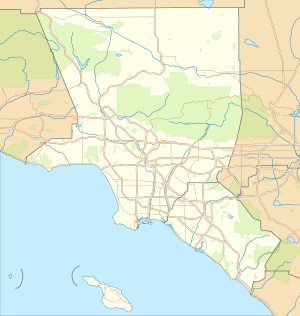 Saugus, Santa Clarita, California Position in Los Angeles County. | |
| Coordinates: 34°24′50″N 118°32′26″W / 34.41389°N 118.54056°WCoordinates: 34°24′50″N 118°32′26″W / 34.41389°N 118.54056°W | |
| Country |
|
| State |
|
| County |
|
| City |
|
| Elevation[1] | 357 m (1,171 ft) |
| Population (2000) | |
| • Total | 41,743 |
| Time zone | Pacific (PST) (UTC-8) |
| • Summer (DST) | PDT (UTC-7) |
| ZIP Code | 91350, 91390 |
| Area code(s) | 661 |
| GNIS feature ID | 1661408[1] |
| Website | http://www.santa-clarita.com |

Saugus is a neighborhood in Santa Clarita, California. Saugus was one of four communities (along with Valencia, Newhall, and Canyon Country) that merged in 1987, to create the city of Santa Clarita. Saugus is named after the town of Saugus, Massachusetts, the hometown of Henry Newhall, upon whose land the town was originally built. The Saugus Cafe, on San Fernando Road, was established in 1887[2] and is among the oldest restaurants in Los Angeles County.[3]
Demographics
In 2000, the total population of Saugus was 41,743, and its population density was 218 persons per square mile. The median age is 32.8 years. Average number of people per household is 3.1. 66.7% of the population is married; 33.3% are single. Median household income is $80,940; per capita income is $29,816. Median home value is $532,700. 82.4% of homes are owner-occupied; 14.8% are rentals.[4]
Notable people
- Red Callender, jazz musician[5]
- Harry Carey, actor and one of silent film's earliest superstars
- Harry Carey, Jr., actor
- Frank Coghlan, Jr., actor and naval aviator
- Mandy Gonzalez, actress and singer
- Ross Lonsberry, professional hockey player[6]
- Cuddles Marshall, professional baseball relief pitcher
- Henry Newhall, businessman whose extensive land holdings became the current communities of Newhall, Saugus, Valencia, and the city of Santa Clarita
- Nick Nickson, radio play-by-play announcer for the Los Angeles Kings
See also
References
- 1 2 U.S. Geological Survey Geographic Names Information System: Saugus
- ↑ "Tales of the Saugus Cafe, at Santa Clarita Valley History in Pictures (retrieved July 22, 2008)
- ↑ "Centenarian (and older) restaurants?" Chowhound (post dated August 26, 2004, retrieved July 22, 2008).
- ↑ City Compare
- ↑ "Red Callender Dies; Jazz Bassist Was 76". The New York Times. 11 March 1992.
- ↑ "The Champs of '75", Sports Illustrated, July 31, 2000.
External links
- Santa Clarita Valley Historical Society: History of Saugus website — photos, text, TV shows.
