Sarrin
This article is about the town in Syria. For the 1st-century rabbi, see
Rabbi Akiva.
Not to be confused with
sarin.
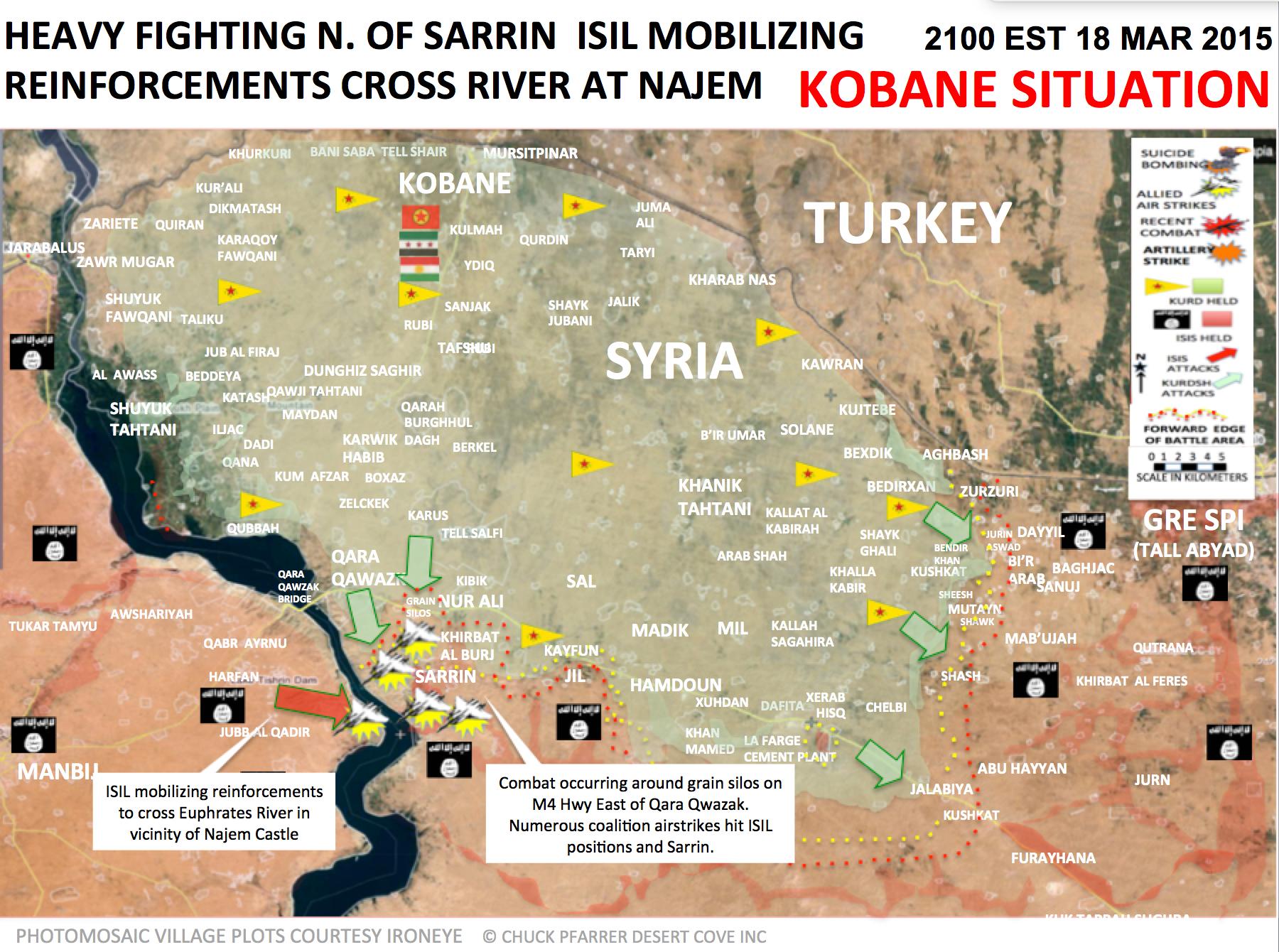
Sarrin (Arabic: صرين,[2] also spelled Serrin or Sareen) is a town in northern Syria, administratively part of the Aleppo Governorate, located northeast of Aleppo. It is situated 3 kilometers east of the Euphrates River, south of Kobanî and east of Manbij.[3] As a preliminary result of the ongoing Syrian Civil War, Sarrin today is situated in Kobanî Canton within the autonomous Federation of Northern Syria – Rojava framework.
In the 2004 census, the town of Sarrin had a population of 6,140, while the Sarrin subdistrict had a total population of 70,522 mostly Arab.[1]
During the Syrian Civil War, the Islamic State of Iraq and the Levant seized control of the town in September 2013.[4] In March 2015, Kurds in the People's Protection Units (YPG), alongside Free Syrian Army (FSA) rebels, launched an attack to take control of the strategic town.[5][6]On July 27, 2015, the town was under the control of Kurdish YPG forces.[7][8]

The location of the Sarrin Subdistrict in the Aleppo Province.
References
See also

