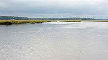
Sapelo River
| Sapelo River | |
|---|---|
 The Sapelo River in McIntosh County | |
| Country | United States |
| Basin | |
| Main source | Georgia |
The Sapelo River is a 23-mile-long (37 km)[1] primarily tidal river in McIntosh County in the U.S. state of Georgia. It forms between Interstate 95 and U.S. Route 17 near the community of Eulonia and winds generally east through salt marshes into Sapelo Sound, an arm of the Atlantic Ocean that separates St. Catherines Island to the north from Sapelo Island to the south.
See also
References
- ↑ U.S. Geological Survey. National Hydrography Dataset high-resolution flowline data. The National Map, accessed April 26, 2011
- U.S. Geological Survey Geographic Names Information System: Sapelo River
- USGS Hydrologic Unit Map - State of Georgia (1974)
Coordinates: 31°32′11″N 81°16′37″W / 31.53633°N 81.27704°W
This article is issued from Wikipedia - version of the 9/11/2016. The text is available under the Creative Commons Attribution/Share Alike but additional terms may apply for the media files.