Santa Ynez, California
| Santa Ynez | |
|---|---|
| census-designated place | |
|
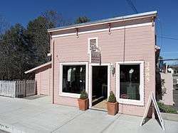
A boutique with western-style architectural details | |
 Location in Santa Barbara County and the state of California | |
| Coordinates: 34°36′43″N 120°5′18″W / 34.61194°N 120.08833°WCoordinates: 34°36′43″N 120°5′18″W / 34.61194°N 120.08833°W | |
| Country |
|
| State |
|
| County | Santa Barbara |
| Government | |
| • Senate | Hannah-Beth Jackson (D) |
| • State Assembly | Monique Limón (D)[1] |
| • U. S. Congress | Lois Capps (D)[2] |
| Area[3] | |
| • Total | 5.143 sq mi (13.321 km2) |
| • Land | 5.136 sq mi (13.302 km2) |
| • Water | 0.007 sq mi (0.019 km2) 0.14% |
| Elevation | 607 ft (185 m) |
| Population (2010) | |
| • Total | 4,418 |
| • Density | 860/sq mi (330/km2) |
| Time zone | PST (UTC-8) |
| • Summer (DST) | PDT (UTC-7) |
| ZIP code | 93460 |
| Area code(s) | 805 |
| FIPS code | 06-70182 |
| GNIS feature ID | 1661407 |
Santa Ynez is a census-designated place (CDP) in the Santa Ynez Valley of Santa Barbara County, California.
The town of Santa Ynez is one of the communities of the Santa Ynez Valley. It features the Santa Ynez Airport for general aviation, with a paved 2804 x 75 foot runway. The population was 4,418 at the 2010 census, down from 4,584 at the 2000 census. It is named after Saint Agnes, Santa Ynez in the Spanish language.
Geography
Santa Ynez is located at 34°36′43″N 120°5′18″W / 34.61194°N 120.08833°W (34.612080, -120.088262).[4]
According to the United States Census Bureau, the CDP has a total area of 5.1 square miles (13 km2), 99.86% of it land, and 0.14% of it covered by water. Santa Ynez is located about 40 miles north of Santa Barbara, California, and is known for its world-class wineries.
Climate
This region experiences warm (but not hot) and dry summers, with no average monthly temperatures above 71.6 °F. According to the Köppen Climate Classification system, Santa Ynez has a warm-summer Mediterranean climate, abbreviated "Csb" on climate maps.[5]
Demographics
2010
The 2010 United States Census[6] reported that Santa Ynez had a population of 4,418. The population density was 859.0 people per square mile (331.7/km²). The racial makeup of Santa Ynez was 3,797 (85.9%) White, 12 (0.3%) African American, 234 (5.3%) Native American, 51 (1.2%) Asian, 4 (0.1%) Pacific Islander, 147 (3.3%) from other races, and 173 (3.9%) from two or more races. Hispanic or Latino of any race were 639 persons (14.5%).
The Census reported that 4,418 people (100% of the population) lived in households, 0 (0%) lived in non-institutionalized group quarters, and 0 (0%) were institutionalized.
There were 1,741 households, out of which 524 (30.1%) had children under the age of 18 living in them, 1,052 (60.4%) were opposite-sex married couples living together, 137 (7.9%) had a female householder with no husband present, 81 (4.7%) had a male householder with no wife present. There were 82 (4.7%) unmarried opposite-sex partnerships, and 18 (1.0%) same-sex married couples or partnerships. 367 households (21.1%) were made up of individuals and 186 (10.7%) had someone living alone who was 65 years of age or older. The average household size was 2.54. There were 1,270 families (72.9% of all households); the average family size was 2.91.
The population was spread out with 916 people (20.7%) under the age of 18, 280 people (6.3%) aged 18 to 24, 785 people (17.8%) aged 25 to 44, 1,559 people (35.3%) aged 45 to 64, and 878 people (19.9%) who were 65 years of age or older. The median age was 47.8 years. For every 100 females there were 96.3 males. For every 100 females age 18 and over, there were 91.7 males.
There were 1,886 housing units at an average density of 366.7 per square mile (141.6/km²), of which 1,327 (76.2%) were owner-occupied, and 414 (23.8%) were occupied by renters. The homeowner vacancy rate was 1.3%; the rental vacancy rate was 11.3%. 3,434 people (77.7% of the population) lived in owner-occupied housing units and 984 people (22.3%) lived in rental housing units.
2000
As of the census[7] of 2000, there were 4,584 people, 1,627 households, and 1,277 families residing in the CDP. The population density was 586.7 people per square mile (226.6/km²). There were 1,670 housing units at an average density of 213.7 per square mile (82.6/km²). The racial makeup of the CDP was 91.84% White, 0.17% African American, 1.22% Native American, 1.29% Asian, 0.02% Pacific Islander, 3.08% from other races, and 2.38% from two or more races. Hispanic or Latino of any race were 9.21% of the population.
There were 1,627 households out of which 36.3% had children under the age of 18 living with them, 68.0% were married couples living together, 7.4% had a female householder with no husband present, and 21.5% were non-families. 15.5% of all households were made up of individuals and 7.0% had someone living alone who was 65 years of age or older. The average household size was 2.78 and the average family size was 3.09.
In the CDP the population was spread out with 26.2% under the age of 18, 4.7% from 18 to 24, 25.5% from 25 to 44, 28.8% from 45 to 64, and 14.9% who were 65 years of age or older. The median age was 42 years. For every 100 females there were 90.7 males. For every 100 females age 18 and over, there were 88.4 males.
The median income for a household in the CDP was $80,284, and the median income for a family was $84,467. Males had a median income of $56,286 versus $45,688 for females. The per capita income for the CDP was $33,811. About 3.0% of families and 5.5% of the population were below the poverty line, including 7.1% of those under age 18 and 2.4% of those age 65 or over.
The Santa Ynez Band of Chumash Mission Indians, a federally recognized Chumash tribe is headquartered in Santa Ynez.[8] They operate the local Chumash Casino.
Government
In the California State Legislature, Santa Ynez is in the 19th Senate District, represented by Democrat Hannah-Beth Jackson, and in the 37th Assembly District, represented by Democrat Monique Limón.[9]
In the United States House of Representatives, Santa Ynez is in California's 24th congressional district, represented by Democrat Lois Capps.[10]
Notable natives
- Ed Fitz Gerald, baseball player
- Eion Bailey, actor
See also
- Neverland Ranch
- Lake Cachuma
- California State Route 154
- Rancho del Cielo
- Santa Ynez Valley
- Santa Barbara County, California
References
- ↑ "Statewide Database". UC Regents. Retrieved November 5, 2014.
- ↑ "California's 24th Congressional District - Representatives & District Map". Civic Impulse, LLC. Retrieved September 29, 2014.
- ↑ "2010 Census U.S. Gazetteer Files – Places – California". United States Census Bureau.
- ↑ "US Gazetteer files: 2010, 2000, and 1990". United States Census Bureau. 2011-02-12. Retrieved 2011-04-23.
- ↑ Climate Summary for Santa Ynez, California
- ↑ "2010 Census Interactive Population Search: CA - Santa Ynez CDP". U.S. Census Bureau. Retrieved July 12, 2014.
- ↑ "American FactFinder". United States Census Bureau. Retrieved 2008-01-31.
- ↑ "Tribal Directory." National Congress of American Indians. Retrieved 6 June 2012.
- ↑ "Statewide Database". UC Regents. Retrieved January 23, 2015.
- ↑ "California's 24th Congressional District - Representatives & District Map". Civic Impulse, LLC.
External links
| Wikivoyage has a travel guide for Santa Ynez. |
- Santa Ynez Valley News
- Santa Ynez Valley Online News and Information
- Chumash Casino
- Santa Ynez Airport
Municipalities and communities of Santa Barbara County, California, United States | ||
|---|---|---|
| Cities | 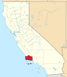 | |
| CDPs | ||
| Unincorporated communities | ||
| Indian reservation | ||
| Ghost towns | ||