Santa Maria de Palautordera
| Santa Maria de Palautordera | ||
|---|---|---|
| Municipality | ||
|
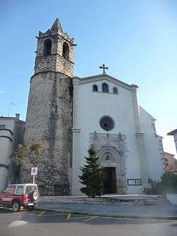
Church | ||
| ||
 Santa Maria de Palautordera  Santa Maria de Palautordera Location in Catalonia | ||
| Coordinates: 41°41′43″N 2°26′45″E / 41.69528°N 2.44583°ECoordinates: 41°41′43″N 2°26′45″E / 41.69528°N 2.44583°E | ||
| Country |
| |
| Autonomous community |
| |
| Province | Barcelona | |
| Comarca | Valles Oriental | |
| Government | ||
| • Alcalde | Jordi Xena Ibáñez (2015)[1] (CiU) | |
| Area[2] | ||
| • Total | 16.9 km2 (6.5 sq mi) | |
| Elevation | 208 m (682 ft) | |
| Population (2015)[1] | ||
| • Total | 9,103 | |
| • Density | 540/km2 (1,400/sq mi) | |
| Demonym(s) | Palauenc, Palauenca | |
| Time zone | CET (UTC+1) | |
| • Summer (DST) | CEST (UTC+2) | |
| Postal code | 08460 | |
| Official language(s) | Catalan | |
| Website |
smpalautordera | |

Santa Maria de Palautordera (Catalan pronunciation: [ˈsantə məˈɾi.ə ðə pəˌɫawturˈðeɾə]) is a village and municipality in the comarca of Vallès Oriental in the province of Barcelona and autonomous community of Catalonia, Spain.
Geography
The village is situated in the valley of the River Tordera, at the foot of the Montseny Massif. The vegetation is predominantly pine and oak woods.
Demographics
The population of Santa Maria de Palautordera as measured by the Town Hall was 9,103 in 2015. The Municipal Population Register[3] has been produced annually since 1998 and demonstrates the change in population:
| Year | Men | Women | Total |
|---|---|---|---|
| 2013 | 4,700 | 4,495 | 9,195 |
| 2008 | 4,445 | 4,169 | 8,614 |
| 2003 | 3,779 | 3,539 | 7,318 |
| 1998 | 2,916 | 2,879 | 5,795 |
Transport
Santa Maria de Palautordera is served by its own station (simply called Palautordera) on the Rodalies de Catalunya regional rail system. The system is currently operated by the Catalan Government.
Notable people
- David Davis Cámara, international handball player for Spain.
- Joan Cañellas, international handball player for Spain.
Twin towns
Santa Maria de Palautordera is twinned with:
References
- 1 2 "Ajuntament de Santa Maria de Palautordera". Generalitat of Catalonia. Retrieved 2015-11-13.
- ↑ "El municipi en xifres: Santa Maria de Palautordera". Statistical Institute of Catalonia. Retrieved 2015-11-23.
- ↑ "Municipal Population Register: Santa Maria de Palautordera". Generalitat of Catalonia. Retrieved 2016-08-05.
External links
 |
Sant Esteve de Palautordera | Fogars de Montclús | | |
| Sant Pere de Vilamajor | |
Sant Celoni | ||
| ||||
| | ||||
| Llinars del Vallès | Vilalba Sasserra | Vallgorguina |
.svg.png)