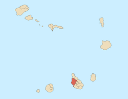
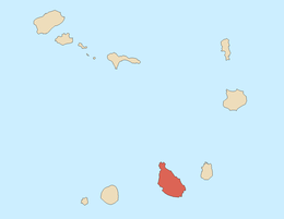
Santa Catarina, Cape Verde
| Santa Catarina | |
|---|---|
| Municipality | |
 | |
| Coordinates: 15°06′N 23°43′W / 15.10°N 23.71°WCoordinates: 15°06′N 23°43′W / 15.10°N 23.71°W | |
| Country | Cape Verde |
| Island | Santiago |
| Area | |
| • Total | 242.6 km2 (93.7 sq mi) |
| Population (2010)[1] | |
| • Total | 41,455 |
| • Density | 170/km2 (440/sq mi) |
Santa Catarina is a concelho (municipality) of Cape Verde. It is situated in the western part of the island of Santiago. Its seat is the town Assomada. Its population was 44,388 at the 2013 census.[2]
The president is of the Movement for Democracy (MpD) party who was elected in 2008.
Subdivisions
The municipality consists of one freguesia (civil parish), Santa Catarina. The freguesia is subdivided into the following settlements, Its population data was as of 2010:
- Achada Galego (pop: 865)
- Achada Gomes (pop: 743)
- Achada Lazão (pop: 2)
- Achada Leite (pop: 142)
- Achada Lem (pop: 2,088)
- Achada Ponta (pop: 195)
- Achada Tossa (pop: 742)
- Aguas Podres (pop: 205)
- Arribada (pop: 286)
- Assomada (pop: 12,332)
- Banana Semedo (pop: 428)
- Boa Entrada (pop: 1,119)
- Boa Entradinha (pop: 637)
- Bombardeiro (pop: 914)
- Chã de Lagoa (pop: 381)
- Chã de Tanque (pop: 1,164), also as Chão de Tanque
- Charco (pop: 266)
- Cruz Grande (pop: 798)
- Entre Picos (pop: 411)
- Entre Picos de Reda (pop: 412)
- Figueira das Naus (pop: 1,157)
- Fonte Lima (pop: 894)
- Fonteana (pop: 747)
- Fundura (pop: 1,070)
- Furna (pop: 433)
- Gamchemba (pop: 107)
- Gil Bispo (pop: 998)
- Japluma (pop: 546)
- João Bernardo (pop: 317)
- João Dias (pop: 546)
- Junco (pop: 336)
- Librão (pop: 391)
- Lugar Velho (pop: 10)
- Mancholy (pop: 903)
- Mato Baixo (pop: 488)
- Mato Gege (pop: 704)
- Mato Sancho (pop: 414)
- Palha Carga (pop: 978)
- Pata Brava (pop: 197)
- Pau Verde (pop: 256)
- Pedra Barro - unpopulated hamlet
- Pingo Chuva (pop: 505)
- Pinha dos Engenhos (pop: 650)
- Ribeira da Barca (pop: 2,317)
- Ribeira Riba, also known as Ribeira Acima (pop: 192)
- Ribeirão Isabel (pop: 409)
- Ribeirão Manuel (pop: 1,086)
- Rincão (pop: 1,048), also known as Porto Rincão
- Saltos Acima (pop: 105), also known as Saltos de Cima
- Sedeguma (pop: 122)
- Serra Malagueta (locally as Serra) (pop: 572)
- Tomba Touro (pop: 82)
Geography
Santa Catarina are dominated by plateaus and agricultural land are common in these areas, mountains dominate the remainder of the municipality. It includes most of Serra da Malagueta and its ranges, the western portion of Pico da Antónia ranges and southwest is Baía do Inferno surrounded by tall cliffs.
History
.jpg)

In the early 19th century, it covered the southwestern and the northern portions of the island.
In 1833, colonial governor Manuel António Martins tried to move the seat of Santa Catarina from Ribeira Grande in the south to nearby Picos.[3] Ribeira Grande would later become part of the municipality of Praia and would remain until 2005 when its own municipality would be created.
Santa Rita Vieira relates to different places which acted as the municipal (county) seat including Ribeira da Barca in 1845, Casa Grande south of Assomada near Picos between 1845 and between 1851 and 1857, Flamengos near Saltos de Cima between 1846 and 1849, Achada Falcão (in Cabeça Carreira) in 1859 and Mangue in Tarrafal in 1869.[3]
By the end of the 19th century, the Municipality of Santa Catarina occupied the northern half of the island,[4] while the southern half was the Municipality of Praia.
On May 4, 1912, the seat of the municipality moved from Tarrafal to Assomada and became the municipality of Santa Catarina by the colonial governor Joaquim Pedro Vieira Júdice Biker[5] The northern portion split and became its own municipality of Tarrafal. In 1917, two northern parishes of the municipality were split off to become the Municipality of Tarrafal.[6] In February 2005, a southern parish of the Municipality was split off to become the Municipality of São Salvador do Mundo.
A series of demonstrations and rebellions took place in the colonial years, the latter being the struggle for Cape Verdean independence took place in Assomada, one was in 1822, then the Fonteana Revolt in 1835, the Ribeirão Manuel Rebellion in 1910, a petition in 1946, demonstrations over the elevation of the Minister of the Overseas in August 1962 and the student's battle in Spring 1970.[5]
Cape Verde's third dam would be built on October 30, 2013, its name is the Saquinho Dam (Barragem de Saquinho) and is located in the west of the municipality northwest of Assomada.[7]
Demography
| Population of Santa Catarina, Cape Verde (1940—2013) | ||||||||
|---|---|---|---|---|---|---|---|---|
| 1940[8][9] | 1950[8][9] | 1960[8][9] | 1970[8][9] | 1980[8][9] | 1990[8][9] | 2000[9][10] | 2010[2][1] | 2013[2] |
| 26848 | 19428 | 30207 | 41462 | 41012 | 41584 | 50024 | 43297 | 44388 |
Persons
- Víctor Borges, once the foreign minister of Cape Verde
- Danielson Gomes Monteiro, footballer
- Gilyto, singer
- Suzanna Lubrano, singer
- António Mascarenhas Monteiro (February 16, 1944-September 2016), a former president of Cape Verde from March 22, 1991 to March 22, 2001.
- Wania Monteiro, athlete
- Ivone Ramos (b.July 9, 1926)
- Jose Maria Neves (b. March 28, 1960), Cape Verdean statesman
- Gil Semedo, singer
- Tcheka, singer
- Manuel Veiga (b. March 27, 1948), Cape Verdean writer
- Anilton Varela, municipal council of Fonte Lima
International relations
Santa Catarina is twinned with:
References
- 1 2 "2010 Census results". Instituto Nacional de Estatística Cabo Verde (in Portuguese). 17 March 2014.
- 1 2 3 "Cape Verde Population Statistics". citypopulation.de.
- 1 2 Vieira, Henrique Lubrano de Santa Rita (1993). A Vila de Assomada. Associação dos Amigos do Concelho de Santa Catarina. p. 14.
- ↑ Portuguese National Digital Libeary - Map of the Island of Santiago, 1890 (Portuguese)
- 1 2 Vieira, Henrique Lubrano de Santa Rita (1993). A Vila de Assomada. Associação dos Amigos do Concelho de Santa Catarina.
- ↑ "History" (in Portuguese). Municipality of Tarrafal.
- ↑ "JMN inaugura Barragem de Saquinho" [Saquinho Dam Opened by JMN]. A Semana (in Portuguese). 30 October 2013. Retrieved 12 November 2013.
- 1 2 3 4 5 6 Source: Statoids
- 1 2 3 4 5 6 7 Includes the population of the present-day São Salvador do Mundo municipality.
- ↑ Source: Instituto Nacional de Estatísticas.
- ↑ "Lisboa - Geminações de Cidades e Vilas" [Lisbon - Twinning of Cities and Towns]. Associação Nacional de Municípios Portugueses [National Association of Portuguese Municipalities] (in Portuguese). Retrieved 2013-08-23.
External links
- In Portuguese:
Geography, features and topics of Santiago and the surrounding islets | ||
|---|---|---|
| Topics |
|  |
| Mountains |
| |
| Streams |
| |
| Points and promontories |
| |
| Reservoirs |
| |
| Other geographic features | ||
| History | ||
| Communities and settlements | | |
|---|---|---|
| Geographical features | ||
| Landmarks and points of Interests | ||
| Culture | ||