Santa Ana Volcano
| Santa Ana Volcano | |
|---|---|
 Close up aerial view of the nested summit calderas and craters, along with the crater lake | |
| Highest point | |
| Elevation | 2,381 m (7,812 ft) |
| Coordinates | 13°51′11″N 89°37′48″W / 13.853°N 89.630°WCoordinates: 13°51′11″N 89°37′48″W / 13.853°N 89.630°W |
| Geography | |
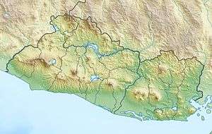 Santa Ana Volcano Location in El Salvador | |
| Location | El Salvador |
| Parent range | Cordillera de Apaneca |
| Geology | |
| Mountain type | Stratovolcano |
| Last eruption | June to October 2005 |
The Santa Ana Volcano or Ilamatepec (Spanish: volcán de Santa Ana) is a large stratovolcano located in the Santa Ana department of El Salvador. At 2,381 metres above sea level, it is the highest volcano in the country. It is located immediately west of Coatepeque Caldera.
The volcano was the inspiration for one of the active volcanoes in Antoine de Saint-Exupéry's famous French novella (The Little Prince), based on his life with his Salvadoran wife Consuelo de Saint Exupéry, who was The Rose in the story.
Geography

The summit of Santa Ana features four nested calderas and volcanic craters, with the innermost containing a small crater lake. Collapse of the summit during the late Pleistocene (inferring from underlying soil samples, the upper age limit is no more than 57 000 years ago) produced a massive debris avalanche that reached the Pacific Ocean, forming the Acajutla Peninsula. Subsequent eruptions have largely rebuilt the edifice.
There have been numerous historical eruptions since the 16th century, both at the summit and from cinder cones on the lower flanks, and also the flank vents of San Marcelino located east of Santa Ana. The San Marcelino vents erupted in 1722 and flowed eastwards for 11 km, destroying the village of San Juan Tecpan.
In October, 2005, the volcano erupted, killing at least two people, injuring seven people, forcing many people to flee their villages. The volcano spat rocks for over 1.5 km (0.93 mi) with rocks the size of cars. The eruption contributed to the damage from Hurricane Stan. The most recent previous eruption had been in 1904.
Climate
The climate on the northeast facing slope of the volcano sees substantial rainfall in the summer months. Located at 13.9 N, 89.6 W, altitude : 1770 m, the climate is classified as a subtropical highland climate (Köppen Cwb).
| Climate data for Santa Ana, Volcano; 13.9 N, 89.6 W, altitude : 1770 m | |||||||||||||
|---|---|---|---|---|---|---|---|---|---|---|---|---|---|
| Month | Jan | Feb | Mar | Apr | May | Jun | Jul | Aug | Sep | Oct | Nov | Dec | Year |
| Average high °C (°F) | 19.3 (66.7) |
20.6 (69.1) |
23.3 (73.9) |
23.2 (73.8) |
22.7 (72.9) |
21.6 (70.9) |
21.6 (70.9) |
21.6 (70.9) |
20.9 (69.6) |
20.0 (68) |
19.2 (66.6) |
18.9 (66) |
21.08 (69.94) |
| Daily mean °C (°F) | 14.7 (58.5) |
15.3 (59.5) |
17.0 (62.6) |
17.7 (63.9) |
17.9 (64.2) |
17.2 (63) |
17.1 (62.8) |
17.1 (62.8) |
16.9 (62.4) |
16.2 (61.2) |
15.2 (59.4) |
14.7 (58.5) |
16.42 (61.57) |
| Average low °C (°F) | 11.2 (52.2) |
11.6 (52.9) |
12.8 (55) |
13.9 (57) |
14.6 (58.3) |
14.3 (57.7) |
14.0 (57.2) |
14.0 (57.2) |
14.2 (57.6) |
13.6 (56.5) |
12.7 (54.9) |
11.8 (53.2) |
13.23 (55.81) |
| Average precipitation mm (inches) | 8 (0.31) |
5 (0.2) |
19 (0.75) |
64 (2.52) |
223 (8.78) |
427 (16.81) |
417 (16.42) |
393 (15.47) |
452 (17.8) |
208 (8.19) |
48 (1.89) |
10 (0.39) |
2,274 (89.53) |
| Source: HKO[1] | |||||||||||||
See also
References
- Notes
- ↑ "Climatological Normals of Los Andes". Hong Kong Observatory. Retrieved 2012-03-13.
- Sources
- Global Volcanism Program: Santa Ana
- Sheets P D, 2004. Apocalypse then: social science approaches to volcanism, people, and cultures in the Zapotitan Valley, El Salvador. Rose W. I., Bommer J. J., Lopez D. L., Carr M. J., Major J. J. (eds), Natural Hazards in El Salvador. Bolder, Colorado, Geological Society of America Special Paper 375, pp 109–120.
- Siebert, L. Kimberly, P., and Pullinger, C.R, 2004, The voluminous Acajulta debris avalanche from Santa Ana Volcano, western El Salvador, and comparison with other Central American edifice-failure evens, in Rose, W.I. et al., Natural Hazards in El Salvador. Boulder, Colorado, Geological Society of America Special Paper 375, pp 5–23.
External links
| Guatemala | 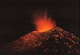 | |
|---|---|---|
| El Salvador | ||
| Nicaragua | ||
| Costa Rica |
| |
| Panama | ||
Note: volcanoes are ordered from north-west to south-east. | ||