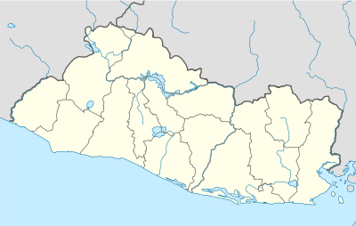
Santa Ana, El Salvador
| Santa Ana Santa Ana | |||
|---|---|---|---|
| |||
| Nickname(s): La Ciudad Heróica (The Heroic City) | |||
| Motto: Capital del mundo, sucursal del cielo. (Capital of the world, branch office of the sky.) | |||
 Santa Ana | |||
| Coordinates: 13°59′N 089°32′W / 13.983°N 89.533°WCoordinates: 13°59′N 089°32′W / 13.983°N 89.533°W | |||
| Country |
| ||
| Department | Santa Ana | ||
| Founded | 1569 | ||
| Government | |||
| • Mayor | Mario Moreira | ||
| Area | |||
| • City | 400.01 km2 (157.5 sq mi) | ||
| Elevation | 665 m (2,182 ft) | ||
| Population (2007) | |||
| • City | 245,421 | ||
| • Urban | 280,000 | ||
| • Metro | 290,000 | ||
| • Density | 601.51/km2 (1,557.9/sq mi) | ||
| ISO 3166-2 | SV-SA | ||
| Website |
www | ||
_flag.jpg)

Santa Ana is the second largest city in El Salvador, located 64 kilometers northwest of San Salvador, the capital city. Santa Ana has approximately 274,830 (2006) inhabitants and serves both as the capital of the department of Santa Ana and as the municipal seat for the surrounding municipality of the same name. For its administration the municipality is divided into 35 colonias (neighborhoods) and 318 small villages.
A major processing center for El Salvador's sizable coffee bean industry is located near Santa Ana.
Santa Ana, which is the second city in importance in El Salvador, has become a very popular tourist destination, especially for tourists eager to learn about Salvadoran culture and traditions.
Currently, the mayor of Santa Ana is Mario Moreira, from the ARENA (Nationalist Republican Alliance ), a right-wing political party.
Geography

The city of Santa Ana is located on a meseta about 665 meters above sea level. The city has year-round warm climate with an average temperature of around 25 °C (77 °F). The main river is the Guajoyo river which is a major tributary of the much larger Lempa River. There is a major Hydroelectric Power station at the Guajoyo river that provides electricity to most of the western sector of the country.
The city is situated among many beautiful green hills such as Tecana hill and Hills of Santa Lucía, among others. In the southern part of the municipality is the Ilamatepec volcano, the highest volcano in the country, which had a moderate eruption in 2005 that killed two people. Close to it is another famous volcano, Izalco, known to sailors throughout the mid-19th century and early 20th century as "The lighthouse of the Pacific" due to its constant eruptions.
Surrounding mountains
The main hills in the municipality are: Cerro Tecana, Cerro Santa Lucia, Cerro Camones, Mount Loquat, Cerro La Tortuga, Kimberly and Cerro El Pinar, Santa Dela. On the other hand, the highest elevation in the town is the Santa Ana volcano (which measures 2365.07 m).
Physio-graphic regions
The relief of the municipality may be divided into three physiographic regions, which are:
The range Apaneca, which is located in the southern part of town and home to the Santa Ana volcano (which is the highest volcano in the country), the volcano of Izalco (which the youngest volcano in the country having originated in 1770) and the Cerro Verde, which is located in the Natural Park of Cerro Verde (which was re-opened after a closure in 2001, motivated by the earthquakes occurring in that year).
Apaneca from the mountains to the center of town lies a plain or plain, which lies on the plateau where the city is located.
North of the plateau is the mountain range-Comecayo Mita, in which small rise orographic configurations such as the hills Tecan, Pinalito, Pinalón, Santa Lucia and Camones.
Hydrology
Guajoyo River is one of the major rivers in the municipality of Santa Ana
The city and the greater part thereof is located in the Lempa River basin region, while the remaining parts of the municipality are in the basin region of Coatepeque. Within the Lempa River basin region, the city and Most of the municipality is located in the upper Lempa River.
The city is surrounded both above aquifers located in the basement, of which most are moderate vulnerability.
Surface waters
Within the streams that flow through the territory of the municipality including the City, the main rivers are:
Lempa River, which forms the border with the municipality of Nueva Concepcion Guajoyo River, which flows into the River Drainage (in Guajoyo River Hydroelectric Plant is Guajoyo) and Suquiapa River, which forms the confluence of the Apanchacal rivers and Zarco (forms the border with the town of Coatepeque).
In addition, another 15 rivers and 52 minor streams flow through the municipality of Santa Ana Of these 15 rivers listed above, the city is crisscrossed by rivers: El Molino, and Apanchacal Apanteos o Sauce.
In the southern part of the town is connected with Lake Coatepeque, which has become one of the main attractions of the entire Department of Santa Ana.
Climate
The city and the entire municipality of Santa Ana are located in the tropics and are located in the tropical savannah climate hot or warm land (according to the Köppen climate classification). So has a semi warm weather which have two distinct seasons, which are: the dry season (November to May) and rainy season (May to November). The municipality of Santa Ana has a mean annual temperature 24 °C (75 °F) with a temperature around 17 °C (63 °F) and 34 °C (93 °F) minimum and maximum. Although at times the maximum temperatures often exceed 35 °C (95 °F), since it is a city with a very hot climate. It also has an annual relative humidity between 70% and 75%. The city is dominated by winds from the southwest and west, both during the dry season and during the rainy season, these winds have an annual rate of 7.8 km/h.24 [1] In addition, any municipality, including the city, is affected by the hurricane season in the Atlantic (June–November). In which, the continuous tropical storms and hurricanes increase the flow of rivers, damaging some areas with flooding.[1][2]
| Climate data for Santa Ana, El Salvador | |||||||||||||
|---|---|---|---|---|---|---|---|---|---|---|---|---|---|
| Month | Jan | Feb | Mar | Apr | May | Jun | Jul | Aug | Sep | Oct | Nov | Dec | Year |
| Average high °C (°F) | 27 (81) |
29 (84) |
31 (88) |
30 (86) |
30 (86) |
28 (82) |
29 (84) |
30 (86) |
28 (82) |
28 (82) |
26 (79) |
25 (77) |
28 (82) |
| Average low °C (°F) | 15 (59) |
16 (61) |
16 (61) |
18 (64) |
19 (66) |
18 (64) |
18 (64) |
18 (64) |
17 (63) |
16 (61) |
14 (57) |
13 (55) |
17 (63) |
| Record low °C (°F) | 10 (50) |
12 (54) |
11 (52) |
13 (55) |
11 (52) |
14 (57) |
12 (54) |
11 (52) |
8 (46) |
5 (41) |
7 (45) |
9 (48) |
10 (50) |
History
Pre-Columbian era
The city of Santa Ana has a pre-Columbian origin. There is evidence of Preclassic settlements in the area of the city, mainly in the archaeological site of Villa Rosita, where the dominant centre was located in the area. This and other settlements were depopulated by the eruption of Lake Ilopango at 250 DC.[3]
The city was founded by the Maya Pocomanes in the classical period. The first name of the settlement is unknown, however, it is known that when the Pipil entered and conquered the area in 1200 during the post-classic period, translated the original Nahuatl name, which was Sihuatehuacán, which means place of priestesses. Sihuatehuacán was located in what is now the suburb of Santa Barbara near the rivers Apanchacal and Apanteos.[4]
Conquest and colonization
The town was conquered by the Spanish between 1530 and 1540. On July 26, 1569 the Guatemalan Bishop Bernardino Villalpando Sihuatehuacán renamed the Santa Ana, La Grande.[4] In the year 1532 was given to Diego de Usagre[5] and from 1540-1786 served on the Mayor of San Salvador . In 1550 he was entrusted to Antonio Docampo.[6] San Salvador, the city of Santa Ana, and the western and central part of the current Salvadoran territory (except St. Vincent and the paracentral area) was administered by the mayor of the department of San Salvador.[6][7] Since 1770 the central parish of the city (located where the cathedral was built later) was the head of the parish of Santa Ana. From the year 1786-1824 was the capitol of the Santa Ana district, which was part of the Municipality San Salvador (Intendencia de San Salvador).[4][6][8]

19th century
In 1806 was established the council of the town of Santa Ana, being its first mayor José Mariano Castro.[6] Five years later, there were two uprisings in the town as part of the uprising in San Salvador, the first on November 17 another on 24 June 1812. In November it was designated with the title of town.[9]
On December 21, 1821 the council declared the independence from Spain. In 1824, it received the title of city, being part of the department of Sonsonate and in 1835 became the department head of that department. In 1854, the town Santa Lucia Chacalcingo became part of Santa Ana as one of its neighborhoods. A year later, the department of Santa Ana was created.[8]
Later, the "revolution of the 44" that overthrew President Carlos Ezeta, who ruled the country from the current headquarters of the Second Infantry Brigade of Santa Ana. Since then, the town earned the nickname of the heroic city because the 44 rebels were from the municipality. The rebels stormed the government headquarters, leading the d'coup that would free the country from the dictatorship. [4][10]
Postwar 20th century and Civil Santa Ana in 1916

In the so-called "golden age of coffee" in El Salvador, Santa Ana was the most prosperous city in the country, because many of the businessmen who lived in that town owned important coffee processing plants that prepared the coffee for sale. La Hacienda El Molino, owned by the Colombian Rafael Alvarez, was the main plantation and coffee processing plant because of its fame and its technological modernism at the time.[11] During the civil war in El Salvador (1980–1992), the municipality of Santa Ana was also affected by armed conflict, which led to the emigration of many residents of the city. After the war, Santa Ana and all of El Salvador began to address the problem of rising crime rates,[12] mostly due to the existence of "maras" or gangs, mainly generated by the deportation of illegal immigrants from the United States. This scourge has been fought with government programs and ordinances issued by the council municipal.[13][14]
Since the civil war, the municipality has received allowances sent by Salvadorians living abroad to their friends and family. This money has become the largest source of revenue for Santa Ana and El Salvador.[15] [16] In 1999 the Urban Development Master Plan (PLAMADUR) was launched by the municipal administration of Moses Macall Monterrosa. The PLAMADUR spurred the growth, expansion and management of ciudad.[17]
Also in 2004, the Salvadorian government introduced the National Land Management Plan and Territorial Development (PNODT) that promotes the development, integration and competitiveness of Salvadoran municipalities. For the purposes of planning and development of municipalities, these have been grouped into regions, subregions and microregions.[18] The municipality of Santa Ana was incorporated into the region, "West Central subregion, Santa Ana - Resume" and "microregion of Santa Ana ".[19]
Education
The city of Santa Ana has 183 schools according to statistics from the Salvadoran Ministry of Education, out of those 53 are private. Some of the best known schools are:
- Colegio Bautista
- Liceo San Luis
- Escuela Interamericana
- Colegio Latinoamericano
- Colegio Salesiano San José
- Colegio Santa María
- CE INSA
- Colegio Maria Auxiliadora
- Liceo Santaneco
Santa Ana has a few universities, some of the major ones are: Universidad Católica de El Salvador, Universidad de El Salvador Facultad Multidiciplinaria de Occidente, Universidad Francisco Gavidia, and Universidad Autónoma de Santa Ana.
Economy
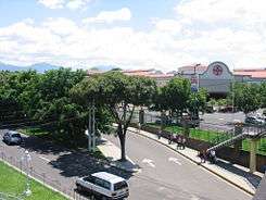
Santa Ana today is the second largest city in population and importance in El Salvador. The main economic engines of the city are in retail and manufacturing. In the north and west of the city are factories and assembly plants mostly of foreign origin. The southern part of the city is more commercially developed, containing many restaurants, commercial banks, hotels and shopping malls. The largest shopping mall in the city is metrocentro.
Santa Ana has two main markets: the Colón and Central Markets, only a few streets from one another, offering a great variety of products.
With respect to tourism, the city has many old buildings such as: Catedral de Santa Ana (The Cathedral of Saint Anne), Alcaldía Municipal de Santa Ana (Santa Ana City Hall) and the Teatro de Santa Ana (Santa Ana Theater).
The only museum in the city registered by the Concultura is the Occidental Regional Museum, also known as the Museum of the West. However El Museo Aja is also located in the city. There are also the Apanteos and Sihuatehuacán water parks.
Fiestas Julias is a big traditional celebration in Santa Ana during the 15 through the 31 of July. Every year they usually take place in the Oscar quiteño stadium.[20]
Sport
Santa Ana is home to C.D. FAS, one of the most famous football (soccer) clubs in El Salvador. Their home stadium is Estadio Óscar Quiteño, built in 1963 with an approximate capacity of 20,000 fans.
Religion
In regard to religion, as in the rest of the country, the population is mostly Catholic, being the host city of the Diocese of Santa Ana, which occupies the departments of Santa Ana and Ahuachapán. And part of the ecclesiastical province of El Salvador.
Among his most important Catholic churches are the Cathedral of Santa Ana, (where is the image of the patron saint of the city), the El Calvario church (rebuilt in the late 19th century by Fray Felipe de Jesús Moraga, which was destroyed partially by the earthquake of January 13, 2001, and subsequently rebuilt), Church El Carmen (which is administered by the Dominican priests since 1929),the Church of Santa Lucia, San Lorenzo church, Santa Barbara Church, the Mother of the Saviour parish church and the San José Obrero.
Also, several Christian evangelical churches, which have seen an increased influx of believers and as an important part of popular faith and, it is claimed, have more worshippers than does the Roman Catholic Church.[21]
Other religious groups, such as The Church of Jesus Christ of Latter-day Saints (better known as Mormons) and Jehovah's Witnesses also have a place in the town and the city of Santa Ana.
Twin towns – Sister cities
The City of Santa Ana has sistership with the following cities:
-
 La Ceiba, Honduras[22]
 -
 Santa Ana, California, United States[23]
 -
 León, Nicaragua[24]
 -
 Piracicaba, Brasil[25]
 - Miramar, Florida, United States[26]
-
 Gävle, Sweden[27]
 -
 Nueva Trinidad, El Salvador[28]
 - Nejapa, El Salvador[28]
- Acajutla, El Salvador[28]
References
- 1 2 "Meteorología". SNET. Retrieved 22 September 2007.
- ↑ Atlas: Snet Huracánes, consultado el 10 de enero de 2008
- ↑ "Perfil de Los Pueblos Indígenas en El Salvador" [Profile of Indigenous Peoples in El Salvador] (PDF). Unidad Regional de Asistencia Técnica, Ministry of Education. February 2003. Archived from the original (PDF) on 6 April 2012. Retrieved 14 December 2015.
- 1 2 3 4 guanaquin.com
- ↑ Jorge Barraza Ibarra Historia de la Economía de la Provincia de San Salvador consultado el 20 October 2009
- 1 2 3 4 FISL-Conoce a tu municipio
- ↑ Templo cristiano Historia de El Salvador, consultado el 28 de enero de 2009
- 1 2 "Historia de Santa Ana". Comisión Cívica Democrática. Retrieved 21 July 2008.
- ↑ Revista Independentista. Movimientos de Libertad. El Salvador: La Prensa Gráfica.
- ↑ "Los 44 valientes de Santa Lucía". EDH. Retrieved 17 July 2007.
- ↑ EDH Rafael Álvarez: pionero de la industrialización del café, consultado el 17 de enero del 2009
- ↑ LPG Triángulo del crimen consultado el 31 July 2008
- ↑ Antonio Martínez Uribe, Los acuerdos de paz en El Salvador: 15 años después consultado el 13 July 2008
- ↑ Alcaldía de Santa Ana: Ordenanzas municipales consultado el 13 July 2008
- ↑ Caritas.org
- ↑ Elizabeth Campbell, La reconstrucción en los países en etapa de posguerra:El Salvador consultado el 21 July 2008.
- ↑ El Diario de Hoy, Santa Ana será una gran ciudad dentro de 20 años consultado el 13 July 2008
- ↑ Ministerio de Obras Públicas Presentación del PNODT, consultado el 27 December 2008
- ↑ Subregión Santa Ana - Ahuachapan Condicionantes, consultado el 27 December 2008
- ↑ http://www.elsalvador.com/especiales/SANTAANA
- ↑ by whom?
- ↑ La Ceiba Página de la ciudad, consultado el 13 December 2008
- ↑ LPG Plan municipal del ex candidato alcalde por ARENA en 2006, consultado el 13 December 2006
- ↑ La Prensa (Nicaragua) Alcaldes buscan hermanamiento con municipios salvadoreños, consultado el 13 December 2008
- ↑ Diaro Co Latino Visita de alcaldes del FMLN a Brasil, consultado el 13 December 2008
- ↑ Office of International Affairs Florida - Sister cities, consultado el 13 December 2008
- ↑ Alcaldía Municipal de Santa Ana Apoyo sueco para la comuna, consultado el 22 December 2008
- 1 2 3 Alcaldía Municipal de Santa Ana Convenio de hermanamiento de municipios, consultado el 22 December 2008
External links
| Wikimedia Commons has media related to Santa Ana. |
 Santa Ana, El Salvador travel guide from Wikivoyage
- Municipality of Santa Ana
- Teatro de Santa Ana
- Catedral de Santa Ana
Capital: Santa Ana | ||
| Municipalities |  | |