Sanilhac-Sagriès
For the town in Ardèche, see Sanilhac.
| Sanilhac-Sagriès | ||
|---|---|---|
|
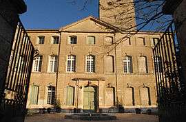
Chateau | ||
| ||
 Sanilhac-Sagriès | ||
|
Location within Occitanie region  Sanilhac-Sagriès | ||
| Coordinates: 43°57′21″N 4°25′31″E / 43.9558°N 4.4253°ECoordinates: 43°57′21″N 4°25′31″E / 43.9558°N 4.4253°E | ||
| Country | France | |
| Region | Occitanie | |
| Department | Gard | |
| Arrondissement | Nîmes | |
| Canton | Uzès | |
| Intercommunality | Uzège | |
| Government | ||
| • Mayor (2008–2014) | Bernard Comte | |
| Area1 | 22.1 km2 (8.5 sq mi) | |
| Population (2008)2 | 834 | |
| • Density | 38/km2 (98/sq mi) | |
| Time zone | CET (UTC+1) | |
| • Summer (DST) | CEST (UTC+2) | |
| INSEE/Postal code | 30308 / 30700 | |
| Elevation |
30–202 m (98–663 ft) (avg. 105 m or 344 ft) | |
|
1 French Land Register data, which excludes lakes, ponds, glaciers > 1 km² (0.386 sq mi or 247 acres) and river estuaries. 2 Population without double counting: residents of multiple communes (e.g., students and military personnel) only counted once. | ||
.svg.png)
Sanilhac-Sagriès is a commune in the Gard department in southern France.
Population
| Historical population | ||
|---|---|---|
| Year | Pop. | ±% |
| 1962 | 401 | — |
| 1968 | 440 | +9.7% |
| 1975 | 442 | +0.5% |
| 1982 | 525 | +18.8% |
| 1990 | 643 | +22.5% |
| 1999 | 785 | +22.1% |
| 2008 | 834 | +6.2% |
See also
References
| Wikimedia Commons has media related to Sanilhac-Sagriès. |
This article is issued from Wikipedia - version of the 3/15/2016. The text is available under the Creative Commons Attribution/Share Alike but additional terms may apply for the media files.