Sangrur
This article is about the municipality in Punjab, India. For its namesake district, see Sangrur district.
| Sangrur ਸੰਗਰੂਰ (Punjabi) Sangroor | |
|---|---|
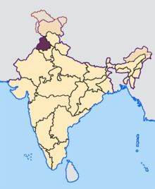
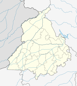 Sangrur  Sangrur Location in Punjab, India | |
| Coordinates: 30°15′02″N 75°50′39″E / 30.25056°N 75.84417°ECoordinates: 30°15′02″N 75°50′39″E / 30.25056°N 75.84417°E | |
| Country |
|
| State | Punjab |
| District | Sangrur |
| Government | |
| • Type | Municipality |
| Elevation | 237 m (778 ft) |
| Population | |
| • Total | 88,043 |
| Time zone | IST (UTC+5:30) |
| PIN | 148001 |
| Telephone code | 01672 |
| Vehicle registration | PB 13 |
| Website |
sangrur |
Sangrur is a city in the Indian state of Punjab, India. It is the headquarters of Sangrur District.
Geography
Sangrur is located at 30°15′02″N 75°50′39″E / 30.25056°N 75.84417°E.[1] It has an average elevation of 232 metres (761 feet).
Climate
| Climate data for Sangrur (1971–1990) | |||||||||||||
|---|---|---|---|---|---|---|---|---|---|---|---|---|---|
| Month | Jan | Feb | Mar | Apr | May | Jun | Jul | Aug | Sep | Oct | Nov | Dec | Year |
| Record high °C (°F) | 29.0 (84.2) |
33.3 (91.9) |
41.1 (106) |
46.1 (115) |
48.3 (118.9) |
47.9 (118.2) |
47.8 (118) |
44.4 (111.9) |
41.7 (107.1) |
40.0 (104) |
35.8 (96.4) |
29.4 (84.9) |
48.3 (118.9) |
| Average high °C (°F) | 18.9 (66) |
21.0 (69.8) |
26.0 (78.8) |
34.6 (94.3) |
38.8 (101.8) |
39.6 (103.3) |
34.9 (94.8) |
32.9 (91.2) |
33.4 (92.1) |
32.0 (89.6) |
26.4 (79.5) |
20.7 (69.3) |
29.9 (85.8) |
| Daily mean °C (°F) | 12.8 (55) |
14.8 (58.6) |
19.4 (66.9) |
26.7 (80.1) |
31.1 (88) |
33.0 (91.4) |
30.5 (86.9) |
28.8 (83.8) |
28.5 (83.3) |
24.9 (76.8) |
19.0 (66.2) |
14.1 (57.4) |
23.6 (74.5) |
| Average low °C (°F) | 6.7 (44.1) |
8.5 (47.3) |
12.8 (55) |
18.8 (65.8) |
23.3 (73.9) |
26.2 (79.2) |
26.1 (79) |
24.8 (76.6) |
23.4 (74.1) |
17.7 (63.9) |
11.6 (52.9) |
7.4 (45.3) |
17.3 (63.1) |
| Record low °C (°F) | −2.2 (28) |
−1.1 (30) |
1.4 (34.5) |
7.1 (44.8) |
11.7 (53.1) |
18.0 (64.4) |
17.4 (63.3) |
18.0 (64.4) |
15.2 (59.4) |
9.4 (48.9) |
0.3 (32.5) |
−1.1 (30) |
−2.2 (28) |
| Average precipitation mm (inches) | 21 (0.83) |
39 (1.54) |
31 (1.22) |
20 (0.79) |
20 (0.79) |
60 (2.36) |
229 (9.02) |
189 (7.44) |
85 (3.35) |
5 (0.2) |
13 (0.51) |
21 (0.83) |
733 (28.86) |
| Average precipitation days (≥ 1.0 mm) | 2.8 | 3.6 | 4.5 | 1.9 | 2.3 | 4.7 | 11.6 | 9.6 | 4.5 | 0.5 | 1.4 | 2.1 | 49.5 |
| Average relative humidity (%) | 74 | 66 | 62 | 44 | 39 | 49 | 71 | 76 | 68 | 61 | 68 | 74 | 63 |
| Source #1: NOAA[2] | |||||||||||||
| Source #2: India Meteorological Department (record high and low up to 2010)[3] | |||||||||||||
Demographics
At the 2011 census Sangrur Municipal Council had a population of 88,043 with 46,931 males and 41,112 females, giving a gender ratio of 876. There were 9,027 children 0-6 years old and an overall literacy rate of 83.54 % - 87.92 % for males and 78.56 % for females.[4]
Notable people
- Naresh Goyal, founder of Jet Airways
- Gurchet Chitarkar, actor
- Irshad Kamil, lyricist and poet
- Bhagwant Mann, comedian & politician
References
- ↑ "Sangrur, India Page". Falling Rain Genomics. Retrieved 2008-08-27.
- ↑ "Sangrur Climate Normals 1971-1990". National Oceanic and Atmospheric Administration. Retrieved April 22, 2015.
- ↑ "Ever recorded Maximum and minimum temperatures up to 2010". India Meteorological Department. Archived from the original on 21 May 2013. Retrieved April 22, 2015.
- ↑ "Sangrur Population Census 2011". Census2011. Retrieved 2 January 2016.
- ↑ "Census 2011".
External links
| Topics |
|  |
|---|---|---|
| Regions | ||
| Districts | ||
| Major Cities | ||
This article is issued from Wikipedia - version of the 10/28/2016. The text is available under the Creative Commons Attribution/Share Alike but additional terms may apply for the media files.