Sancey-le-Long
| Sancey-le-Long | |
|---|---|
 | |
 Sancey-le-Long | |
|
Location within Bourgogne-Franche-Comté region  Sancey-le-Long | |
| Coordinates: 47°18′23″N 6°36′11″E / 47.3064°N 6.6031°ECoordinates: 47°18′23″N 6°36′11″E / 47.3064°N 6.6031°E | |
| Country | France |
| Region | Bourgogne-Franche-Comté |
| Department | Doubs |
| Arrondissement | Montbéliard |
| Canton | Clerval |
| Intercommunality | Vallon de Sancey |
| Government | |
| • Mayor (2008–2014) | Yves Brand |
| Area1 | 7.02 km2 (2.71 sq mi) |
| Population (2012)2 | 351 |
| • Density | 50/km2 (130/sq mi) |
| Time zone | CET (UTC+1) |
| • Summer (DST) | CEST (UTC+2) |
| INSEE/Postal code | 25530 / 25430 |
| Elevation | 480–675 m (1,575–2,215 ft) |
|
1 French Land Register data, which excludes lakes, ponds, glaciers > 1 km² (0.386 sq mi or 247 acres) and river estuaries. 2 Population without double counting: residents of multiple communes (e.g., students and military personnel) only counted once. | |
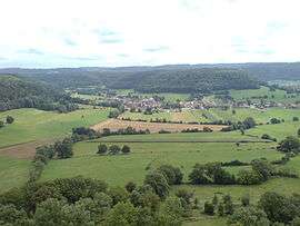
Sancey-le-Long is a former commune in the Doubs department in the Bourgogne-Franche-Comté region in eastern France. On 1 January 2016, it was merged into the new commune Sancey.[1]
Geography
The commune lies 51 km (32 mi) east of Besançon near the Swiss border.
Population
| Historical population | ||
|---|---|---|
| Year | Pop. | ±% |
| 1962 | 330 | — |
| 1968 | 362 | +9.7% |
| 1975 | 315 | −13.0% |
| 1982 | 341 | +8.3% |
| 1990 | 335 | −1.8% |
| 1999 | 367 | +9.6% |
| 2008 | 386 | +5.2% |
| 2012 | 351 | −9.1% |
See also
References
- ↑ Arrêté préfectoral 23 September 2015 (French)
External links
| Wikimedia Commons has media related to Sancey-le-Long. |
This article is issued from Wikipedia - version of the 2/11/2016. The text is available under the Creative Commons Attribution/Share Alike but additional terms may apply for the media files.