Sana'a International Airport
| Sana'a International Airport مطار صنعاء الدولي | |||||||||||
|---|---|---|---|---|---|---|---|---|---|---|---|
 | |||||||||||
| IATA: SAH – ICAO: OYSN | |||||||||||
| Summary | |||||||||||
| Airport type | Military/Public | ||||||||||
| Owner | Government of Yemen | ||||||||||
| Operator | Government of Yemen | ||||||||||
| Serves | Sana'a | ||||||||||
| Location | Sana'a | ||||||||||
| Hub for | |||||||||||
| Elevation AMSL | 7,216 ft / 2,199 m | ||||||||||
| Coordinates | 15°28′35″N 044°13′11″E / 15.47639°N 44.21972°ECoordinates: 15°28′35″N 044°13′11″E / 15.47639°N 44.21972°E | ||||||||||
| Map | |||||||||||
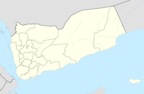 SAH/OYSN Location within Yemen | |||||||||||
| Runways | |||||||||||
| |||||||||||
Sana'a International Airport (IATA: SAH, ICAO: OYSN) is the primary international airport of Yemen located in Sana'a, the capital of Yemen. It serves the city of Sana'a. Initially, a small passenger terminal was built in the 1970's. The runway is shared with a large military base with several fighter jets and transport aircraft of the Yemeni Air Force.
Impact of the 2015 military intervention
Due to the 2015 military intervention in Yemen, a no-fly zone has been imposed over the entire country, as of 28 March 2015, so civilian flights have ceased operation.[1][2] The only flights operating from then on were flights by foreign countries to evacuate their nationals.[3]
On 29 April 2015, the airport was the target of severe bombardment from the Saudi Arabian air force. The only runway and the passenger terminal building have been severely damaged and are unusable for the foreseeable future.[4] On 9 August 2016, the airport was closed down once again after resumption of services by Yemenia due to closure of airspace by the Saudi Coalition
Airlines and destinations
Currently, many of the formerly served routes are suspended due to the aforementioned heavy damage to the airport's facilities. As of early 2016, all of Yemenia's flights operate via Bisha Domestic Airport.[5] However, Yemenia does not have the traffic rights to transport passengers solely to or from Bisha.
| Airlines | Destinations |
|---|---|
| Yemenia | Amman–Queen Alia,1 Cairo1 |
Accidents and incidents
- On September 14, 1994, an Alymeda Boeing 737 flight from Aden to Sana'a, Yemen was hijacked by a man with a hand grenade. He reportedly demanded to be taken to Saudi Arabia. When the hijacker went into the flight deck, he was overpowered by security personnel who had entered the plane and was arrested.[6]
- On October 30, 2011, a shelling attack by opposition tribesmen on the neighboring Air Force base damaged the airport's runway, forcing incoming flights to be diverted to Aden. There were no reports of casualties, although an ammunition storage and two fighter jets were destroyed.[7]
- On November 21, 2012, A Russian made Antonov 26 crashed in the abandoned Al-Hasaba Marketplace. Pilots saw that there was an engine which caught fire. The aircraft was operated by the Yemeni Air Force.
- On February 19, 2013, A Yemeni Air Force fighter plane, Sukhoi Su-17 crashed on to a building shortly after taking off from Sana'a International Airport close to a busy road. The crash location was behind a local hospital. 18 people died and 16 were injured. Yemeni Air Force was concerned in the aftermath of two plane crashes.
- On June 23, 2014, British citizen and pro-democracy campaigner Andargachew Tsige was controversially arrested at Sana'a airport and later extradited to Ethiopia.[8]
- On March 26, 2015, the Saudi Air Force bombed positions in Sana'a including the airport, in reaction to the 2014-15 Yemen coup d'etat.[9]
References
- ↑ Ghattas, Abir. "Yemen's No Fly Zone: Thousands of Yemenis are Stranded Abroad". Retrieved 8 April 2015.
- ↑ Ahmed, Amel (28 March 2015). "Stranded Yemeni-Americans consider alternate escape routes". Al-Jazeera. Retrieved 8 April 2015.
- ↑ Elbagir, Nima (6 April 2015). "CNN Crew flies into Yemen capital". CNN. CNN. Retrieved 8 April 2015.
- ↑ http://www.aerotelegraph.com/jemen-luftfahrt-stillstand-felix-airways-yemenia
- ↑ "Schedule Tue 01 Sep 2015". Yemenia Airways. 31 August 2015. Retrieved 1 March 2016.
- ↑ Hijacking description at the Aviation Safety Network
- ↑ "UPDATE 2 — Mortar shells hit Yemeni Air Force Base, destroying two fighter jets". BNO News. Retrieved 31 October 2011.
- ↑ https://web.archive.org/web/20160722191112/https://www.theguardian.com/world/2014/jul/04/uk-accused-extradition-ethiopia-andargachew-tsige
- ↑ Mazzetti, Mark; Kirkpatrick, David. "Saudi Arabia Begins Air Assault in Yemen". New York Times. Retrieved 26 March 2015.
External links
![]() Media related to Sana'a International Airport at Wikimedia Commons
Media related to Sana'a International Airport at Wikimedia Commons
- Accident history for SAH at Aviation Safety Network
- Airport information for OYSN at Great Circle Mapper. Source: DAFIF (effective October 2006).
- Current weather for OYSN at NOAA/NWS
- Airport information for OYSN at World Aero Data. Data current as of October 2006.Source: DAFIF.