San Vicente Boulevard
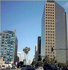
San Vicente Boulevard is a major northwest-southeast thoroughfare located in the western portion of the metropolitan area of Los Angeles, CA.
Built in the early 20th century and named for the Rancho San Vicente y Santa Monica that had previously occupied the area, the boulevard originally ran from the Soldiers' Home (Sawtelle Veterans Home) in Los Angeles to Ocean Avenue in Santa Monica. This tree-lined street was 130 feet (40 m) wide, with trolley lines used by the Los Angeles Pacific Electric Railway running down its center. It was oiled and surfaced in 1906 and, when completed, it "made one of the finest drives in the country."[1]
Today the boulevard begins at Venice Boulevard between Crenshaw Boulevard and La Brea Avenue and travels in a northwesterly direction towards Beverly Hills. The roadway splits into two streets past La Cienega Boulevard: the western branch becoming Burton Way, which eventually becomes South Santa Monica Boulevard and connects directly to downtown Beverly Hills. The northern branch remains as San Vicente Blvd. itself, passes Beverly Center, continues north into West Hollywood and becomes N Clark St. at Sunset Boulevard (served by Metro Local lines 30 and 330). A separate stretch of road with the same name runs from Santa Monica to Brentwood.
Addressing
Locating an address on San Vicente Boulevard can be especially tricky. The easternmost end at Venice Boulevard begins with the number 4600 and increases to the west. By Los Angeles convention, since there is no E. San Vicente Boulevard, i.e. the boulevard does not go east of Main Street, San Vicente Boulevard is not termed W. San Vicente Boulevard. The address numbers continue to increase up to 6600 at Wilshire Boulevard. Two complications begin at this point. First, since San Vicente Boulevard does not follow the overall grid of Los Angeles but rather a slowly arcing curve, the intersection at Wilshire Boulevard is chosen as the point where the numbering switches from east-west numbers to north-south numbers with respect to the city grid. Secondly, between Wilshire Boulevard and La Cienega Boulevard, the median of San Vicente forms a border between Beverly Hills and Los Angeles. The east side of San Vicente is known as S. San Vicente Boulevard, with numbering decreasing between 700 at the Wilshire end and 400 at the La Cienega end—even numbers only. The west side of San Vicente is known as N. San Vicente Boulevard, with numbering increasing between 100 at the Wilshire end and 300 at the La Cienega end—odd numbers only. North of La Cienega, both sides of the street are in Los Angeles. The numbering continues accordingly as 400 S. San Vicente Boulevard. The street becomes N. San Vicente Boulevard at Gracie Allen Drive. As in the rest of Los Angeles, the numbers at the city's grid axis start with 100. Numbers 0-99 are not used. At 300 N. San Vicente Boulevard, the boulevard enters the city of West Hollywood at Beverly Boulevard. The street name and numbering do not change. The street terminates at Sunset Boulevard in West Hollywood at the number 1100 N. San Vicente.
A second San Vicente Boulevard begins in the Brentwood neighborhood of the city of Los Angeles. This street is unrelated to the former except in name. Once again, and for the same reason at before, this street is not known as W. San Vicente Boulevard. However, some navigation systems call this street West San Vicente to differentiate it from the other. This San Vicente Boulevard begins at Wilshire Boulevard west of Interstate 405. This second intersection of Wilshire and San Vicente Boulevard is 5.5 miles (8.9 km) west of the former. Once again, the numbering increases to the west, beginning with the number 11400 at Wilshire Boulevard. As the street continues, it eventually crosses the border of the city of Santa Monica, and does not change names, at Santa Monica's 26th Street. The last number on San Vicente Boulevard in Los Angeles' address grid is 13100. On the Santa Monica side, the numbering follows that city's grid and begins at 2600 and decreases towards the ocean. At Ocean Avenue, San Vicente Boulevard has its western terminus at the number 100.
San Vicente curves diagonally and cuts through both east-west and north-south streets, allowing quick access between Downtown Los Angeles and Beverly Hills or West Hollywood.
Current construction
In summer 2011, construction was to begin on the San Vicente median between Pico Boulevard and Fairfax Avenue.[2]
Planning meetings have taken place in the affected Olympic Park Neighborhood Council, Pico Neighborhood Council, and the Mid-City West Community Council.[3] Money for the project is coming from these three councils and the Community Redevelopment Agency of Los Angeles (CRA/LA). The Olympic Park Neighborhood Council is committing $30,000 for the project.[4] According to the Beverly Press (4/21/2011), "The plan calls for the medians between Fairfax Avenue and Pico Boulevard to be adorned with new trees, a walking path and seating areas. Trees and plaques at the intersections at Pico Boulevard and Fairfax Avenue, identifying them as gateways, will also be installed."
References
- ↑ Luther A. Ingersoll: Ingersoll's Century History, Santa Monica Bay Cities, 1908
- ↑ Folven, Edwin. "Medians Will Provide Green Oasis in Urban Setting". Beverly Press. Beverly Press. Retrieved 5/2/2011. Check date values in:
|access-date=(help) - ↑ "San Vicente Median Project meeting November 7th, 2010". Mid-City West Blog. Mid-City West Community Council.
- ↑ Pineda, Carla. "Olympic Park Neighborhood Council March 2011". The Neighborhood News Online. Retrieved 5/2/2011. Check date values in:
|access-date=(help)
Coordinates: 34°3′54″N 118°22′19″W / 34.06500°N 118.37194°W