San Vero Milis
| San Vero Milis Santeru | |
|---|---|
| Comune | |
| Comune di San Vero Milis | |
|
The tower of Cape Mannu | |
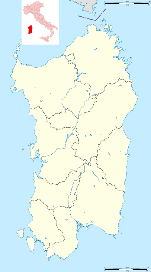 San Vero Milis Location of San Vero Milis in Sardinia | |
| Coordinates: 40°1′N 8°36′E / 40.017°N 8.600°ECoordinates: 40°1′N 8°36′E / 40.017°N 8.600°E | |
| Country | Italy |
| Region | Sardinia |
| Province / Metropolitan city | Province of Oristano (OR) |
| Area | |
| • Total | 72.2 km2 (27.9 sq mi) |
| Population (Dec. 2004) | |
| • Total | 2,506 |
| • Density | 35/km2 (90/sq mi) |
| Time zone | CET (UTC+1) |
| • Summer (DST) | CEST (UTC+2) |
| Postal code | 09070 |
| Dialing code | 0783 |
.jpg)
San Vero Milis (Sardinian: Sant' Eru) is a comune (municipality) in the Province of Oristano in the Italian region Sardinia, located about 100 kilometres (62 mi) northwest of Cagliari and about 13 kilometres (8 mi) north of Oristano. As of 31 December 2004, it had a population of 2,506 and an area of 72.2 square kilometres (27.9 sq mi).[1]
San Vero Milis borders the following municipalities: Baratili San Pietro, Milis, Narbolia, Riola Sardo, Tramatza, Zeddiani.
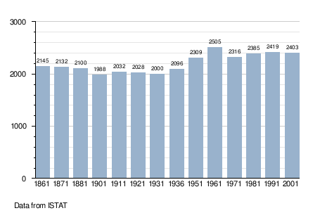
Demographic evolution
References
| Wikimedia Commons has media related to San Vero Milis. |
- ↑ All demographics and other statistics: National Institute of Statistics (Italy) (Istat).
This article is issued from Wikipedia - version of the 6/16/2015. The text is available under the Creative Commons Attribution/Share Alike but additional terms may apply for the media files.