San Pablo Atlazalpan
Coordinates: 19°13′02″N 98°54′32″W / 19.21724°N 98.908957°W
| San Pablo Atlazalpan, Chalco | |
|---|---|
| Town | |
| San Pablo Atlazalpan | |
| Nickname(s): Beside waterfalls | |
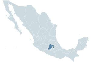
 Location of State of Mexico within Mexico Country. | |
 Location of Chalco Municipality within Mexico State. | |
| Country |
|
| State | Mexico State |
| Municipality | Chalco |
| Founded | 16 century |
| Incorporated | 1824 |
| Area | |
| • Total | 1.67[1] km2 (0.6447906 sq mi) |
| Elevation | 2,260 m (7,414 ft) |
| Population (2010) | |
| • Estimate (2010[2]) | 11,236 |
| Time zone | CST (UTC-6) |
| • Summer (DST) | CDT (UTC-5) |
| ZIP codes | 56620 |
| Area code(s) | +52 55 |
Saint Pablo Atlazalpan (/ˈætəlʒlpŋ/)is a town of 11,236 inhabitants [3] located within the municipality of Chalco, State of Mexico, Mexico.
History


Saint Pablo Atlazalpan has a main church whose period of construction dates of the 18th century, which inside was restored in 1982.

The façade of panteón Reform, was built in August 1906.
Also in the town is located the ex-inland revenue of Axalco whose date of built is ignored.
Festivities and celebrations
The town has a lot of parties each year, but the main one is celebrated on June 29, honoring Saint Peter and Saint Pablo, saints by the Catholic Church.
Also in December, is held the Tamal Fair , this one lasts one week, and it gathers the best tamale in the region, so they can compete in the annual contest of the Best Tamale, also is a good place for eating, chilling, and get in touch with the native people.

Religious division

In 1979, arrived to Saint Pablo Atlazalpan a priest called Adolfo Zamora, banned women from entering to San Pedro and Saint Pablo main church, dressed with trousers, short skirts or with the head discovered. Also it banned the entry of the divorced and began to speech masses in Latin.
The measures of the priest provoque that inhabitants got into a religious fight. Ten years ago ninety percent of the population were Catholic, now only 10 percent.
In the need of having a place for praying, the group of the traditional catholics improvised a chapel in a house, situated in the street Independence corner with Hidalgo avenue, and them brought priests of other places to speech masses. It was such the conflict that the churches held the same name: Saint Peter and Saint Pablo Church.
The public works weren't working, as the people were of different religious groups, refused all proposal of their opossitors, even the division was in the own members of the families.
Because of the conflict, in the first decade of the millenium other religions like the evangelic, the pentecostal and mormons; got more followers, taking advantage of the catholic division.

The conflict become to an end in August 2004, when the cops of the Mexico State, entered to the main church and gave it back to the catholics, despite this, the traditional people that hold masses in latin still exist with their own church, that was built in 2011.
Since then both parts live and coexist peacefully in the town.
Demography
In the town there are 5,451 men and 5,785 women. The relation women/men is of 1.041. The ratio of fecundity of the feminine population is of 2.28 children by woman. The percentage of illiteracy between the adults is of 3.5% (2.21% in the men and 4.75% in the women) and the degree of escolaridad is of 8.02 (8.40 in men and 7.66 in women).
References
- ↑ "Population in Chalco" (PDF). Universidad Iberoamericana. Retrieved 2015-05-21.
- ↑ "Population Estimates". United States Census Bureau. Retrieved 2015-05-21.
- ↑ INEGI.